


 Country:

 City:
City:


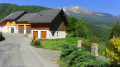
(S/E) After parking your car in the shaded car park with a nearby picnic area at the bottom of Césarches, follow the D118 towards Ugine (north) for about 700 metres.
Then leave the departmental road and turn right onto the Route du Bassin. After 500 metres, you’ll come out onto a departmental road leading to the village of Césarches.
(1) Turn left and follow it for a good kilometre; after a 30-minute walk, you’ll reach the entrance to Césarches Grand Village, situated at an altitude of 476 metres.
(2) At the entrance to the village, after admiring the bread oven, turn left onto the Chemin du Cap d’Arly and admire Mont Charvin directly ahead.
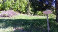
At the school, leave the road and take a path climbing up to the right, signposted towards Montessuit-Prasier.
You’ll soon reach a fork; carry on straight ahead, whilst a path branches off to the left, running level towards Molliex-les Sance.
Further up, at a hairpin bend, turn right. After three bends, the path comes out onto a road. Cross it and then carry on straight ahead along a path which then levels out.
(3) Turn right to reach the hamlet of Prasier via the road you are following. After passing the signpost indicating the direction of Beaufort, you will arrive at the Col de Montessuit at an altitude of 640m after an hour’s walk.
(4) Then head back down the road and pass through the hamlet of Arechettaz.
(5) At the second left-hand bend, take the footpath on the right, which is for pedestrians only. Follow this undulating path for a good kilometre, running along the slope above the Doron, before reaching the hamlet of La Vignette.
The path eventually joins a road near vineyards and gardens.
(6) After 500 metres, leave the road and take a signposted path that descends to the left towards the village of Césarches.
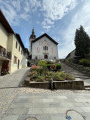
As you enter the village, the tarmac path becomes the Chemin du Grand Village. Continue straight on until you reach the junction at La Boucle du Plan.
(7) Take care not to leave the village and make sure you take the road on the left. At the first house, turn right onto the descending path signposted for mountain biking (black sign on the right overlooking the Césarches district road below).
You’ll eventually rejoin this road just before reaching the hamlet known as Le Château. Carry on to the left.
(1) Ignore the road on the right which you took on the way out and carry straight on to reach the end of our route (S/E).

 Visorando Member
 Easy
Easy 
 Difficult
  Tourism professional
 Very difficult
