


Refine your search for walks in Oradour
Oradour walks


 The short walk around Lavergne
 Visorando Member
 1.87 mi
 +171 ft
 -171 ft
 1h 00
1h 00
 Easy
Easy
 Departure from Oradour (Cantal)
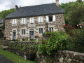
A short, idyllic walk along farm tracks, through a lovely wood of pine and beech trees, before returning gently downhill towards the village of Lavergne and its old farmhouses, typical of 19th-century Auvergne rural architecture. You can take a break on the sturdy stone bench, which is also your starting point. It is only 40 years old and has nothing in common with a menhir apart from the raw material from which both monuments are made! A lovely walk, ideal for families or to start your day!
Route between La Truyère and Neuvéglise
8.53 mi
+1,591 ft
-1,591 ft
5h 20
 Moderate
Departure from Neuvéglise (Cantal)
Moderate
Departure from Neuvéglise (Cantal)
Route through rolling countryside with views of the Lanau dam. Magnificent houses in Orcières.
Paulhac - Valuéjols
9.60 mi
+2,005 ft
-1,916 ft
6h 10
Moderate
Departure from Paulhac (Cantal)
Second stage of the Saint-Flour Planèze tour. This is the shortest and highest stage. It takes place in the foothills of the Plomb du Cantal and crosses the wildest parts of the circuit.
Les Fonds de la Salesse
 3.87 mi
+262 ft
-240 ft
2h 00
Easy
Departure from Paulhac (Cantal)
3.87 mi
+262 ft
-240 ft
2h 00
Easy
Departure from Paulhac (Cantal)
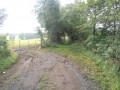
Discovery hike around Paulhac, very easy and ideal for those new to mountain biking, especially children. It is also accessible to pedestrians, horses and even people with all-terrain pushchairs (3 wheels).
The Mercou Woods
 6.79 mi
+558 ft
-574 ft
3h 35
Moderate
Departure from Paulhac (Cantal)
6.79 mi
+558 ft
-574 ft
3h 35
Moderate
Departure from Paulhac (Cantal)
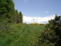
Circuit no. 1 in the guidebook of walking, horse riding and mountain biking routes in the commune of Paulhac.
Lavergne and Belinay Woods
 8.21 mi
+1,086 ft
-1,086 ft
4h 45
Moderate
Departure from Paulhac (Cantal)
8.21 mi
+1,086 ft
-1,086 ft
4h 45
Moderate
Departure from Paulhac (Cantal)
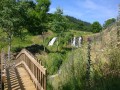
An encounter with nature in the heart of the Monts du Cantal, with a complete change of scenery guaranteed.
The Narse de Lascols
 7.52 mi
+417 ft
-417 ft
3h 50
Moderate
Departure from Paulhac (Cantal)
7.52 mi
+417 ft
-417 ft
3h 50
Moderate
Departure from Paulhac (Cantal)
The ‘Grande Randonnée’ trail in the Pays de Saint-Flour allows you to walk several circular routes around the capital of the Planèze and Margeride regions and passes through the village of Paulhac. The circular route crosses the Narse de Lascols from south to north, starting from Cussac, passing the Puy de Mercou, and heading back up towards the Bois des Fraux via the mountain pastures. The route described below is inspired by this, offering a wonderful exploration of the Planèze de Saint-Flour by combining the GR® de Pays and PR® trails around Paulhac.
La Borie Waterfalls (Brezons Valley)
 0.91 mi
+338 ft
-338 ft
0h 45
Moderate
Departure from Brezons (Cantal)
0.91 mi
+338 ft
-338 ft
0h 45
Moderate
Departure from Brezons (Cantal)
Truly spectacular waterfalls. Well-designed facilities (without which a visit would be impossible), including a vertiginous 30-metre staircase and viewing platforms. A short but steep walk. The hamlet of Laborie is also very charming.
The Grandval Dam via La Mourache
 5.76 mi
+1,168 ft
-1,184 ft
3h 40
Moderate
Departure from Fridefont (Cantal)
5.76 mi
+1,168 ft
-1,184 ft
3h 40
Moderate
Departure from Fridefont (Cantal)
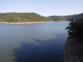
Over the centuries, the Truyère has carved out deep gorges which, with the rising water levels caused by the construction of the Grandval and Lanau dams, have given way to a natural landscape of surprising and contrasting beauty: islands and peninsulas, cirques with distant shores, mysterious meanders, narrow gorges opening onto vast expanses of water, a wooded valley… Following the PR la Mourache route, the walk offers magnificent views from the embankment supporting the Alleuze road.
Walking the route in the opposite direction offers more shade, but do keep an eye out for the signposting – which, to be honest, is rather sparse.
Montréal Waterfall and Montréal Cross in Brezons
3.09 mi
+1,135 ft
-1,135 ft
2h 25
Moderate
Departure from Brezons (Cantal)
A gentle warm-up walk in the superb Brezons valley. The walk starts in this pretty village, typical of the Cantal region. The Croix de Montréal, our destination, is clearly visible against the backdrop of the forest. There’s a viewpoint overlooking the lovely Montréal waterfall, followed by the climb up to the cross, offering panoramic views across the whole valley. For almost the entire walk, apart from a few short sections, you’ll be in the shade of a beautiful beech forest.
Route around Cantoin
4.71 mi
+322 ft
-322 ft
2h 25
Easy
Departure from Cantoin (Aveyron)
A route taking in the carriage driving school and the Mourgues and Mas crosses
Brieu Beach from Cantoin
 7.30 mi
+1,089 ft
-1,112 ft
4h 20
Moderate
Departure from Cantoin (Aveyron)
7.30 mi
+1,089 ft
-1,112 ft
4h 20
Moderate
Departure from Cantoin (Aveyron)
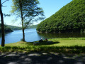
Discover Peyrarque, Brieu Beach and the view of the Laussac Peninsula.
Chemin des Burons to the Bagpipe Museum
4.22 mi
+338 ft
-335 ft
2h 15
Easy
Departure from Cantoin (Aveyron)
This trail will introduce you to the burons, typical Aubrac buildings once used during the summer grazing season. At the Bagpipe Museum, you can discover the history of the cabrette and the world'slargest collection of bagpipes. Along the way, you can admire the Plomb du Cantal, the Puy Mary, the church of Vines and its Stations of the Cross, as well as an exceptional view of Lake Sarrans.
Route du Bois des Fraux
 6.59 mi
+486 ft
-489 ft
3h 25
Moderate
Departure from Valuéjols (Cantal)
6.59 mi
+486 ft
-489 ft
3h 25
Moderate
Departure from Valuéjols (Cantal)
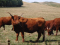
This is a route that captures the mountain atmosphere of the Haute Planèze – the land of burons and summer pastures – starting from Saint-Maurice, a hamlet of Valuéjols, and leading to one of the few wooded areas in the Planèze. The route follows signposted sections (local PR® and GRP® trails) along tracks suitable for vehicles, which link the hamlets and farms scattered across the area. The Bois des Fraux, meanwhile, is maintained by foresters who have cleared tracks there for walking or cross-country skiing, provided there is still snow in winter.
Carladez - The Laussac Peninsula.
 9.42 mi
+1,358 ft
-1,368 ft
5h 30
Moderate
Departure from Thérondels (Aveyron)
9.42 mi
+1,358 ft
-1,368 ft
5h 30
Moderate
Departure from Thérondels (Aveyron)
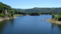
This hike, leading from the Thérondels plateau to the wooded slopes of the Truyère, offers a bird's eye view of the narrow "fjord" formed by the Sarrans Lake reservoir. The Laussac peninsula and its splendid chapel are one of the most iconic sites in Carladez, north of Aveyron.
Valuéjols - Saint-Flour
13.01 mi
+974 ft
-1,608 ft
6h 50
 Difficult
Departure from Valuéjols (Cantal)
Difficult
Departure from Valuéjols (Cantal)
Third and final stage of the Planèze tour. Entirely on the GR®4. This stage crosses varied environments and allows you to discover some very interesting, albeit little-known, sites. In particular, the route runs alongside the Narse de Nouvialle (a remarkable wetland) and passes close to the Château du Sailhant and the Babory waterfall.
The Malbonnet circuit
 Association / Club / Walk leader
 6.97 mi
+1,010 ft
-1,007 ft
4h 05
Moderate
Departure from Malbo (Cantal)
6.97 mi
+1,010 ft
-1,007 ft
4h 05
Moderate
Departure from Malbo (Cantal)
A walk through the hills above Malbo, amongst woods and pastures.
The Rocaillade Trail starting from Malbo
 2.86 mi
+463 ft
-423 ft
1h 45
Easy
Departure from Malbo (Cantal)
2.86 mi
+463 ft
-423 ft
1h 45
Easy
Departure from Malbo (Cantal)
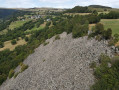
A geological account of the formation of this periglacial scree.
Route des Volcans de Malbo
 5.44 mi
+735 ft
-715 ft
3h 10
Moderate
Departure from Malbo (Cantal)
5.44 mi
+735 ft
-715 ft
3h 10
Moderate
Departure from Malbo (Cantal)
A path offering the chance to discover distinctive geological formations (tuff).
Las Combes
 AONB
AONB 2.56 mi
+479 ft
-459 ft
1h 35
Easy
Departure from Anterrieux (Cantal)
2.56 mi
+479 ft
-459 ft
1h 35
Easy
Departure from Anterrieux (Cantal)
A short route to explore the Gorges du Bès
From Valiette, this route descends past the dam before entering the gorges, offering superb views of the valley.
The Ramparts Trail and the old town of Saint-Flour
 2.05 mi
+197 ft
-213 ft
1h 05
Easy
Departure from Saint-Flour (Cantal)
2.05 mi
+197 ft
-213 ft
1h 05
Easy
Departure from Saint-Flour (Cantal)
A walk that allows you to explore the old town of Saint-Flour, perched on its volcanic rocky outcrop, which forms a natural rampart.
Short tour of the Planèze de Saint-Flour in three days
37.92 mi
+4,419 ft
-4,446 ft
3 days
Difficult
Departure from Saint-Flour (Cantal)
Starting from Saint-Flour, this tour of the northern part of the Planèze de Saint-Flour allows you to appreciate the diversity of the landscapes of this high basalt plateau in just three days of walking.
The stages in Paulhac and Valuéjols offer accommodation in stopover lodges.
The route follows part of a variant of the GR® de Pays de Saint-Flour and part of the GR®4.
Saint-Flour - Paulhac
15.30 mi
+1,460 ft
-745 ft
8h 20
Difficult
Departure from Saint-Flour (Cantal)
This is the first of three stages of the Saint-Flour Planèze tour. It is the longest stage, passing through several small villages typical of the Planèze with their bread ovens, which provide welcome shelter for a short break in rainy weather. The very quiet paths and small roads run alongside meadows grazed by numerous herds of cattle in season.
Saut de la Truite and the waterfalls of the Livernade stream
 3.61 mi
+1,211 ft
-1,220 ft
2h 45
Moderate
Departure from Brezons (Cantal)
3.61 mi
+1,211 ft
-1,220 ft
2h 45
Moderate
Departure from Brezons (Cantal)
Waterfalls, woodland, stream, at the bottom of the magnificent Brezons Valley.Forests and pastures, magnificent Cantalian landscapes; old stone burons, summer pastures, views of the Plomb du Cantal peaks.Three routes: easy (40 mins), moderate (1 hr 30 mins), full (3 hr 30 mins).Well-designed facilities to make the most of the site’s beauty without spoiling it.
Upper town of Saint-Flour via the Montée des Chèvres
2.23 mi
+354 ft
-354 ft
1h 20
Easy
Departure from Saint-Flour (Cantal)
Passing through Auvergne? Take the opportunity to enjoy a pleasant break in Saint-Flour. From the banks of the Anver, climb up to discover the upper town via the Chemin des Chèvres and don't forget to stock up on cheese!
Prat de Bouc – Thiézac
 11.90 mi
+1,969 ft
-3,927 ft
7h 10
Moderate
Departure from Albepierre-Bredons (Cantal)
11.90 mi
+1,969 ft
-3,927 ft
7h 10
Moderate
Departure from Albepierre-Bredons (Cantal)
Stage2 of theGR®400, travelling clockwise.
Plomb du Cantal and a long panoramic ridge before descending to Thiézac.
Plateau de la Planèze from Col de Prat de Bouc
 7.80 mi
+853 ft
-863 ft
4h 20
Moderate
Departure from Albepierre-Bredons (Cantal)
7.80 mi
+853 ft
-863 ft
4h 20
Moderate
Departure from Albepierre-Bredons (Cantal)
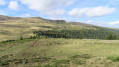
The Plateau de la Planèze starting from Prat de Bouc.
N.B. Following the route with the Visorando app can be very useful in the forest due to the numerous trail intersections encountered.
Prat de Bouc–Lavessière
 9.12 mi
+814 ft
-2,316 ft
4h 55
Moderate
Departure from Albepierre-Bredons (Cantal)
9.12 mi
+814 ft
-2,316 ft
4h 55
Moderate
Departure from Albepierre-Bredons (Cantal)
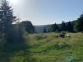
Stage 7 of our Tour du Cantal. This is the final stage of the Tour du Cantal, with another change to the GR®400 route: instead of returning to Murat, we head back to Laveissière (where we left our vehicle, see episode 1). Most of this stage is in the shade, but the descent brings the heat..
Plomb du Cantal from the Col de Prat-de-Bouc
 4.88 mi
+1,535 ft
-1,535 ft
3h 35
Moderate
Departure from Albepierre-Bredons (Cantal)
4.88 mi
+1,535 ft
-1,535 ft
3h 35
Moderate
Departure from Albepierre-Bredons (Cantal)
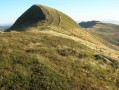
The highest peak in Europe's largest volcanic complex, the Plomb du Cantal (1,855 m) offers unobstructed views of the Monts-Dore (Puy-de-Sancy) to the north and the Cézallier and Aubrac plateaus to the south.
Plomb du Cantal and its ridge via the Prés Marty
12.14 mi
+2,549 ft
-2,543 ft
7h 50
Moderate
Departure from Albepierre-Bredons (Cantal)
Hike on one of the must-see sites in Cantal, preferably outside the tourist season, when the Lioran chairlifts are not in operation. After the tranquillity of the summer pastures on the Prés Marty, the Plomb du Cantal reveals superb landscapes. A return trip along the ridge to the Chapelle du Cantal allows you to make the most of these heights.
Loop around Plomb du Cantal
 8.85 mi
+3,061 ft
-3,061 ft
6h 45
Difficult
Departure from Albepierre-Bredons (Cantal)
8.85 mi
+3,061 ft
-3,061 ft
6h 45
Difficult
Departure from Albepierre-Bredons (Cantal)
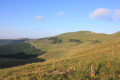
Its height of 1855 metres make Plomb du Cantal the second highest peak in the Massif Central after the Puy de Sancy.
Starting from the Col de Prat de Bouc, this hike initially leads to the summit ascent and descent on the northern slope, followed by a climb up the slopes of the Puy du Rocher before returning to Prat de Bouc.
The Vergnes Waterfall
4.50 mi
+951 ft
-935 ft
2h 55
Easy
Departure from Albepierre-Bredons (Cantal)
A partially shaded hike in the Lagnon valley offering views of two waterfalls.
From Plomb du Cantal to Lioran via Puy du Rocher
 4.08 mi
+404 ft
-2,205 ft
2h 15
Moderate
Departure from Saint-Jacques-des-Blats (Cantal)
4.08 mi
+404 ft
-2,205 ft
2h 15
Moderate
Departure from Saint-Jacques-des-Blats (Cantal)
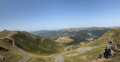
Short hike along the ridges with breathtaking views of the Cantal mountains. You can reach the starting point by taking the cable car from Le Lioran or by following the same route in the opposite direction. After enjoying the view from the highest point in this beautiful department, you will reach the Pas des Alpins by following the GR®4/GR®400 marked trail. You will then climb up to the Puy du Rocher to enjoy another breathtaking view of the Plomb du Cantal and its surroundings. Then you will descend towards the Lioran resort on the ridges. The walk ends in the Lioran forest.Please note: after passing Puy du Rocher, two areas may seem a little difficult for some as they require descending the rock, but aids have been put in place.