Waterfall of Croûtes in Narnhac

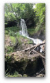
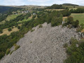
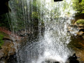
An interesting and easy walk through the countryside with geological features. The River Hirondelle has a waterfall on a barrier of hard rock, then flows beneath it into a cavern it has carved out of the softer rock. You walk beneath the lava flow and can see the volcanic prisms from below.

Details

n°12472462
Creation:
Last update:
Last review:
  • Walking
    Activity: Walking
  • ↔
    Distance: 1.62 mi
  • ◔
    Average duration: 1h 05 
  • ▲
    Difficulty: Easy

  • ⚐
    Back to start: Yes
  • ↗
    Ascent: + 423 ft
  • ↘
    Descent: - 436 ft

  • ▲
    Highest point: 3,294 ft
  • ▼
    Lowest point: 2,949 ft

Photos

Description of the walk

Blue signposts (sparse).

(S/E) From the hamlet of La Serre, in Narnhac, take a road running perpendicular to the D54; it is initially a flat tarmac road, then becomes a track leading downhill towards the River Hirondelle.

(1) 50 m before reaching a bridge over the river, turn sharply right down a wide path marked ‘Private property’ but open to the public (signposted). 200 m further on, turn sharply left onto a wide path running parallel to the river.

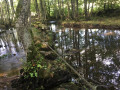
(2) Cross the river over the stones marked with blue signposts and continue towards the Waterfall des Croûtes: a cave carved out beneath the rock.

(3) Return along the same path to the hamlet of Le Serre (S/E).

Waypoints

  1. S/E : mi 0 - alt. 3,294 ft - The hamlet of Le Serre in Narnhac
  2. 1 : mi 0.5 - alt. 3,097 ft - Junction before the river
  3. 2 : mi 0.78 - alt. 2,976 ft - Path running parallel to the river
  4. 3 : mi 0.81 - alt. 3,074 ft - Cascade des Croûtes
  5. S/E : mi 1.62 - alt. 3,294 ft - The hamlet of Le Serre in Narnhac

Notes

Start at the hamlet of La Serre, 300 m north of Narnhac church on the D54.

Worth a visit

Resistance Monument and church in Narnhac.

Reviews and comments

5 / 5
Based on 1 review

Reliability of the description
5 / 5
Ease of following the route
5 / 5
Route interest
5 / 5
User 27104543
• Edited:

Unfortunately, the last 200 metres were off limits because they appear to be on private property and the owner has prohibited access. The children were disappointed.

Machine-translated

Chalsa
Chalsa

Overall rating : 5 / 5

Date of your route : Aug 21, 2023
Reliability of the description : ★★★★★ Very good
Ease of following the route : ★★★★★ Very good
Route interest : ★★★★★ Very good
Very busy route : No

A lovely walk and a beautiful waterfall in a stunning and distinctive setting.

Machine-translated

Other walks in the area

For more walks, use our search engine .

The GPS track and description are the property of this route's author. Please do not copy them without permission.