


 Country:

 City:
City:


Park in the Malbo car park located near the bridge at the bottom of the village.
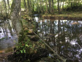
(S/E) Take the D54 towards Roupon. Leave the road shortly afterwards and head down to the left onto the path running parallel to the Ruisseau de Malbonnet. At the bottom of the descent, you’ll reach a ford.
(1) Cross the ford, then begin the climb to reach a signpost for La Rocaillade.
(2) Carry on straight ahead, continue the climb and reach the junction with a wider track leading to the hamlet of Roupons.
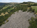
(3) Leave this track on your right and continue uphill along the path on the left. Pass a tomb and then some aerial masts. You will then reach the D54. Turn left onto it, then at thefirst bend – signposted ‘Puy de la Garde’ – turn left to reach the summit of La Rocaillade.
(4) Return to the D54, follow it to the left, pass Bois Blanc, walk alongside the cemetery, then cross the Ruisseau du Malbonnet again via the small bridge, and climb back up to Malbo via a steep path which leads onto the road back to the Malbo car park (S/E).
 Association / Club / Walk leader
 Moderate
 Visorando Member
 Difficult
