The short walk around Lavergne

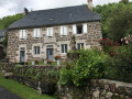
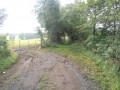
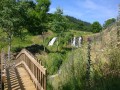
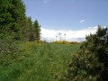
A short, idyllic walk along farm tracks, through a lovely wood of pine and beech trees, before returning gently downhill towards the village of Lavergne and its old farmhouses, typical of 19th-century Auvergne rural architecture. You can take a break on the sturdy stone bench, which is also your starting point. It is only 40 years old and has nothing in common with a menhir apart from the raw material from which both monuments are made! A lovely walk, ideal for families or to start your day!

Details

n°109323308
Creation:
Last update:
Last review:
–
  • Walking
    Activity: Walking
  • ↔
    Distance: 1.87 mi
  • ◔
    Average duration: 1h 00 
  • ▲
    Difficulty: Easy

  • ⚐
    Back to start: Yes
  • ↗
    Ascent: + 171 ft
  • ↘
    Descent: - 171 ft

  • ▲
    Highest point: 3,074 ft
  • ▼
    Lowest point: 2,867 ft

Description of the walk

Leave your car near the junction of the Route du Pré de Vincent – which leads up to the hamlet of Lavergne – and the RD56. Park under the lime trees next to the stone bench, which is marked on the map as a menhir (!).

(S/E) Return to the D56, cross it carefully and take the correct path opposite leading towards the small copse, leaving the rubbish dump of our consumer society on your left. Cross the copse and head down to a three-way junction.

(1) Turn right onto the path leading downhill. Cross the Ruisseau de Gonrex and head back up the opposite side to rejoin the D56 departmental road.

(2) Follow it to the right for 40 metres, then cross carefully to follow the path on the left. Continue for about 200 metres until you reach a three-way junction and turn sharply right. The path continues along the hillside to a four-way junction: a large wooden barn with solar panels below.

(3) Head to the right, then keep to the left about forty metres further on. Continue towards the hamlet of Lavergne. The path joins the road between two old farmhouses, with the old village fountain situated further up.

(4) Take the Route du Pré de Vincent on the right to cross the village. Walk down the avenue of lime trees, passing an old farm on your right, and continue to the car park (S/E).

Waypoints

  1. S/E : mi 0 - alt. 3,038 ft - Car park on Route du Pré Vincent
  2. 1 : mi 0.57 - alt. 2,943 ft - Three-way junction, on the right
  3. 2 : mi 0.97 - alt. 2,910 ft - Return to the RD56
  4. 3 : mi 1.43 - alt. 3,002 ft - The four paths
  5. 4 : mi 1.78 - alt. 3,074 ft - Lavergne – fountain
  6. S/E : mi 1.87 - alt. 3,038 ft - Car park on Route du Pré Vincent

Notes

The paths used are accessible all year round. The water from the fountain has not been tested.

Other walks in the area

For more walks, use our search engine .

The GPS track and description are the property of this route's author. Please do not copy them without permission.