Country:

 City:
City:


Park in the car park at Place du Meze in Oradour.
(S/E) Head towards the church. Opposite the war memorial, take the road on the left towards Mons and make your way to the hamlet.
(1) Follow the road to the right, then the path that continues to the left. Carry on until you reach the T-junction.
(2) Turn right towards the hamlet of Metge. Walk through a small wood, take the wooden footbridge over the Ruisseau de la Garde and head up to the hamlet.
(3) At the crossroads, take the road on the left, walk through the hamlet until you reach a fountain on your right. Continue along the path, then turn right at a 90° angle towards the pine forest. After a short climb, enter the woods and then turn right onto the path leading downhill. Cross the Ruisseau de Gonrex and climb up the opposite side to join the D56.
(4) Follow it to the right for a few dozen metres, then cross it carefully to join the path on the left. Continue to a three-way junction and turn sharply right. The path continues along the hillside to a four-way junction: a large wooden barn with solar panels below.
(5) Head to the right, then keep left about forty metres further on. Carry on towards the hamlet of Lavergne. The path joins the road between two old farmhouses. Head to the fountain at the top of the hamlet, take the Route du Pré de Vincent on the right and walk down the avenue of lime trees, passing an old farmhouse on your right. Continue to the junction with the D56.
(6) Turn left onto it and follow it carefully as far as the bend. Then head left to reach Chabannes. When you reach the first house, follow the path on your right, which then passes between a cowshed on the left and an old farm on the right.
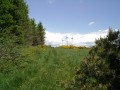
(7) Continue along the path which climbs to the right, going round a farm building. About 300 m further up, turn right onto the path leading up to Le Cheyla: panoramic views and a map post.
(8) Retrace your steps and rejoin the route to the right, heading slightly uphill.
(9) At the junction, continue to the right, pass through the hamlet of La Rode and come out onto the D48. Take it to the right, then turn left to reach a junction near the buildings at La Chaumette.
(10) First turn left then right and follow the path which leads further up to the small road heading towards the hamlet of Lieuriac. Continue in the same direction to reach the hamlet.
(11) After the first few houses, turn right onto Rue Émile de Laroque (a guesthouse with blue shutters on the left). Pass a long, narrow farm building, then take the path on the right which descends towards Oradour and joins the small road linking this village to Lieuriac.
(12) Continue in the same direction up to the village of Oradour, pass the cemetery and you’ll reach the car park (S/E).

 Visorando Member
 Easy
Easy