Country:

 City:
City:



Start from the Octroi car park, situated on the edge of Avenue du Docteur Louis Mallet (D621).
(S/E) From the car park, head towards the Municipal Police building, cross the D621 and continue towards the town centre, passing the fountain opposite. Go straight on along Rue des Lacs and, at Place du Palais, turn right until you reach a junction with a small fountain on your left.
(1) Take a sharp right onto Rue de la Rollandie, go under a portico, then immediately turn left onto Rue des Tuilles Haut. Follow this road down to Rue Jacques Paul Migne, which branches off to the right. Ignore this street and, between numbers 45 and 47, take the stairs on the left. These lead onto an uphill path; quickly head for the next flight of steps on the left.
(2) Take the steps to go back and forth through this narrow passage carved into the rock.
(2) On your return, continue along the narrow lane, which soon descends. Cross a street diagonally and carry on along Chemin des Chèvres until you reach the start of a path with a small gate on the left. Go through the gate , taking care to close it behind you, and you’ll soon come to a barely visible fork a few metres before a bench.
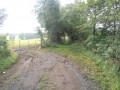
Turn right onto a gentle descent and follow the grassy path across the meadow. After walking alongside a fence on your right, you’ll reach another gate a few metres after entering the woodland. Go through it , taking care to close it behind you, then continue slightly uphill along the path, which turns into a grassy track and then a tarmac road. Walk past a row of garages on your left and you’ll reach a fork in the road.
Carry on left, uphill, then enter the old town. Ignore the streets on the right and head for the Place d’Armes and the Tourist Office.
(3) Pass through the archway to the left of the Tourist Office and arrive at an esplanade with a viewpoint over the valley and the lower town of Saint-Flour.
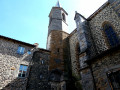
(3) Back at the square, head towards Saint-Pierre Cathedral, then make your way to the start of Rue Sorel between nos. 10 and 11. Follow it until you come to Rue des Jacobins on the right.
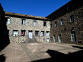
(4) Turn right onto it and walk a few metres; just before the car park, turn right into the passageway at No. 5 (this looks like a private passage but is open to the public) and you’ll arrive at a magnificent little courtyard.
Then head back to Rue Sorel.
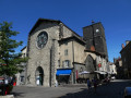
(4) Head straight ahead onto Rue des Écoles, pass Place des Mets and reach Place de la Halle au Bled. Turn right, walk past the collegiate church on your right to reach Place de la Halle (or perhaps Place de la Halle aux Bleds?). Carry on straight ahead and take the alleyway to the left of No. 17. You’ll reach a small square; walk past the theatre on your left (note the murals in place of the windows), leave the old town and follow the paths around the large car park to reach the Parking de l’Octroi near the roundabout (S/E).

 Visorando Member
 Difficult

 Moderate