Chemin des Morts du Bousquet

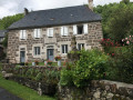
Part of this path was once used to carry the deceased from Le Bousquet to Malbo cemetery.

Details

n°32770193
Creation:
Last update:
Last review:
  • Walking
    Activity: Walking
  • ↔
    Distance: 6.10 mi
  • ◔
    Average duration: 3h 30 
  • ▲
    Difficulty: Moderate

  • ⚐
    Back to start: Yes
  • ↗
    Ascent: + 807 ft
  • ↘
    Descent: - 830 ft

  • ▲
    Highest point: 4,459 ft
  • ▼
    Lowest point: 3,638 ft

Photos

Description of the walk

Starting point: Le Bousquet. On arrival at Le Bousquet, park your car in the car park on the right before the village bakery.

(S/E) Cross the road and follow the light blue signposts.

(1) Take the path leading off to the left.

(2) Take the path on the right.

(3) Follow the path ahead, lined with 300-year-old trees, to the ladder leading into the meadows. Cross over, following the signposts.

(4) Turn right, following the signposts which lead to a gate. Once you’ve gone through it, turn left onto the path which will take you to the entrance to the Bois d’Esmat.

(5) Head slightly to the left to enter the woodland and follow the path straight on to its northern exit. On leaving the woodland, cross the pasture to reach a fairly wide path.

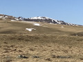
(6) Follow this path to the right all the way along the Bois de las Fros: views of the Aubrac mountains. The path joins a tarmac road.

(7) Turn right onto it.

(8) Leave the road and take a track on the right which climbs up to Grange Valat and joins a junction near two large farm buildings.

(9) Turn left and head for the car park (S/E).

Waypoints

  1. S/E : mi 0 - alt. 3,773 ft - Le Bousquet car park
  2. 1 : mi 0.08 - alt. 3,793 ft - Road/path junction
  3. 2 : mi 0.24 - alt. 3,793 ft - Junction
  4. 3 : mi 0.36 - alt. 3,789 ft - Tree-lined path
  5. 4 : mi 0.71 - alt. 3,904 ft - Turn right at the fork
  6. 5 : mi 1.21 - alt. 4,012 ft - Bois d’Esmat
  7. 6 : mi 2.33 - alt. 4,459 ft - Bois des las Fros path
  8. 7 : mi 4.06 - alt. 3,855 ft - Route
  9. 8 : mi 5 - alt. 3,638 ft - Road/path junction
  10. 9 : mi 5.69 - alt. 3,757 ft - Crossroads, farm buildings
  11. S/E : mi 6.1 - alt. 3,773 ft - Le Bousquet car park

Reviews and comments

4.7 / 5
Based on 1 review

Reliability of the description
5 / 5
Ease of following the route
5 / 5
Route interest
4 / 5
Les chemins de la découverte

Yes, indeed, and people would stop at each cross along the route: the cross at the sunken lane and the large cross on the way to Malbo. The walk only follows part of the path that used to take the deceased from Le Bousquet to Malbo, as some sections are currently on private land.

Machine-translated

Les chemins de la découverte
• Edited:

Thank you for your comments, and enjoy your walks

Machine-translated

murded
murded

Overall rating : 4.7 / 5

Date of your route : Jun 05, 2023
Reliability of the description : ★★★★★ Very good
Ease of following the route : ★★★★★ Very good
Route interest : ★★★★☆ Good
Very busy route : No

A pleasant walk. Between two …long gravel tracks… a path climbs gently through the woods. Scenery of meadows used for summer grazing. A 2-hour 15-minute walk with a profusion of flowers in spring.

Machine-translated

Other walks in the area

For more walks, use our search engine .

The GPS track and description are the property of this route's author. Please do not copy them without permission.