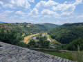
The Grandval Dam via La Mourache

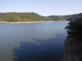
Over the centuries, the Truyère has carved out deep gorges which, with the rising water levels caused by the construction of the Grandval and Lanau dams, have given way to a natural landscape of surprising and contrasting beauty: islands and peninsulas, cirques with distant shores, mysterious meanders, narrow gorges opening onto vast expanses of water, a wooded valley… Following the PR la Mourache route, the walk offers magnificent views from the embankment supporting the Alleuze road.
Walking the route in the opposite direction offers more shade, but do keep an eye out for the signposting – which, to be honest, is rather sparse.

Details

30384947
Creation:
Last update:
Last review:
  • Walking
    Activity: Walking
  • ↔
    Distance: 5.76 mi
  • ◔
    Average duration: 3h 40 
  • ▲
    Difficulty: Moderate

  • ⚐
    Back to start: Yes
  • ↗
    Ascent: + 1,168 ft
  • ↘
    Descent: - 1,184 ft

  • ▲
    Highest point: 2,923 ft
  • ▼
    Lowest point: 2,198 ft

Photos

Description of the walk

Access. From Fridefont, take the D40 towards the Grandval dam, then turn right onto the Route de la Bastide and park on the verge near the Fridefont War Memorial – Route de la Bastide.

(S/E) Head for the Vialard crossroads via the PR® la Mourache trail, walking against the direction of traffic, which joins theGRP® Tour de Saint-Flour trail for a short while. Turn right onto the tarmac Allée des Frênes.

(1) Pass the entrance to a farm on the right and continue straight ahead, over the D40, along the edge of the field, closing any animal gates as you go. Join the departmental road at the end of a bend.

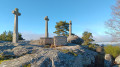
(2) Follow the road to the left for a few metres. Note the cross marking the site of the former village of Sarrus before turning right towards a bend in the Truyère. You’ll reach the site of the village, which was submerged when the dam was built.

(3) Leave thePR® for a return trip to an isthmus on Lake Lanau.

(4) Retrace your steps back to the previous junction.

(3) Turn left and pass under a high-voltage power line before reaching Sandouillère.

(5) Turn left before a holiday home and walk alongside the river beneath a power line. Reach a junction

Temporary departure from thePR®

(6) Turn left towards the bend in the Mourache and then join the access road to the hamlet.

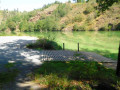
(7) Walk past the isolated house to reach the Mourache jetty, where a picnic table under the trees is the perfect spot to take a breather.

(8) After your break, retrace your steps back to the isolated house.

(8) Take the road on the left. After 1,200 metres along the narrow track, you’ll reach the junction with the D40 upstream of the Grandval dam. Turn left here and walk to the dam and back to admire the lake created by the reservoir, following theGR® de Pays de Saint-Flour (yellow-red markings).

(9) Return via the D40 and, on the left as you come out of the bend, look out for a path leading into the forest.
Follow theGRP® markings heading east, then turn right and head uphill through the woodland. After two hairpin bends, the path joins the road at the Bastide farm.

(10) Continue along the tarmac road to the War Memorial (S/E)

Waypoints

  1. S/E : mi 0 - alt. 2,894 ft - Monument commemorating 21 June 1944 – Fridefont
  2. 1 : mi 0.18 - alt. 2,920 ft - Continuation of Allée des Frènes
  3. 2 : mi 0.59 - alt. 2,785 ft - Crossing the D 40 – Croix de Sarrus
  4. 3 : mi 1.18 - alt. 2,372 ft - Sarrus crossroads. Return via the isthmus
  5. 4 : mi 1.42 - alt. 2,221 ft - Sarrus Isthmus - Truyère (rivière)
  6. 5 : mi 2.22 - alt. 2,589 ft - Sandouillère. Fork in the road
  7. 6 : mi 2.6 - alt. 2,326 ft - Junction beneath the high-voltage pylons
  8. 7 : mi 3.04 - alt. 2,339 ft - Junction. Return to the jetty
  9. 8 : mi 3.38 - alt. 2,198 ft - La Mourache jetty
  10. 9 : mi 4.64 - alt. 2,441 ft - Barrage de Grandval
  11. 10 : mi 5.35 - alt. 2,838 ft - Ferme de la Bastide
  12. S/E : mi 5.76 - alt. 2,890 ft - Monument commemorating 21 June 1944 – Fridefont

Notes

There are several places to stay in Fridefont but no shops.

(7) Picnic table.

Worth a visit

The Grandval Dam
Situated in the Truyère Gorges, the Grandval Dam was built between 1955 and 1960. The reservoir began to fill in 1959, resulting in the creation of a reservoir covering an area of 1,100 ha, which submerged the villages of Mallet and Magnac.
The dam consists of six arches, each 50 m wide, and two side walls. Its maximum height above the Truyère is approximately 75 m and its length is 350 m. The surface area of the Grandval Dam reservoir is around 1,100 ha.

Sarrus
Before becoming a village, Sarrus was the name of a Visigothic chieftain who had rallied to the Roman Empire. Appointed a count of the empire, he was granted the Auvergne region. He then settled in the Truyère valley, a crossing point between the north and the south, at the site that would later take the name of Sarrus.
The village disappeared, submerged by the waters when the dam was built, just like Mallet and Magnac… All that remains is an iron cross erected at the entrance to the village in 1925 to mark the centenary of the commune’s transfer to the parish of Fridefont.

Always be cautious and plan ahead when you're outdoors. Visorando and the author of this route cannot be held responsible for any accidents occurring on this route.

The GR® and PR® markings are the intellectual property of the Fédération Française de Randonnée Pédestre.

Reviews and comments

4.6 / 5
Based on 3 reviews

Reliability of the description
5 / 5
Ease of following the route
4.3 / 5
Route interest
4.3 / 5
franmo
franmo

A lovely walk, with very detailed instructions...

Machine-translated

News31
News31

Overall rating : 4.7 / 5

Date of your route : Oct 07, 2024
Reliability of the description : ★★★★★ Very good
Ease of following the route : ★★★★★ Very good
Route interest : ★★★★☆ Good
Very busy route : No

A lovely walk which (rather unusually) takes you close to the Truyère. Very shady – ideal in summer.
Generally interesting, though not particularly thrilling.

Machine-translated

Girafe_zen
Girafe_zen
• Edited:

Overall rating : 4.7 / 5

Date of your route : Jul 30, 2024
Reliability of the description : ★★★★★ Very good
Ease of following the route : ★★★★☆ Good
Route interest : ★★★★★ Very good
Very busy route : No

A lovely walk through the Truyère Gorges. Do take care on thesecond part of the route: near the farm, the path has been altered, and if you follow it, you’ll end up back where you started.

Machine-translated

dupontsabine
dupontsabine

Overall rating : 4.3 / 5

Date of your route : Oct 12, 2023
Reliability of the description : ★★★★★ Very good
Ease of following the route : ★★★★☆ Good
Route interest : ★★★★☆ Good
Very busy route : No

A route through the countryside – but watch out for hunters

Machine-translated

Other walks in the area

For more walks, use our search engine .

The GPS track and description are the property of this route's author. Please do not copy them without permission.