Prat Nalt

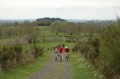
An easy-to-moderate difficulty trail exploring the Haute Planèze. It’s ideal for spending time with family or friends and isn’t just for mountain bikers; horse riders, walkers and trail runners can all enjoy it without any problems.

Details

n°60006
Creation:
Last update:
Last review:
  • Mountain biking
    Activity: Mountain biking
  • ↔
    Distance: 14.50 mi
  • ◔
    Duration according to the author: 3 hrs 
  • ▲
    Difficulty: Moderate

  • ⚐
    Back to start: Yes
  • ↗
    Ascent: + 1,280 ft
  • ↘
    Descent: - 1,293 ft

  • ▲
    Highest point: 4,098 ft
  • ▼
    Lowest point: 3,392 ft
  • ⚐ Country: France
  • ⚐
  • ⚐ City: Paulhac (15430)
  • ⚑
    Start/End: N 45.006792° / E 2.904569°
  • ❏
    IGN map(s): Ref. 2535O, 2536O

  • ◶
    Type of surface: Not specified
  • ⇧
    Bike carrying: Not specified
  • ▲
    Difficulty: Not specified
  • Hour-by-hour weather

Photos

Description of the route

Start from Paulhac (church).

(S/E) Head towards Prat de Bouc (D44).

(1) After the water tower, take the first path on the left, walk 10 metres and turn right, then follow the path uphill. At a path halfway up the slope on the left, follow the path (passing by the old aviary) and admire the 270° view. Continue along the path towards the woods (left).

(2) Enter the woodland on the left (at the bend just before the D44, an internal track of about 2 km), then 1 km further on, turn left to return to the same junction.

(2) Turn left at the bend to join the road (D44). Follow it to the right as if heading back towards Paulhac; at the cattle holding pen, take the path on the left (GR® de Pays) and follow it to the road leading to the football pitch.

(3) Continue along the road to the left until you reach the village of Bressange; take the country lane on the left as you leave the village. Continue along the lane for 1 km, then turn right down the slope towards the Sauvages bridge and head for the village.

(4) Turn left at the bend and, at the Sauvages oven, take the country lane to the Buron des Fraux. A long straight stretch of 1.5 km leads to Frau Bas.

(5) Turn immediately right (before the buron), continue along the track and enter the woods. When you reach the timber storage area and car park, leave theGR® de Pays and take the forest road on the right (tarmac). Follow it for about 700 metres.

(6) Turn right onto the path between the trees, follow the track through the mountain pasture, then the switchbacks, and continue along the path. Follow the path as it emerges, turning left for 2 km, then right and finally left to reach Le Jarry (nearby you can buy farmhouse Cantal cheese).

(7) Cross the D34 and take the path opposite towards Nozières. At the next junction, turn right then left to head up into the village. Turn right to rejoin the D34.

(8) Turn left onto the road and follow it for 1 km until you reach the entrance to the village of Loudiers. Take the first path on the left to rejoin theGR® de Pays. Carry on and let theGR® de Pays branch off to the left whilst you continue straight ahead.

(9) On the D44, turn right then immediately left to enter the village of La Salesse. Head towards the Tombe de la Dame (Romanesque sarcophagus – see photo). From the Tombe de la Dame, continue along the path for 300 metres, then turn right towards Pradalanche (bakery, wash house, basalt fountains).

(10) Leave the village on the right via the D34 and continue right along the footpath for 200m after leaving the village.
In the housing estate, turn left onto the road and follow it towards the church (S/E).

Waypoints

  1. S/E : mi 0 - alt. 3,668 ft - Paulhac Church
  2. 1 : mi 0.53 - alt. 3,845 ft - To the left
  3. 2 : mi 1.22 - alt. 3,957 ft - Crossroads of the circular loop
  4. 3 : mi 3.21 - alt. 3,698 ft - Football pitch
  5. 4 : mi 4.71 - alt. 3,720 ft - Wild
  6. 5 : mi 5.75 - alt. 3,973 ft - Frau Bas
  7. 6 : mi 6.72 - alt. 3,976 ft - To the right, amongst the trees
  8. 7 : mi 8.77 - alt. 3,612 ft - Jarry
  9. 8 : mi 10.44 - alt. 3,576 ft - Turn left onto the D34
  10. 9 : mi 12.38 - alt. 3,428 ft - D44
  11. 10 : mi 13.94 - alt. 3,579 ft - Pradalanche
  12. S/E : mi 14.5 - alt. 3,668 ft - Paulhac Church

Notes

No special equipment is required, although it is still advisable to take a bottle of water and a snack. As the walk passes through mountain pastures (where cattle are present), dogs are strongly discouraged.

Worth a visit

On the Chemin de Devant, take the time to admire the 270° panorama that unfolds before you: from the Plomb du Cantal, a peak at 1,856 metres, to the Margeride.

Always be cautious and plan ahead when you're outdoors. Visorando and the author of this route cannot be held responsible for any accidents occurring on this route.

The GR® and PR® markings are the intellectual property of the Fédération Française de Randonnée Pédestre.

Reviews and comments

4.7 / 5
Based on 1 review

Reliability of the description
5 / 5
Ease of following the route
5 / 5
Route interest
4 / 5
Matéorando
Matéorando

Overall rating : 4.7 / 5

Date of your route : Dec 24, 2018
Reliability of the description : ★★★★★ Very good
Ease of following the route : ★★★★★ Very good
Route interest : ★★★★☆ Good

A lovely route to whet your appetite for this beautiful region.

Machine-translated

For more walks, use our search engine .

The GPS track and description are the property of this route's author. Please do not copy them without permission.