The Narse de Lascols

The ‘Grande Randonnée’ trail in the Pays de Saint-Flour allows you to walk several circular routes around the capital of the Planèze and Margeride regions and passes through the village of Paulhac. The circular route crosses the Narse de Lascols from south to north, starting from Cussac, passing the Puy de Mercou, and heading back up towards the Bois des Fraux via the mountain pastures. The route described below is inspired by this, offering a wonderful exploration of the Planèze de Saint-Flour by combining the GR® de Pays and PR® trails around Paulhac.

Details

103358258
Creation:
Last update:
Last review:
  • Walking
    Activity: Walking
  • ↔
    Distance: 7.52 mi
  • ◔
    Average duration: 3h 50 
  • ▲
    Difficulty: Moderate

  • ⚐
    Back to start: Yes
  • ↗
    Ascent: + 417 ft
  • ↘
    Descent: - 417 ft

  • ▲
    Highest point: 3,652 ft
  • ▼
    Lowest point: 3,333 ft

Photos

Description of the walk

Park in the car park at Paulhac cemetery.

(S/E) Leave the cemetery car park and carefully cross the D34 to join Rue des Violettes, marked with the ‘colours’ of the GR® de Pays Tour de Saint-Flour. You’ll reach the junction with the Route de la Planèze in the Chazeaux neighbourhood.

(1) Avoid the road by turning right towards the houses (signpost indicating various local routes) and pass to the left of a house with green shutters. At the adjoining shed, turn left onto the grassy path that leads back up to the road. Walk a few metres along the D34 until you reach a junction just before the Garage de la Planèze, on the outskirts of the town. Turn right onto the PR® “La Tombe de la Dame” (route No. 8 indicated on a sign, organised by the “Loisirs Nature Paulhac” association). Pass a farm building on your left and cross the Pré de la Jambe, heading slightly downhill to Fond de la Salesse. You’ll come out onto the D44 (Km 9 marker).

(2) Take the road to the left. Ignore the PR® signposting, which follows the access road to La Salesse. Stay on the road, joining the PR® “La Narse de Lascols” route coming from the other access point to La Salesse. Follow the yellow signposting for approximately 2 km, passing livestock farms.

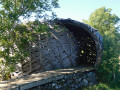
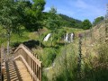
(3) At the “Pointe de Cornaire”, leave the road and take the Narse de Lascols nature trail on the right. Head towards the protected area and continue exploring this environment by taking a detour along a path between low stone walls, then across a footbridge leading to the wooden domed observatory, situated on the edge of the wetland. This open-air site features three information boards detailing various bird species.

(4) Return to the nature route after this informative stop.Head back towards Lascols by turning right at the junction. Pass through the hamlet and follow the south-eastern edge of the wetland before emerging onto the D57.

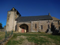
(5) Turn right onto the Route de Cussac and cross the road bridge. At the sign marking the entrance to the built-up area, turn right onto the Chemin des Prats Claus. Once there, follow the Rue de l’Église to the right and stop for a moment in front of the church, “which is well worth a visit”, though unfortunately it is closed.

(6) The PR® joins the GRP®, to the right of the church. Follow it to the right towards the north-west and cross the Ruisseau de Cussac again. You’ll reach the junction at the Tombe de la Dame.

(7) After a stop at the “empty” sarcophagus, turn left. At the Ronzière crossroads, head right towards the hamlet of Pradalenche.

(8) You’ll come out onto the D34. Turn right and leave the hamlet. 200 metres further on, take the path on the right rather than the road; this leads to the Saint-Laurent district of Paulhac. You’ll come out onto the D44.

(9) Turn left onto the road to Paulhac, head through the village and cross it to reach the cemetery car park (S/E).

Waypoints

  1. S/E : mi 0 - alt. 3,648 ft - Car park at Paulhac cemetery - Église Saint-Julien (Paulhac)
  2. 1 : mi 0.11 - alt. 3,638 ft - D 34 – Chazeaux district
  3. 2 : mi 1.05 - alt. 3,432 ft - Junction with the D44
  4. 3 : mi 2.49 - alt. 3,366 ft - Chemin de la Narse – Pointe de Cornaire
  5. 4 : mi 2.93 - alt. 3,369 ft - Birdwatching hide – Narse de Lascols
  6. 5 : mi 4.02 - alt. 3,350 ft - Junction with the D57
  7. 6 : mi 4.92 - alt. 3,497 ft - Cussac Church
  8. 7 : mi 6.23 - alt. 3,455 ft - Crossroads at the ‘Tombe de la Dame’
  9. 8 : mi 6.85 - alt. 3,576 ft - The hamlet of Pradalenche (D34)
  10. 9 : mi 7.25 - alt. 3,602 ft - Paulhac – St-Laurent district
  11. S/E : mi 7.52 - alt. 3,645 ft - Car park at Paulhac cemetery - Église Saint-Julien (Paulhac)

Notes

Picnic table near the church in Cussac. Another table in La Salesse with an open shelter, and one in Lascols

Please note: Following a long heatwave, the wetland has dried up and the birds have gone. The walk is therefore less appealing. Best done in spring, I imagine.

Worth a visit

La Narse de Lascols
La Narse de Lascols is a vast wetland area with exceptional biodiversity. It is home to rare species, which are showcased along a nature trail. This route also offers beautiful views across the Planèze plain. High-quality features (a lava-stone totem, enamelled lava panels and an observatory with an original design) line the route.
On the edge of the Narse de Lascols stands an imposing wooden observation tower, offering views of the wetland and its birdlife. It forms part of an 8.5 km trail dedicated to exploring the Narse and the unique character of the Planèze. The route starts at the church in Cussac and passes through the hamlets of La Salesse and Lascols. It is dotted with information points on the history of the wetland, how it functions and its biodiversity, and forms part of the initiatives of the Natura 2000 site managed by the Saint-Flour Community.
As it is a refuge for many birds, a pair of binoculars is highly recommended.

The Church of Saint-Amand in Cussac
Listed as a historic monument, this church comprises a nave with three bays opening onto three side chapels (15th century) and a choir with a flat chevet (Romanesque period). The chancel is covered by a ribbed vault, the ribs of which rest on corbels decorated with foliage, a man’s head and a mermaid. Outside, in front of the main entrance, stands a porch rebuilt in 1626 in the style of the chancel: a naked man holding a tree and a head serve as corbels for the ribs of the vault.

The Lady’s Tomb
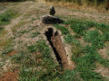
At the junction with the Saint-Flour GRP® trail, you can see on the ground, surrounded by grass, a Romanesque sarcophagus with a recess for the head of the deceased; this is the‘Lady’s Tomb’. It was here that a lady of high standing, caught unawares by a heavy snowfall, died and was buried there by her family.

The village of Paulhac
At the end of the walk, take the time to visit the Romanesque-style Church of Saint-Julien. It was burnt down and demolished during the Hundred Years’ War. The stepped bell tower has been replaced by a 30-metre spire to serve as a beacon for walkers who may lose their way in this area, which is often covered in snow. Several altarpieces and a polychrome figure of Christ adorn the interior. Nearby, the 13th-century castle catches the eye with its parapet walkways topping the towers.

Always be cautious and plan ahead when you're outdoors. Visorando and the author of this route cannot be held responsible for any accidents occurring on this route.

The GR® and PR® markings are the intellectual property of the Fédération Française de Randonnée Pédestre.

Other walks in the area

For more walks, use our search engine .

The GPS track and description are the property of this route's author. Please do not copy them without permission.