The Bès Gorges

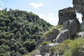
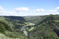
This somewhat rugged circuit follows a narrow path along the Gorges du Bès and offers wonderful landscapes with the ruins of Arzenc d'Apcher Castle on the opposite bank (Lozère). The path then climbs slightly onto the plateau and the view widens beyond the gorges. Throughout the valley, a climbing site offers numerous equipped routes. Passing through the villages of Morsanges and Chazals, you can admire old bread ovens.

Details

759402
Creation:
Last update:
Last review:
  • Walking
    Activity: Walking
  • ↔
    Distance: 3.90 mi
  • ◔
    Average duration: 2h 25 
  • ▲
    Difficulty: Moderate

  • ⚐
    Back to start: Yes
  • ↗
    Ascent: + 745 ft
  • ↘
    Descent: - 748 ft

  • ▲
    Highest point: 3,248 ft
  • ▼
    Lowest point: 2,818 ft

Photos

Description of the walk

Starting point: in front of the communal oven in the hamlet of Morsanges.

(S/E) From the starting point, take the path on the right that passes in front of the fountain.

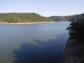
(1) After passing the granite chaos above the path, go through a series of gates (view of the Grandval dam reservoir). The path winds downhill.

(2) At the fourth hairpin bend, leave the path that leads to the penstock and follow the path on the right. At another hairpin bend, take the path below a dry stone wall. The path crosses the woods and becomes fairly flat again, then enters the gorge.

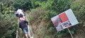
(3) Over the next kilometre, you will cross several climbing areas: Pré des Filles, Griffes du Diable, Roche Longue, belvedere and Bec de l'Aigle. Take care with children: there are sections with cable handrails.

(4) After the Bec de l'Aigle section, take the path on the right that climbs up to a chicane and then joins a gate. Continue to the hamlet of Chazals and cross it, continuing straight ahead.

(5) At the crossroads after the hamlet of La Grenouillère, turn right onto the road to Morsanges with a view of the ruins of the Arzenc-d'Apcher tower on the other side of the gorges in Lozère. Return to the starting point (S/E).

Waypoints

  1. S/E : mi 0 - alt. 3,212 ft - Morsanges communal oven
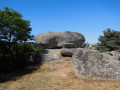
  2. 1 : mi 0.42 - alt. 3,159 ft - Path through the granite chaos of Morsanges
  3. 2 : mi 0.68 - alt. 2,959 ft - Gorges trail - Bès (rivière)
  4. 3 : mi 1.19 - alt. 2,835 ft - Pré des Filles
  5. 4 : mi 2.39 - alt. 3,038 ft - Bec de l'Aigle
  6. 5 : mi 3.04 - alt. 3,248 ft - La Grenouillère
  7. S/E : mi 3.9 - alt. 3,212 ft - Morsanges communal oven

Notes

Crossing private property and presence of sheep herds: dogs are not allowed, even on a leash.
The trail is steep and not recommended for people who are prone to vertigo or in foggy weather.
Yellow markings.

Worth a visit

Bread ovens in Morsanges and Chazals.
Granite chaos at Morsanges.
Bès Gorges.
Roche Longue.
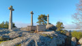
Ruins of Arzenc-d'Apcher Castle.
Grandval dam reservoir.

Reviews and comments

4.7 / 5
Based on 45 reviews

Reliability of the description
4.7 / 5
Ease of following the route
4.7 / 5
Route interest
4.8 / 5
User 18871878

Overall rating : 5 / 5

Date of your route : Mar 09, 2026
Reliability of the description : ★★★★★ Very good
Ease of following the route : ★★★★★ Very good
Route interest : ★★★★★ Very good
Very busy route : No

Very nice course

Machine-translated

lyryc28
lyryc28

Overall rating : 5 / 5

Date of your route : Sep 05, 2025
Reliability of the description : ★★★★★ Very good
Ease of following the route : ★★★★★ Very good
Route interest : ★★★★★ Very good
Very busy route : No

Very beautiful hike, superb views of the gorges.
A few technical sections, but with good footwear it's doable!

Machine-translated

Jean puydomois
Jean puydomois

Overall rating : 4.3 / 5

Date of your route : Aug 26, 2025
Reliability of the description : ★★★★☆ Good
Ease of following the route : ★★★★☆ Good
Route interest : ★★★★★ Very good
Very busy route : Yes

Not very long, little elevation gain but spectacular. Caution: very narrow ledge path, risk of falling due to elevation gain. Signs posted are very explicit about this

Machine-translated

Mamay78
Mamay78

Overall rating : 4.7 / 5

Date of your route : Aug 09, 2025
Reliability of the description : ★★★★☆ Good
Ease of following the route : ★★★★★ Very good
Route interest : ★★★★★ Very good
Very busy route : No

A very beautiful and pleasant hike. The trail is partly open and partly shaded. Please note that dogs are not allowed and young children should be supervised as the trail can be dangerous in places.
Some sections are quite narrow and may be intimidating for those prone to vertigo. Many sections are equipped with chain handrails or cables.
very enjoyable.
There are many views of the Bès Gorges and the ruined castle of Arzenc-d'Apcher.
With a touch of history, this trail is part of the path taken by the Spaniards who built the pipes used to supply the hydroelectric power stations that are still in use today. And instead of the maquisards, there are a few mines, which are refreshing.
A beautiful discovery that leaves you with wonderful memories

Machine-translated

legodvicien
legodvicien
• Edited:

Overall rating : 5 / 5

Date of your route : Aug 06, 2025
Reliability of the description : ★★★★★ Very good
Ease of following the route : ★★★★★ Very good
Route interest : ★★★★★ Very good
Very busy route : No

A very beautiful hike with exceptional views!
the hike may be very easy for experienced walkers, but it should be noted that it can be quite challenging and technical in some places.
I was enchanted by this route!

Machine-translated

HorizonVagabond
HorizonVagabond

Overall rating : 5 / 5

Date of your route : Aug 02, 2025
Reliability of the description : ★★★★★ Very good
Ease of following the route : ★★★★★ Very good
Route interest : ★★★★★ Very good
Very busy route : No

A very beautiful hike without any major difficulties.
Some sections are quite narrow and overhanging and may be challenging for those prone to vertigo, but these sections are equipped with chain handrails or cables.
There are many magnificent views of the Bès Gorges and the ruined castle of Arzenc-d'Apcher.
The area also has a rich history, as part of the trail follows the path taken by the Spanish who built the pipes used to supply the hydroelectric power stations that are still in use today.
A wonderful discovery.

Machine-translated

Rémy Poncelet
Rémy Poncelet

Overall rating : 5 / 5

Date of your route : Jul 02, 2025
Reliability of the description : ★★★★★ Very good
Ease of following the route : ★★★★★ Very good
Route interest : ★★★★★ Very good
Very busy route : No

A very beautiful hike, with an easy-to-follow trail and a few sections where caution is advised, especially if you have children. Best done in dry weather

Machine-translated

Joel7842
Joel7842

Overall rating : 5 / 5

Date of your route : Jun 22, 2025
Reliability of the description : ★★★★★ Very good
Ease of following the route : ★★★★★ Very good
Route interest : ★★★★★ Very good
Very busy route : No

A beautiful hike overlooking the Bès Gorges. The trail is very well marked and signposted.
The few steep sections are perfectly secured. The return via the plateaus allows you to discover the small hamlets of the Cantal region. An easy but very pleasant hike, with a good portion in the woods. Perfect for a hot day.

Machine-translated

Daniel Thoraval
Daniel Thoraval

Overall rating : 5 / 5

Date of your route : Apr 07, 2025
Reliability of the description : ★★★★★ Very good
Ease of following the route : ★★★★★ Very good
Route interest : ★★★★★ Very good
Very busy route : No

A very beautiful walk.

Machine-translated

zebulon1961
zebulon1961

Overall rating : 5 / 5

Date of your route : Aug 31, 2024
Reliability of the description : ★★★★★ Very good
Ease of following the route : ★★★★★ Very good
Route interest : ★★★★★ Very good
Very busy route : No

Apart from the last kilometre on the road (which is very quiet) to return to the starting point, this is a really lovely walk. The gorges are stunning, with lots of great views. The route is well signposted and easy to follow.

Machine-translated

SophieDo
SophieDo

Overall rating : 5 / 5

Date of your route : Aug 22, 2024
Reliability of the description : ★★★★★ Very good
Ease of following the route : ★★★★★ Very good
Route interest : ★★★★★ Very good
Very busy route : No

Very beautiful hike, but beware: dogs are not allowed, even on a leash, and there are some dizzying passages. You need good shoes!

Machine-translated

joemarie
joemarie

Overall rating : 5 / 5

Date of your route : Aug 26, 2024
Reliability of the description : ★★★★★ Very good
Ease of following the route : ★★★★★ Very good
Route interest : ★★★★★ Very good
Very busy route : No

A beautiful hike in an exceptional setting along the Bes Gorges. No difficulty, the site is well secured and marked. However, I recommend good hiking boots as there are many stones and rocks on steep paths.

Machine-translated

Girafe_zen
Girafe_zen

Overall rating : 5 / 5

Date of your route : Aug 05, 2024
Reliability of the description : ★★★★★ Very good
Ease of following the route : ★★★★★ Very good
Route interest : ★★★★★ Very good
Very busy route : No

Great hike with beautiful views of the gorges, trails through the woods and down the slopes.
Well laid out and safe. No access to the river

Machine-translated

Bertrand P.
Bertrand P.

Overall rating : 4.7 / 5

Date of your route : Jun 17, 2024
Reliability of the description : ★★★★★ Very good
Ease of following the route : ★★★★☆ Good
Route interest : ★★★★★ Very good
Very busy route : No

Hello, beautiful hike, beautiful gorges, met a few people, nice. Be careful when you arrive at a hangar that you have to leave on your left, make sure you find the track on the left in the field, otherwise you'll quickly get lost.

Machine-translated

Marie Pierre Rague
Marie Pierre Rague

Overall rating : 5 / 5

Date of your route : Aug 28, 2023
Reliability of the description : ★★★★★ Very good
Ease of following the route : ★★★★★ Very good
Route interest : ★★★★★ Very good
Very busy route : No

A very beautiful hike with magnificent views, sometimes along the edge of cliffs but perfectly safe. A real treat.

Machine-translated

For more walks, use our search engine .

The GPS track and description are the property of this route's author. Please do not copy them without permission.