Prat de Bouc – Thiézac

Stage2 of theGR®400, travelling clockwise.
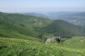
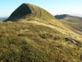
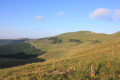
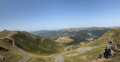
Plomb du Cantal and a long panoramic ridge before descending to Thiézac.

This walk is part of a multi-day hike: Tour du volcan Cantalien par le GR®400 dans le sens horaire

Details

1935715
Creation:
Last update:
Last review:
  • Walking
    Activity: Walking
  • ↔
    Distance: 11.90 mi
  • ◔
    Average duration: 7h 10 
  • ▲
    Difficulty: Moderate

  • ⚐
    Back to start: No
  • ↗
    Ascent: + 1,969 ft
  • ↘
    Descent: - 3,927 ft

  • ▲
    Highest point: 6,079 ft
  • ▼
    Lowest point: 2,493 ft

Photos

Description of the walk

(S) From the lodge, head back down the road a short way, then turn left onto the signpostedGR® path which climbs to the Plomb du Cantal via the Col de la Tombe du Père, where the views open out over the valleys to the west. Below the Plomb, take the diagonal path to the right which joins the steps.

(1) Descend from the Plomb and begin the long, beautiful traverse along the ridge. The route passes beneath the Puy Brune.

:: 2.. Then the Col de la Pourtoune.

(3) Continue past Puy de la Cède and cross the Col de Chèvre near Puy Gros.

(4) On the outskirts of Puy Gros, you’ll catch sight of the Chapelle du Cantal with its monumental cross. Stay on the path to the right (a path to the left passes beneath the chapel). Then head for the Buron de la Tuillière.

(5) At the corner of the buron, turn right down the slope towards Thiézac. You’ll soon enter the woodland and emerge again after a crossroads of paths.

(6) Turn slightly to the right to re-enter the woods. The path is almost flat at first, then zigzags slightly downhill to reach a tarmac road at the Ferme de Malgrat.

(7) Turn left, then left again at the next junction and head downhill until you reach the Lafon lodge. Continue along the road past the lodge until you reach theGR® junction at a bend.

(8) Turn left onto theGR® path towards the Chaos de Casteltinet. Walk alongside the high cliff face of Casteltinet, which can be seen through the trees. Pass through the Porte du Lion, an archway in a volcanic breach. Continue down the slope to the railway line.

(9) Pass under the railway line and follow the road. At the next junction, marked by a fountain, turn left. Continue along this small road to the hamlet of Cère. Turn right and join a road that passes under the N122. You’ll reach another junction.

(10) Turn right, cross the bridge over the Cère, turn left, then slightly left again. Next, follow the signposts carefully as they lead across a field; the path is lined with street lamps. This will take you to the centre of Thiézac, today’s destination (E).

Waypoints

  1. S : mi 0 - alt. 4,567 ft - Prat de Bouc - Col de Prat de Bouc
  2. 1 : mi 1.91 - alt. 5,997 ft - Below the - Plomb du Cantal
  3. 2 : mi 2.72 - alt. 5,548 ft - Col de la Pourtoune
  4. 3 : mi 3.87 - alt. 5,318 ft - Col de Chèvre
  5. 4 : mi 4.56 - alt. 5,210 ft - Chapelle du Cantal. Near - Le Puy Gros
  6. 5 : mi 7.24 - alt. 4,380 ft - Buron de la Tuillière
  7. 6 : mi 7.69 - alt. 4,026 ft - Junction in the meadow
  8. 7 : mi 9.06 - alt. 3,527 ft - Tarmac road
  9. 8 : mi 9.62 - alt. 3,205 ft - Lafon
  10. 9 : mi 10.77 - alt. 2,789 ft - Railway line
  11. 10 : mi 11.46 - alt. 2,500 ft - Bridge over the - Cère (rivière)
  12. E : mi 11.9 - alt. 2,625 ft - Thiézac

Notes

In hot weather, take plenty of water.
Two water points: after Puy Brunet, and at Lafon in the lodge (if the lodge is open).
Long ridge walk after Le Plomb: watch out for the risk of thunderstorms.
Take care to stay on course in foggy weather in some meadows where the path becomes somewhat obscured and signposting is very sparse.
No explicit mention ofthe GR®400, but there are directional signs (e.g. Buron de la Tuillière, Chaos de Casteltinet, with red and white markings)
Accommodation in Prat de Bouc and Thiézac. Grocery shop and bakery in Thiézac.

Worth a visit

Always be cautious and plan ahead when you're outdoors. Visorando and the author of this route cannot be held responsible for any accidents occurring on this route.

The GR® and PR® markings are the intellectual property of the Fédération Française de Randonnée Pédestre.

Reviews and comments

4.1 / 5
Based on 3 reviews

Reliability of the description
3.7 / 5
Ease of following the route
4 / 5
Route interest
4.7 / 5
Jacqed
Jacqed

Overall rating : 4.7 / 5

Date of your route : Jun 18, 2026
Reliability of the description : ★★★★☆ Good
Ease of following the route : ★★★★★ Very good
Route interest : ★★★★★ Very good
Very busy route : No

Stage 2 of our Tour of the Cantal Volcano (GR 400)
A very beautiful route from Prat de Bouc to La Tuillière. The route is completely open on the climb up to the Plomb du Cantal and then all the way along the stunning ridge. No water supplies available before La Tuillière (unless the inn is open).
The descent from La Tuillière to Thiezac is entirely through woodland; it’s quite long, even seemingly endless.
Signposting is excellent.
This stage, classified as ‘Medium’ difficulty, would be better classified as ‘Difficult’, given its length and the very significant descent.

Machine-translated

danielrollet
danielrollet

Overall rating : 3.7 / 5

Date of your route : Jun 15, 2021
Reliability of the description : ★★★☆☆ Average
Ease of following the route : ★★★☆☆ Average
Route interest : ★★★★★ Very good
Very busy route : No

A lovely walk, but I think this route should be rated ‘difficult’ rather than ‘moderate’ because of its length. I walked 19,650 metres with an elevation gain of 625 metres.
There’s a mistake right at the start: you’re supposed to leave the track and take the path on the left leading to Le Plomb, but the signposts aren’t visible when you arrive as you’d expect – you have to turn round.
One sign at the start of the track says “Plomb du Cantal 7.5 km, 2 hours 15 minutes”!!! Whereas it’s actually only 3.5 km and 1 hour 30 minutes.
The path leading to Le Plomb is not marked in accordance with the route shown on the IGN map or the Visorando map; the route has been altered.
The water source indicated after Puy Brunet is in fact located after the Col de la Pourtoune at an altitude of 1,690 metres and consists of a trough, the potability of which is unknown.
There are a few fairly steep descents after La Tuillière Buron, particularly at La Porte du Lion, which is very dangerous.
The grocery shop and bakery in Thiézac are closed on Wednesdays.
Instead of ‘spotting the Chapelle du Cantal’, it is better to advise walkers to ‘pass above the chapel and then stay on the south-westerly path above it’.
Beware of the sun on the ridge walk.
Daniel Rollet

Machine-translated

bernardgemenos
bernardgemenos

Overall rating : 4 / 5

Date of your route : Jun 15, 2021
Reliability of the description : ★★★★☆ Good
Ease of following the route : ★★★★☆ Good
Route interest : ★★★★☆ Good
Very busy route : No

A route completed in the opposite direction, starting from the Lafon lodge, which balances out the two
days. After the climb, there’s another long and magnificent ridge walk to the Plomb du Cantal along very easy-going and well-marked paths. Pure enjoyment!

Machine-translated

Other walks in the area

For more walks, use our search engine .

The GPS track and description are the property of this route's author. Please do not copy them without permission.