Route du Bois des Fraux

This is a route that captures the mountain atmosphere of the Haute Planèze – the land of burons and summer pastures – starting from Saint-Maurice, a hamlet of Valuéjols, and leading to one of the few wooded areas in the Planèze. The route follows signposted sections (local PR® and GRP® trails) along tracks suitable for vehicles, which link the hamlets and farms scattered across the area. The Bois des Fraux, meanwhile, is maintained by foresters who have cleared tracks there for walking or cross-country skiing, provided there is still snow in winter.

Details

107758319
Creation:
Last update:
Last review:
  • Walking
    Activity: Walking
  • ↔
    Distance: 6.59 mi
  • ◔
    Average duration: 3h 25 
  • ▲
    Difficulty: Easy

  • ⚐
    Back to start: Yes
  • ↗
    Ascent: + 486 ft
  • ↘
    Descent: - 489 ft

  • ▲
    Highest point: 4,265 ft
  • ▼
    Lowest point: 3,753 ft

Photos

Description of the walk

Starting point: Saint-Maurice Church (hamlet of Valuéjols)

PR® “Les Quatre Charreyres” (route no. 5)

(S/E) At the junction with the Chemin de Cabretaïre (bus shelter), take the road opposite which runs alongside the church.

(1) Turn right onto “route no. 5”, which descends into the Brageac valley before climbing back up to the mountain pasture.

Junction with the GR®4 and GRP® from Saint-Flour (white-and-red markings, as the GR® takes priority)

(2) Turn left onto a track that climbs slightly to ‘bypass’ the 1,182-metre altitude on the Levers. Then descend to Brageac.

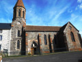
(3) At the Place du Four, continue to the right along Rue des Pierres Plates and head for the hamlet of Lescure Bas, then carry on to Lescure Haut, keeping the bell tower of Notre-Dame de la Visitation in sight. Take a break to visit the church, as it is open.

(4) On leaving the church, turn right to come out onto the D134, but leave it immediately by turning left at the Fork in the road to continue following the GR®, heading due west. Make a sweeping arc towards the south-west, around the Pré de la Grange hollow, and cross the Ruisseau de Chambeyrac. You’ll reach the Roche Jean crossroads, where the GR® and GRP® routes part ways. A picnic bench marks the junction just past the entrance to the “Forêt sectionale de Valuéjols”. There is a car park for the cross-country skiing area (signposted with trail routes).

Point where theGR® and GRP® routes split.

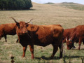
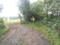
(5) Carry on straight ahead, following the GRP® southwards along the edge of the woodland. The vast summer pastures of Roche Jean on the right allow ‘Salers’ and other breeds to graze in complete tranquillity, with hardly a glance (photo) from passing walkers. Walk 700 m before reaching the start of a track on the left (blue ski run).

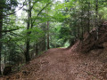
(6) Turn left into the forest. Make your way to the opposite edge of the woodland, then turn right for another stretch through the undergrowth. At the Fork in the road, turn left to stay under the canopy.

(7) Rejoin route no. 5 and follow it to the left, then join a track. Turn right onto this track and continue to a large crossroads (picnic table). (Recording the route has made it possible to pinpoint the path’s location on the IGN map, where it was not previously marked.)

(8) Leave the GRP® – which you’ve only just rejoined at the “4 chemins” junction – as well as route no. 5, by taking a small, shaded road to the left. Head straight towards the Gardille hill to the north-east, then turn off towards Saint-Maurice. Cross the hamlet to reach the church (S/E).

Waypoints

  1. S/E : mi 0 - alt. 3,780 ft - St-Maurice – Church
  2. 1 : mi 0.08 - alt. 3,799 ft - Piste des Moulins
  3. 2 : mi 0.83 - alt. 3,753 ft - GRP/GR junction
  4. 3 : mi 1.6 - alt. 3,862 ft - Brageac
  5. 4 : mi 2.29 - alt. 3,953 ft - Lescure Haut - Église Notre-Dame de la Visitation (Lescure)
  6. 5 : mi 3.5 - alt. 4,206 ft - Crossroads – cross-country ski trail car park
  7. 6 : mi 3.9 - alt. 4,265 ft - Path to the left of the cross-country ski trail
  8. 7 : mi 4.87 - alt. 4,091 ft - Bois des Fraux – Fork in the road on route No. 5
  9. 8 : mi 5.13 - alt. 4,039 ft - Crossroads of the 4 paths
  10. S/E : mi 6.59 - alt. 3,776 ft - St-Maurice – Church

Notes

Picnic tables at the Roche Jean crossroads (4) and in the Bois des Fraux (8).

Toilets at Lescure Haut.

Route No. 5 is part of a free guidebook available from the Loisirs Nature Paulhac association, which features several suggested walks starting from the village. Enquire at the town hall.

Worth a visit

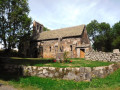
The Church of Notre-Dame-de-la-Visitation is a French church in the Neo-Gothic style situated in the village of Lescure, in the commune of Valuéjols. It is a place of pilgrimage dedicated to the Virgin Mary. It has an annexe for religious services, which attract many pilgrims.

The Bois des Fraux
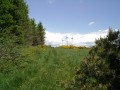
It is one of the few wooded areas in the Planèze region. It is home to Scots pines, firs, common spruces and larches, whilst the undergrowth is rich in flowers: foxgloves, willowherbs, blueberries and raspberries. It is situated to the west of the municipality, beyond the villages of Saint-Maurice and Brageac. It is a wonderful place for walks, both in summer and winter (cross-country ski trails). Hunting takes place here in autumn, and foresters work there all year round. It is also renowned for its mushrooms, from spring to autumn.

Always be cautious and plan ahead when you're outdoors. Visorando and the author of this route cannot be held responsible for any accidents occurring on this route.

The GR® and PR® markings are the intellectual property of the Fédération Française de Randonnée Pédestre.

Other walks in the area

For more walks, use our search engine .

The GPS track and description are the property of this route's author. Please do not copy them without permission.