lippo

 Visorando Member
 Premium user
 - Location: Villardonnel (11600)
- Gender: man
Sign up:
Published route(s)
 Caunettes Hautes, the Heath du Sauvage
 3.99 mi
 +433 ft
 -430 ft
 2h 15
2h 15
 Easy
Easy
 Departure from Moussoulens (Aude)
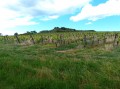
A short walk that climbs gently to (2) along a track suitable for vehicles but gravelled and in full sun.
The second section is better sheltered from the sun and runs across the Causse. The final stretch passes through three estates and ends along a vineyard path back to the cars.
Cuxac, Goutarende, Bertrande and Plaine de Cazelle
 4.26 mi
+604 ft
-614 ft
2h 30
4.26 mi
+604 ft
-614 ft
2h 30
 Average
Departure from Cuxac-Cabardès (Aude)
Average
Departure from Cuxac-Cabardès (Aude)
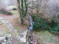
Three-quarters of the route is sheltered from the wind and sun. A beautiful walk through a chestnut forest.
The different markings cross each other. This should not be taken into account as several of the paths taken are marked with a cross, but they are the right paths nonetheless. (in (2), in (6) and in (7))
Moussoulens to La Plaine via Caunettes Hautes
 4.02 mi
+302 ft
-302 ft
2h 05
Easy
Departure from Moussoulens (Aude)
4.02 mi
+302 ft
-302 ft
2h 05
Easy
Departure from Moussoulens (Aude)
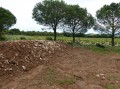
An interesting circular route through vineyards and heath around the Plaine de Moussoulens.
Col de Fangas Haut and the boundary markers
 4.14 mi
+571 ft
-551 ft
2h 25
Average
Departure from Lacombe (Aude)
4.14 mi
+571 ft
-551 ft
2h 25
Average
Departure from Lacombe (Aude)
A walk entirely through the woodland of the Forêt de La Loubatière. Following paths and tracks, without ever walking on tarmac, you will follow the Ruisseau de Fraïssègne, one of the streams feeding into Lac de la Galaube, along whose eastern arm you will walk.
Drystone shelters of Conques - Plaine de Cocalière
 4.00 mi
+200 ft
-200 ft
2h 00
Easy
Departure from Conques-sur-Orbiel (Aude)
4.00 mi
+200 ft
-200 ft
2h 00
Easy
Departure from Conques-sur-Orbiel (Aude)
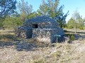
This is an easy walk on a limestone plateau that was cultivated until a century ago, despite the poor soil. This is why there are many drystone shelters, which were small shelters to protect workers in case of bad weather. These shelters were built with countless stones taken from the land during agricultural work.
Drystone shelters of Conques - Aribeau wall
 3.37 mi
+289 ft
-292 ft
1h 50
Easy
Departure from Conques-sur-Orbiel (Aude)
3.37 mi
+289 ft
-292 ft
1h 50
Easy
Departure from Conques-sur-Orbiel (Aude)
In the Heath du Roi in Conques-sur-Orbiel, many dry stone structures have been restored by a village association. On this walk, we will show you the walls that were originally used to mark out boundaries and create enclosures for livestock at night.
Preixan in the vineyards and fields
 4.99 mi
+630 ft
-636 ft
2h 50
Average
Departure from Preixan (Aude)
4.99 mi
+630 ft
-636 ft
2h 50
Average
Departure from Preixan (Aude)
A pleasant route through very hilly terrain. Fields, vineyards and forests alternate throughout the walk.
Fraïsse-Cabardès and Les Bouriettes
 3.36 mi
+344 ft
-315 ft
1h 50
Easy
Departure from Fraisse-Cabardès (Aude)
3.36 mi
+344 ft
-315 ft
1h 50
Easy
Departure from Fraisse-Cabardès (Aude)
An easy walk through woods and fields. A lovely climb through the forest alongside the Moureau stream.
Saint-Denis and the walk around its lake
 3.78 mi
+305 ft
-305 ft
2h 00
Easy
Departure from Aude
3.78 mi
+305 ft
-305 ft
2h 00
Easy
Departure from Aude
A short, easy walk, sheltered for half the route.
Moussoulens and the Zelkova
 4.20 mi
+348 ft
-338 ft
2h 15
Easy
Departure from Moussoulens (Aude)
4.20 mi
+348 ft
-338 ft
2h 15
Easy
Departure from Moussoulens (Aude)
Half of the hike is under the trees and half is in the heath.
Lampy, Lampiot, around the lake
 4.34 mi
+220 ft
-220 ft
2h 10
Easy
Departure from Saissac (Aude)
4.34 mi
+220 ft
-220 ft
2h 10
Easy
Departure from Saissac (Aude)
Three quarters of the hike is sheltered from the sun and wind by the beech forest (mainly). Wear good shoes as the trail is often muddy with some stream crossings that are more or less maintained. Foresters have cleared the trail, which creates some large puddles, but these can always be avoided by walking along the edges of the forest.
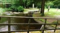
The channel through the Lac de Saint-Denis
 4.51 mi
+161 ft
-161 ft
2h 15
Easy
Departure from Saissac (Aude)
4.51 mi
+161 ft
-161 ft
2h 15
Easy
Departure from Saissac (Aude)
This is an easy hike, sheltered from the sun for 90% of the route. The hike can be done in either direction. You will be better sheltered from the sun if you follow the directions given here.
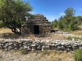
Drystone shelters of Conques-sur-Orbiel
 4.33 mi
+312 ft
-315 ft
2h 15
Easy
Departure from Conques-sur-Orbiel (Aude)
4.33 mi
+312 ft
-315 ft
2h 15
Easy
Departure from Conques-sur-Orbiel (Aude)
On 300 hectares, an association in Conques-sur-Orbiel has restored a large number of drystone shelters, which were once used to shelter farmers when they worked on this inhospitable land. The rocks dug up during the work were used to build these shelters. You will come across around thirty of these drystone shelters.
The Martys
 4.10 mi
+266 ft
-266 ft
2h 05
Easy
Departure from Les Martys (Aude)
4.10 mi
+266 ft
-266 ft
2h 05
Easy
Departure from Les Martys (Aude)
A gentle walk in the shade for the first third of the route. No difficulty. Tarmac road for 20% of the route and wide paths for the rest.
Villardonnel et Notre-Dame de Canabès
4.40 mi
+2,507 ft
-2,536 ft
4h 10
Easy
Departure from Villardonnel (Aude)
Petite balade autour du village durant laquelle vous allez souvent longer des murettes en pierres sèches. Les sentiers ont été creusés à flanc de colline et ces murettes ont été montées pour retenir la terre du fond dominant.
Nous sommes en 2016 et le tracé a été reconnu et identifié par des marques de couleur Rouge. Ces marques ne respectent pas la forme officielle de la FFR mais sont parfaitement visibles car assez larges. Cela n'est pas inutile car certains sentiers sont dans les champs.
Fraïsse-Cabardès and its cliff
 4.06 mi
+489 ft
-489 ft
2h 20
Easy
Departure from Fraisse-Cabardès (Aude)
4.06 mi
+489 ft
-489 ft
2h 20
Easy
Departure from Fraisse-Cabardès (Aude)
A short walk, sheltered from the sun and wind for almost the entire length as it is in the forest. It had been marked in blue for an event and these markings remain visible in 2016 – but for how long? In two places, we follow paths that are not shown on the IGN map. Hence the importance of following the Visorando route.
Laprade Lake - Les Tables
 3.68 mi
+371 ft
-354 ft
2h 00
Easy
Departure from Cuxac-Cabardès (Aude)
3.68 mi
+371 ft
-354 ft
2h 00
Easy
Departure from Cuxac-Cabardès (Aude)
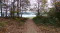
The walk remains entirely in the forest and is completely off-road. Wear suitable footwear as the route is very stony.
Bize-Minervois and the Pech tour
 4.39 mi
+591 ft
-568 ft
2h 30
Easy
Departure from Bize-Minervois (Aude)
4.39 mi
+591 ft
-568 ft
2h 30
Easy
Departure from Bize-Minervois (Aude)
An easy, gentle walk. Long path along the hillside and return via the ridge.
Puichéric, along the Canal du Midi
 3.74 mi
+30 ft
-26 ft
1h 45
Easy
Departure from Puichéric (Aude)
3.74 mi
+30 ft
-26 ft
1h 45
Easy
Departure from Puichéric (Aude)
A walk on flat ground (less than 10 metres elevation gain), always in full sun. The ground is very clayey and should be avoided after heavy rain. Let’s not forget that the entire Marseillette and Puichéric basin used to be a lake that was drained for agricultural purposes. There’s water everywhere, and numerous canals and ditches criss-cross the area.
Cuxac Cabardès - The heights of Saint-Pierre
 5.05 mi
+715 ft
-715 ft
2h 55
Easy
Departure from Caudebronde (Aude)
5.05 mi
+715 ft
-715 ft
2h 55
Easy
Departure from Caudebronde (Aude)
A mid-season hike as it’s always exposed to the sun and wind. It climbs for 3.5 km before heading back down… obviously!
La Rigole via the Prise d'Alzeau
 3.76 mi
+144 ft
-144 ft
1h 50
Easy
Departure from Lacombe (Aude)
3.76 mi
+144 ft
-144 ft
1h 50
Easy
Departure from Lacombe (Aude)
The walk is always in the shade and sheltered by very large beech and oak trees. There is practically no elevation gain as you follow the water.
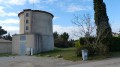
Villegailhenc and the Bade du Goy
 3.57 mi
+351 ft
-344 ft
1h 55
Easy
Departure from Villegailhenc (Aude)
3.57 mi
+351 ft
-344 ft
1h 55
Easy
Departure from Villegailhenc (Aude)
The trail is on very clayey ground; best avoided within ten days of rain.
It’s best to go in summer, but do take the usual precautions (exposure to direct sunlight).
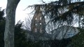
Grèzes, Herminis and Caux around the Las Sabartèzes stream
 4.62 mi
+131 ft
-131 ft
2h 15
Easy
Departure from Carcassonne (Aude)
4.62 mi
+131 ft
-131 ft
2h 15
Easy
Departure from Carcassonne (Aude)
A route with absolutely no shade and very little elevation gain. Runs through fields and vineyards the whole way. Passes through three villages.
The route is occasionally marked with yellow FFR stripes, but these are only there to confirm that you are indeed on a path where it’s hard to get lost.
Lac de Laprade via the peat bogs
 4.05 mi
+138 ft
-167 ft
2h 00
Easy
Departure from Cuxac-Cabardès (Aude)
4.05 mi
+138 ft
-167 ft
2h 00
Easy
Departure from Cuxac-Cabardès (Aude)
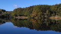
Here is a variation on the "Lac de Laprade, around the lake" hike. This variation avoids the climb up the paved road to the village of Laprade Basse. It allows you to visit the Laprade peat bogs and enjoy a pleasant walk on pontoons.
Montipèze to Aragon around Le Trapel
 4.32 mi
+335 ft
-338 ft
2h 15
Easy
Departure from Villegailhenc (Aude)
4.32 mi
+335 ft
-338 ft
2h 15
Easy
Departure from Villegailhenc (Aude)
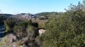
Walk in full sun. Don't forget your hat and water. Avoid when it has rained the previous week as the vineyard soil is very clayey and remains sticky for a long time. Very beautiful views of the village of Aragon.
Fraïsse-Cabardès, the Aiguebelle stream and the Cascailloux
 3.46 mi
+269 ft
-236 ft
1h 50
Easy
Departure from Fraisse-Cabardès (Aude)
3.46 mi
+269 ft
-236 ft
1h 50
Easy
Departure from Fraisse-Cabardès (Aude)
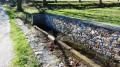
An easy walk through fields and woodland. Well signposted in yellow. Three signs reading ‘Entre puits et heaths’ indicate that you are on the right track.
Lac des Cammazes and the Gravette Dam
 3.52 mi
+748 ft
-748 ft
2h 15
Easy
Departure from Les Cammazes (Tarn)
3.52 mi
+748 ft
-748 ft
2h 15
Easy
Departure from Les Cammazes (Tarn)
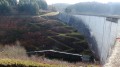
A very pleasant walk, almost entirely through forest. Wide, easily passable paths and superb views of the lake and dam.
Les Escoussols, Fraisse-Cabardès and Brousses
 5.07 mi
+663 ft
-663 ft
2h 55
Easy
Departure from Fraisse-Cabardès (Aude)
5.07 mi
+663 ft
-663 ft
2h 55
Easy
Departure from Fraisse-Cabardès (Aude)
A walk through woods and fields. The first kilometre is a bit muddy after heavy rain.
Sallèles-Cabardès – Marmorières – Limousis
 3.41 mi
+463 ft
-476 ft
2h 00
Average
Departure from Limousis (Aude)
3.41 mi
+463 ft
-476 ft
2h 00
Average
Departure from Limousis (Aude)
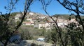
A walk that takes you round the three villages. The second half is quite a steep climb almost right up to the finish.
La Galaube, Cals and Prat d’al Rei
 3.89 mi
+430 ft
-410 ft
2h 10
Easy
Departure from Lacombe (Aude)
3.89 mi
+430 ft
-410 ft
2h 10
Easy
Departure from Lacombe (Aude)
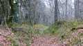
A short, leisurely walk, always on fairly wide paths and well sheltered from the wind that is common in our region. In spring, the undergrowth is strewn with daffodils, dog’s-tooth violets and small comfrey plants.
In 2016, the foresters felled a great deal of timber and left the undergrowth in a sorry state. Let’s hope that, over time, the forest will regain its usual appearance. But that doesn’t spoil the walk.
Montolieu via Villeneuve and La Frigoule
 6.07 mi
+564 ft
-584 ft
3h 15
Average
Departure from Montolieu (Aude)
6.07 mi
+564 ft
-584 ft
3h 15
Average
Departure from Montolieu (Aude)
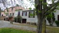
A ten-kilometre hike that winds through forests and fields. There are some beautiful properties to see, and above all, the village of Montolieu is worth a visit.
Sidobre, a journey to the land of granite
 4.37 mi
+420 ft
-584 ft
2h 20
Easy
Departure from Lacrouzette (Tarn)
4.37 mi
+420 ft
-584 ft
2h 20
Easy
Departure from Lacrouzette (Tarn)
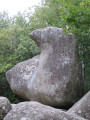
This region, between Mazamet and Castres, is extraordinary for its accumulation of granite boulders, left in all directions by nature. The walk is always sheltered from the sun and wind, and there is no tarmac.
I am making an exception to my rule of ignoring the markings left on rocks and trees. This walk is well signposted, but only pay attention to the FFR markings. White and red lines for theGR® and yellow lines elsewhere.
La Rigole via La Galaube
 4.56 mi
+299 ft
-315 ft
2h 20
Easy
Departure from Lacombe (Aude)
4.56 mi
+299 ft
-315 ft
2h 20
Easy
Departure from Lacombe (Aude)
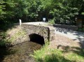
The Rigole de la Montagne again. But this time you won’t be walking alongside it. You’ll go round it on a route that’s shaded all the way. The return along the road is a bit long, but you can walk on the verges if you don’t like tarmac.
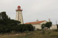
Leucate lighthouse, semaphore and redoubt.
 4.35 mi
+200 ft
-203 ft
2h 10
Easy
Departure from Leucate (Aude)
4.35 mi
+200 ft
-203 ft
2h 10
Easy
Departure from Leucate (Aude)
Enjoy a beautiful walk along the top of the Leucate cliffs. There are no difficulties, but be careful of the heat in summer as you will be in direct sunlight the whole time.
Villardonnel, La Valouvière via the Racaudy ford and Capservy Abbey
 6.45 mi
+755 ft
-758 ft
3h 35
Average
Departure from Villardonnel (Aude)
6.45 mi
+755 ft
-758 ft
3h 35
Average
Departure from Villardonnel (Aude)
The walk is half sheltered from the sun and wind. There is a little tarmac and a lot of almost carriageable, limestone and very stony paths.
Cailhau, in the footsteps of Achille Laugé
 4.18 mi
+213 ft
-230 ft
2h 05
Easy
Departure from Cailhau (Aude)
4.18 mi
+213 ft
-230 ft
2h 05
Easy
Departure from Cailhau (Aude)
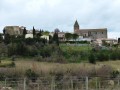
This walk allows you to see reproductions of some of the works of Achille Laugé, a pointillist painter who died in 1944 after returning to the Aude region and who painted many landscapes around Cailhau, his village. There are six display stands showing Achille Lauger's paintings from the place where he created them. Enjoy a short 7 km hike.
Villardonnel via Les Bagnadous and Gleyre
 3.99 mi
+725 ft
-751 ft
2h 30
Average
Departure from Villardonnel (Aude)
3.99 mi
+725 ft
-751 ft
2h 30
Average
Departure from Villardonnel (Aude)
A pleasant hike with quite a few climbs. The descent after (4) is a little tricky, so make sure you have good footwear.
This walk is marked with large orange brushstrokes. But as always, it is best to follow Visorando.
Lac de Laprade Basse around Grand Bois
 3.85 mi
+351 ft
-374 ft
2h 05
Easy
Departure from Lacombe (Aude)
3.85 mi
+351 ft
-374 ft
2h 05
Easy
Departure from Lacombe (Aude)
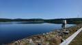
Hike in the forest, almost always marked in yellow. Short off-trail excursion on paths not marked on the map. In autumn, you may be lucky enough to find some porcini mushrooms.
Lake Saint-Denis, Les Cabanelles and Bès
 3.74 mi
+240 ft
-253 ft
1h 55
Easy
Departure from Saissac (Aude)
3.74 mi
+240 ft
-253 ft
1h 55
Easy
Departure from Saissac (Aude)
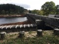
A pleasant walk through woodland and fields. The lake and the Bès reservoir prove, if proof were needed, that the Montagne Noire is like a sponge. Pierre-Paul Riquet was spot on when he created the Rigole, which feeds the Canal du Midi.
La Tourette-Cabardès, Couroulès and La Perdition
 4.41 mi
+571 ft
-584 ft
2h 30
Average
Departure from Miraval-Cabardes (Aude)
4.41 mi
+571 ft
-584 ft
2h 30
Average
Departure from Miraval-Cabardes (Aude)
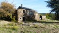
Hike on wide, often passable paths. We are in the low mountains with views of the Pyrenees and various villages in the Montagne Noire.
Cuxac and La Combe Haute Wind Farm
 5.32 mi
+371 ft
-381 ft
2h 45
Easy
Departure from Cuxac-Cabardès (Aude)
5.32 mi
+371 ft
-381 ft
2h 45
Easy
Departure from Cuxac-Cabardès (Aude)
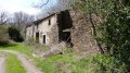
A lovely walk, almost entirely through woodland, sheltered from the wind and direct sunlight. La Combe Haute is an old, abandoned property now in ruins.
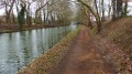
Port-Lauragais, Montferrand and the Canal du Midi
 4.16 mi
+167 ft
-184 ft
2h 05
Easy
Departure from Avignonet-Lauragais (Haute-Garonne)
4.16 mi
+167 ft
-184 ft
2h 05
Easy
Departure from Avignonet-Lauragais (Haute-Garonne)
Enjoy a carefree walk in the Lauragais plain, surrounded by well-cultivated fields. Return via the Canal du Midi.
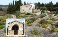
Villelongue and Saint-Martin-le-Vieil
 3.63 mi
+433 ft
-423 ft
2h 05
Easy
Departure from Saint-Martin-le-Vieil (Aude)
3.63 mi
+433 ft
-423 ft
2h 05
Easy
Departure from Saint-Martin-le-Vieil (Aude)
A walk through vineyards and woods with no real difficulties. It is well signposted in yellow.
Please note: the paths can be very muddy after heavy rain.
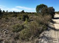
Drystone shelters of Conques - The Rieussec cliffs
 3.64 mi
+331 ft
-305 ft
2h 00
Easy
Departure from Conques-sur-Orbiel (Aude)
3.64 mi
+331 ft
-305 ft
2h 00
Easy
Departure from Conques-sur-Orbiel (Aude)
A leisurely walk offering an interesting view of the Rieusec valley, Salsigne and Villanière, and on the other side, the Orbiel valley.
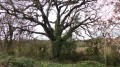
Villardonnel and Bancalis
 5.00 mi
+620 ft
-627 ft
2h 50
Easy
Departure from Villardonnel (Aude)
5.00 mi
+620 ft
-627 ft
2h 50
Easy
Departure from Villardonnel (Aude)
An easy walk through vineyards and open woodland.
Montolieu and the Saint-Roch Chapel
 3.84 mi
+571 ft
-558 ft
2h 15
Easy
Departure from Montolieu (Aude)
3.84 mi
+571 ft
-558 ft
2h 15
Easy
Departure from Montolieu (Aude)
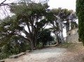
This is a beautiful walk, but it is exposed to the wind and sun. The first kilometre is quite steep, but the next two kilometres are gentler.
Rough wooden signs engraved with "Circuit Saint-Roch" will guide you along the way, even if they are not very visible or legible...
Since 15 October 2018 and the floods, a lot of earth has been washed away from the paths and many of them have become very stony and rocky. However, the circuit remains entirely feasible.
Brousses, following in the footsteps of ancient paths
 4.19 mi
+427 ft
-420 ft
2h 20
Easy
Departure from Brousses-et-Villaret (Aude)
4.19 mi
+427 ft
-420 ft
2h 20
Easy
Departure from Brousses-et-Villaret (Aude)
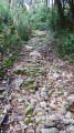
This route was created by the association "Environnement, Territoires et Paysages" and is very well marked with yellow lines in accordance with FFRP coding. Every slightly complicated crossroads has been clearly marked.
Very well protected, it can be done in both winter and summer.
Two or three fords have been damaged by the floods of 15 October 2018, but they can be crossed without any problems.
You can visit the town hall website to download another description of this hike.
Brousses - Between woods, meadows and heaths.
 4.89 mi
+328 ft
-331 ft
2h 30
Easy
Departure from Brousses-et-Villaret (Aude)
4.89 mi
+328 ft
-331 ft
2h 30
Easy
Departure from Brousses-et-Villaret (Aude)
This walk was created by the association "Environnement, territoires et paysages" (Environment, Territories and Landscapes). Another description can be found at the Brousses town hall or at the paper mill.
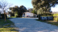
Half of the route is on tarmac roads, but with wide, well-mowed verges that allow you to walk on the grass. This walk is particularly enjoyable after heavy rainfall, as in 2018/2019.