Villardonnel and Bancalis

An easy walk through vineyards and open woodland.

Details

1020552
Creation:
Last update:
Last review:
  • Walking
    Activity: Walking
  • ↔
    Distance: 5.00 mi
  • ◔
    Average duration: 2h 50 
  • ▲
    Difficulty: Easy

  • ⚐
    Back to start: Yes
  • ↗
    Ascent: + 620 ft
  • ↘
    Descent: - 627 ft

  • ▲
    Highest point: 1,214 ft
  • ▼
    Lowest point: 702 ft

Photos

Description of the walk

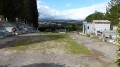
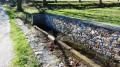
(S/E) In the centre of the village of Villardonnel, set off from in front of the post office. Walk down past the community centre and take the first street on the right, Route de Salsigne. Walk past the church, turn left and take the first road on the right, Chemin de Rivals. Walk past the sewage treatment plant, then cross the bridge over a stream that is often dry.

(1) Continue along the path on the right which leads back up towards the road. Cross the D118.

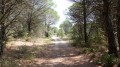
(2) Directly opposite you, behind the safety barrier, take a small path that climbs gently to the left. When you reach a track that is passable by vehicle but full of stones and roots, turn left. This track runs through the forest parallel to the road until it opens out onto poorly maintained land and vineyards. Continue along the road until you reach a wide track that descends to the right.

(3) Follow this track – which is passable but in fairly poor condition – downwards, skirting vineyards and woodland. You’ll arrive at the uninhabited Bancalis vineyard.

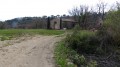
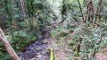
(4) Turn right, still between vineyards and woodland. Pass the ford over the Vallouvière stream on your left. Continue along this track, which climbs alongside the vineyards. Walk past a ruined hut and, after the last vineyard, continue climbing through the woodland. You’ll reach the track that runs alongside the road you took on the way there. Take it to the left for 150 metres. Walk past a fenced-off plot of land.

(5) Immediately after this plot, turn left onto a path that isn’t shown on the map. Continue until you reach a junction with a barely visible track on the right. Follow this track until you reach a wide path, which you take to the left.

(6) When you reach the tarmac road that goes round the cemetery, take the right-hand branch and head down to the D118. Continue along the path that runs alongside the road, passing behind the transformer. One hundred metres further on, cross the D118 and take the road to Villardonnel. Pass two hairpin bends.

(7) Turn right onto the path leading towards the village until you reach a tarmac road. Continue along this road and enter the village via the Carcassonne road to return to your starting point (S/E).


Waypoints

  1. S/E : mi 0 - alt. 1,207 ft - Opposite the Post Office
  2. 1 : mi 0.54 - alt. 968 ft - Path on the right after the ford
  3. 2 : mi 0.76 - alt. 1,063 ft - Path climbing diagonally to the left
  4. 3 : mi 1.58 - alt. 984 ft - Turn right onto a white-surfaced track.
  5. 4 : mi 2.27 - alt. 722 ft - Bancalis
  6. 5 : mi 3.5 - alt. 1,047 ft - Path on the left which is not shown on the map
  7. 6 : mi 3.86 - alt. 1,125 ft - Junction with the tarmac road
  8. 7 : mi 4.54 - alt. 1,109 ft - Path leading towards the village
  9. S/E : mi 5 - alt. 1,211 ft - Opposite the Post Office

Notes

Alternative starting point: the cemetery car park.

Worth a visit

Those interested can visit the Villardonnel cemetery.

Reviews and comments

3.8 / 5
Based on 4 reviews

Reliability of the description
4 / 5
Ease of following the route
3.8 / 5
Route interest
3.8 / 5
turchetto chantal
turchetto chantal

Overall rating : 3.3 / 5

Date of your route : Apr 23, 2024
Reliability of the description : ★★★★☆ Good
Ease of following the route : ★★★☆☆ Average
Route interest : ★★★☆☆ Average
Very busy route : No

A walk with no particular difficulties

Machine-translated

lippo
lippo

Hello.
As stated in the description under points 2 and 3:
This track runs through the forest parallel to the road until it leads out onto poorly maintained land and vineyards. Continue along the road until you reach a wide track that descends to the right.

Machine-translated

Relf
Relf

Overall rating : 4 / 5

Date of your route : Jun 13, 2021
Reliability of the description : ★★★★☆ Good
Ease of following the route : ★★★★☆ Good
Route interest : ★★★★☆ Good
Very busy route : No

Hike completed this Sunday the 13th. A pleasant route, with at least 60 per cent of the route in the shade.
Between points 2 and 3, after crossing the D118, there is no path; we walked through the vineyards to reach point 3.
The same issue arises between points 5 and 6: once you’ve passed the fenced-off area (which you went past on the way there), turn left and then take the first path on the right. Follow this path until you come across a slightly better-defined track, which you’ll need to head up.
Some lovely panoramic views. A hike with plenty of elevation gain, very little flat ground, but nothing too daunting.
The route took 2 hours at a leisurely pace.

Machine-translated

tehanie
tehanie

Overall rating : 4 / 5

Date of your route : May 24, 2018
Reliability of the description : ★★★★☆ Good
Ease of following the route : ★★★★☆ Good
Route interest : ★★★★☆ Good

I combined this walk with the one from Villardonnel to Notre-Dame-de-Canabes, making for a 12-kilometre walk. It’s a very pleasant walk, but there are junctions where you need to be careful as there are several paths and very few signposts.
Enjoy the walk!

Machine-translated

randonnéeaude
randonnéeaude

Overall rating : 4 / 5

Date of your route : Apr 15, 2018
Reliability of the description : ★★★★☆ Good
Ease of following the route : ★★★★☆ Good
Route interest : ★★★★☆ Good

An easy walk (2 hours), with enough shade to make it suitable for summer.
Between points 2 and 3, after the forest, follow the road along the edge of the field to the northern edge of the next forest, where you’ll find the path leading down to Bancalis.
At point 5, after the fenced-off area, turn immediately left, then straight away right, and stay on the wide, barely marked path on the right. Ignore all side tracks.

Machine-translated

Other walks in the area

For more walks, use our search engine .

The GPS track and description are the property of this route's author. Please do not copy them without permission.