


 Country:

 City:
City:


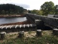
In the centre of the village of Saint-Denis, take the D8 towards Lacombe and Fontiers-Cabardès. After the town hall, turn left onto the D308 signposted ‘Bassin de Saint-Denis’. When you reach the dam, cross it and park at the other end in the car park marked on the map.
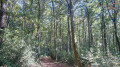
(S/E) Leave the dam on your right and set off along a wide track to the left heading north-west. Pass the first junction and follow this track through the forest until you reach a wider track suitable for vehicles, bordered by a fairly high wire fence. Continue uphill along the fence until you reach the Rigole de la Montagne and a large wooden beam, which may be open or closed. Go through this barrier, which is intended for vehicles, and follow the Rigole.
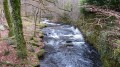
(1) After about 150 metres, take a path that descends to the right. Follow this forest path until you reach the Alzeau.
(2) Turn right onto the track and cross the bridge over the Alzeau. Continue along this track, which becomes tarmac after the dairy farm of Régatel.
(3) Pass the hamlet of Bès and rejoin the D53, turning right onto it.
(4) After 200m, turn right again onto a wide, carriageable track. It becomes less well-maintained and eventually turns into a path through the heath. Follow this stony path downwards, ignoring the side paths branching off to the right and left.
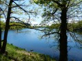
(5) At the T-junction, turn right and you’ll reach the dam. Cross it and you’ll come back to the car park (S/E).




 Visorando Member

 Moderate
