Country:

 City:
City:




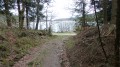

Access: Head to the village of Fontiers-Cabardès. Leave the village via the north-west road, the D8. Ignore the first road on the right and take the second one, the D153. Pass through the village of Perry Haut. At the next major junction, you’ll find Lacombe on the left and Cals on the right. Go straight through the junction and park immediately on the left in a small grassy clearing.
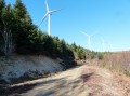
(S/E) You are on a track that is passable but unpaved. Further up this track you will see a mobile phone mast.
(1) Follow the road uphill towards the relay station (marked as ‘réservoir’ on the map as it was recently built next to the water tower). Pass in front of the relay station and continue straight ahead along this track.
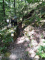
(2) Be careful not to miss this turn. At the left-hand bend, carry on straight ahead through the bushes. After 15 or 20 metres, you’ll come to a well-marked, sunken path. The path winds through a coniferous forest and becomes increasingly steep, with embankments rising over 3 metres high. In 2017, the path was blocked by fallen trees or log jams left by foresters. Get past these obstructions by climbing up the embankment. Pass a square boundary marker on the left-hand side of the path.
(3) Carry on until you reach a pointed rock standing on the left-hand embankment. Climb up towards this rock and continue along a narrow path running parallel to the top of the embankment. Carry on until you reach a track suitable for vehicles, which you should take straight ahead. Follow this track through the woodland.
(4) On your left you’ll find a fairly wide, ascending track, though it’s not suitable for cars. After the short initial climb, the track descends gently through a varied woodland with plenty of holly. After a right-angled bend to the left, you’ll rejoin a track suitable for vehicles.
(5) Take it to the left for 50 metres and, at the next bend, leave it and continue straight on along a path which will take you, past an old hunters’ hut, to the shores of Lac de la Galaube. Turn left onto the road that runs alongside the lake and follow it.
(6) The road continuing to the right is blocked by a barrier. Take the path going uphill to the left, which is a bit stony.
(7) At this junction, turn left at the hairpin bend. Carry on uphill to the next junction. Turn right and head gently downhill until you rejoin the track leading to the telephone relay station.
(1) Turn right onto it. You’ve been able to see your cars for a while now, so there’s no risk of getting lost on the way back to the car park (S/E).

 Visorando Member
 Moderate