Cuxac and Les Grands Champs Wind Farm

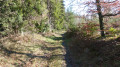
A lovely walk, sheltered from the sun and wind for two-thirds of the route. You’ll pass right by several wind turbines.

Details

n°953801
Creation:
Last update:
Last review:
  • Walking
    Activity: Walking
  • ↔
    Distance: 5.28 mi
  • ◔
    Average duration: 2h 50 
  • ▲
    Difficulty: Easy

  • ⚐
    Back to start: Yes
  • ↗
    Ascent: + 476 ft
  • ↘
    Descent: - 472 ft

  • ▲
    Highest point: 2,654 ft
  • ▼
    Lowest point: 2,208 ft

Photos

Description of the walk

If you’re coming from Cuxac-Cabardès or one of the surrounding villages, join the D562. Heading north, you’ll come to a junction with a sign for ‘Cuxac & Grand Bois Wind Farm’. There’s enough space there to park several cars.

(S/E) Start the walk by heading due east towards the arrow on the sign mentioned above. A wide, rather bumpy track will take you to the foot of the first wind turbine.

(1) Take the wide track on the left, which will take you past three wind turbines. Note the large red graphic on the second one – I couldn’t work out what it represented.

(2) Immediately after the third one, turn right at the T-junction. Follow this wide track, keeping to the right as you go round a wind turbine. Carry on straight ahead at the next junction where the tracks narrow, passing another wind turbine.

(3) Turn right at a right angle and carry on along this path, keeping to your left at the fork.

(4) At the next junction, head slightly to the left (though if you carry on straight ahead, you’ll also reach the next point!). Further on, keep to the right.

(5) Carry on to the left until you reach a tarmac road ahead, which you follow for about 200 metres. Leave the road to the right, into a field, and follow the row of trees on your right until you reach another road.

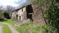
(6) Cross the ditch and cross this road with care. Head to the right and, a few metres further on, take the path to the left. Even though the path is a bit overgrown, keep to the right to avoid passing between the houses. Walk down to the Pousset stream and then back up to Les Augers.

(7) Walk between the two blocks of buildings and head up the tarmac road towards the north-west. At the first junction, carry straight on.

(8) At the second junction, where there is a very wide, well-maintained but unpaved track, turn right. Follow this track, which climbs gently, to the large car park at the foot of the ‘Wind Farm’ sign (S/E).

Waypoints

  1. S/E : mi 0 - alt. 2,641 ft - Large car park at the foot of the ‘Wind Farm’ sign
  2. 1 : mi 0.43 - alt. 2,638 ft - Turn left towards the wind turbines
  3. 2 : mi 0.74 - alt. 2,621 ft - Turn right at the T-junction
  4. 3 : mi 1.29 - alt. 2,575 ft - After this wind turbine, on the right
  5. 4 : mi 1.8 - alt. 2,598 ft - To the left
  6. 5 : mi 2.35 - alt. 2,464 ft - Turn left towards the tarmac road
  7. 6 : mi 2.71 - alt. 2,359 ft - Junction D562
  8. 7 : mi 3.53 - alt. 2,244 ft - Between the buildings at Augers
  9. 8 : mi 4.16 - alt. 2,411 ft - Wide, well-maintained track on the right
  10. S/E : mi 5.28 - alt. 2,641 ft - Large car park at the foot of the “Wind Farm” sign

Reviews and comments

4.2 / 5
Based on 2 reviews

Reliability of the description
4.5 / 5
Ease of following the route
4.5 / 5
Route interest
3.5 / 5
jipeso
jipeso
• Edited:

Overall rating : 4.3 / 5

Date of your route : Aug 20, 2018
Reliability of the description : ★★★★★ Very good
Ease of following the route : ★★★★★ Very good
Route interest : ★★★☆☆ Average

Long, rather poor-quality paths with nothing of interest (between 7 and the finish). On the other hand, the farms you pass through are very pleasant, as is the route at the foot of the ten or so wind turbines
Thanks to the walker who marked out (in green) the paths to follow (there are no signposts, which is a real shame).

Machine-translated

visobut
visobut

Overall rating : 4 / 5

Date of your route : Jul 12, 2018
Reliability of the description : ★★★★☆ Good
Ease of following the route : ★★★★☆ Good
Route interest : ★★★★☆ Good

0 Overall:
A pleasant route in summer with plenty of shade

1 access point:
Enter Cuxac Cabardès
Head towards Saissac
After the cemetery, take the first road on the right (hairpin bend)

2. Route:

Between routes 4 and 5, the very grassy, unmaintained path will no longer be usable in a few years’ time

Machine-translated

Other walks in the area

For more walks, use our search engine .

The GPS track and description are the property of this route's author. Please do not copy them without permission.