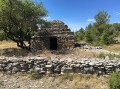
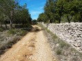
Villegailhenc and the Bade du Goy

The trail is on very clayey ground; best avoided within ten days of rain.
It’s best to go in summer, but do take the usual precautions (exposure to direct sunlight).

Details

434436
Creation:
Last update:
Last review:
  • Walking
    Activity: Walking
  • ↔
    Distance: 3.57 mi
  • ◔
    Average duration: 1h 55 
  • ▲
    Difficulty: Easy

  • ⚐
    Back to start: Yes
  • ↗
    Ascent: + 351 ft
  • ↘
    Descent: - 344 ft

  • ▲
    Highest point: 659 ft
  • ▼
    Lowest point: 407 ft

Photos

Description of the walk

Access: When arriving from Carcassonne via the D118, enter Villegailhenc, pass the co-operative, go past the side road and turn left into the street immediately after. Be careful: the first left is a dead end; you need to take the one at the open angle. Take the first left and you’ll find car parks just before the cemetery.

(S/E) Continue along this street and walk alongside the cemetery. The tarmac road will soon turn into a path that climbs quite steeply and is strewn with exposed rocks. You’ll rejoin the tarmac in front of the water tower; carry on.

(1) Turn right onto the Chemin des Hauts du Thou. Follow this road past some rather attractive houses. The tarmac turns into a grassy path. Follow it to a junction.

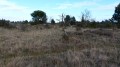
(2) Head diagonally left and then immediately right. Continue along this path, which winds through abandoned fields where you can make out a few low stone walls. Make sure you follow the yellow markings carefully, as there are many paths branching off to the right or left. Pass some kennels. After a few bends, you’ll reach a tarmac road that’s in poor condition.

(3) Turn right. Ride between vineyards and fields until you come to a grassy track on your right marked with a sign saying ‘No motorbikes’.

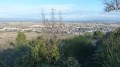
(4) Turn right onto this path and follow the yellow markings. Pass a small well protected by a few stakes. Follow this path. On your left, you’ll find a viewpoint overlooking the village; continue on until you reach a junction.

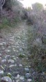
(5) Leave this path by taking the one on the left, which is paved with large pebbles and leads down to the edge of the village. Enter the village via Rue du Thou. Continue, keeping to the left, until you reach Rue des Carriers.

(6) Turn right onto it and follow it to the Ruisseau de Merdeau, which is channelled through the village. Follow the stream to the right along Rue du Mail. At the end of the street, turn slightly right and then left at the three-way junction. Continue straight on along Rue de Pyrénées until you reach the car park in front of the cemetery (S/E).


Waypoints

  1. S/E : mi 0 - alt. 413 ft - Car park in front of the cemetery
  2. 1 : mi 0.43 - alt. 564 ft - Chemin des Hauts du Thou
  3. 2 : mi 0.89 - alt. 610 ft - Junction of paths
  4. 3 : mi 1.61 - alt. 482 ft - Turn right onto the tarmac road
  5. 4 : mi 2.03 - alt. 525 ft - Sign: ‘No motorbikes’
  6. 5 : mi 2.68 - alt. 627 ft - A pebbly path leading downhill
  7. 6 : mi 3.24 - alt. 427 ft - We’ll head back towards the village centre
  8. S/E : mi 3.57 - alt. 410 ft - Car park in front of the cemetery

Notes

This walk is clearly signposted with yellow markings in accordance with FFR standards.
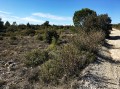
Don’t forget your cowboy hat – there’s no shade at all. And take something to drink too.

Reviews and comments

4.4 / 5
Based on 3 reviews

Reliability of the description
4.7 / 5
Ease of following the route
4.7 / 5
Route interest
4 / 5
karfro
karfro

Overall rating : 3.7 / 5

Date of your route : Jan 22, 2024
Reliability of the description : ★★★★☆ Good
Ease of following the route : ★★★★☆ Good
Route interest : ★★★☆☆ Average
Very busy route : No

There is little vegetation.

Machine-translated

scorpion11620
scorpion11620

Overall rating : 5 / 5

Date of your route : Sep 01, 2017
Reliability of the description : ★★★★★ Very good
Ease of following the route : ★★★★★ Very good
Route interest : ★★★★★ Very good

Be sure to keep this in your notes. The only downside is that you should not go on this walk in wet weather, as the descents on all the trails at La Bade du Goy are dangerous.

Machine-translated

nanarddu11
nanarddu11

Hi Lippo
I agree with you about tracking on a smartphone, and that’s what I do. That’s how I realised quite quickly that we were no longer on the right track. My comment is aimed at those using the map and the downloaded description
Kind regards
Nanarddu11

Machine-translated

lippo
lippo

Hi Nanarddu11.
Thanks for your comments. Next time I do this route, I’ll take a closer look and update the description.
It’s true that I never use the descriptions – following the track on my phone is so handy. The route in blue and my progress in red – it’s brilliant!
Have a good day.

Machine-translated

nanarddu11
nanarddu11

Overall rating : 4.7 / 5

Date of your route : Feb 23, 2017
Reliability of the description : ★★★★★ Very good
Ease of following the route : ★★★★★ Very good
Route interest : ★★★★☆ Good

Hello Lippo
First of all, thank you for this route, which we thoroughly enjoyed following today.
Just a quick clarification: between waypoints 2 and 3, when you leave the path leading down from the plateau, you come onto a farm track. The yellow markings lead off to the right, whilst a cross marks the turn-off to the left. However, your route takes this left-hand direction and leads to the kennels. So you need to follow the markings, which are clearly signposted except at this point. If you follow the markings, you’ll shorten the route.
A lovely, well-documented outing.
Nanarddu11

Machine-translated

Other walks in the area

For more walks, use our search engine .

The GPS track and description are the property of this route's author. Please do not copy them without permission.