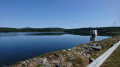
Goutarende and the Camp de las Brugos

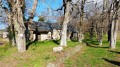
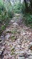
A walk that’s fairly well sheltered from the wind and sun. A beautiful chestnut forest. A section of this route is also featured in other routes on Visorando. This is a testament to the wealth of walking trails and paths in our regions.

Details

n°788873
Creation:
Last update:
Last review:
  • Walking
    Activity: Walking
  • ↔
    Distance: 4.08 mi
  • ◔
    Average duration: 2h 20 
  • ▲
    Difficulty: Moderate

  • ⚐
    Back to start: Yes
  • ↗
    Ascent: + 535 ft
  • ↘
    Descent: - 554 ft

  • ▲
    Highest point: 2,408 ft
  • ▼
    Lowest point: 1,847 ft

Photos

Description of the walk

It’s not easy to find the starting point without a map. Setting off from Cuxac-Cabardès, take the D62 westwards. Take the hairpin bend to the right onto the D562, then, at the next bend to the right, leave this road to the left and take the road to Goutarende. You can park at the entrance to the hamlet; there’s always space.

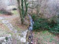
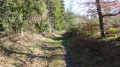
(S/E) Take the road heading north-west and leave it straight away to follow a path that climbs into the forest. Follow this path, which initially runs above the Pousset stream before drawing closer to it. The path climbs due north and is quite overgrown with low brambles, but remains clearly marked enough that you won’t lose your way. You’ll reach the point where the path crosses the stream.

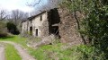
(1) Cross this bridge and head back south along a much wider track. Pass behind the long buildings at Les Augers and continue to the right along the tarmac road. Cross another road and carry on straight ahead towards Sié. At the first wide, unpaved track, turn left.

(2) A hundred metres further on, turn right onto a narrower track. As you follow this track, you’ll pass a large fenced-off field on your right.

(3) At the end of the field, turn left onto another track that branches off at a right angle. Cross the tarmac road and continue along a narrower track that descends south-east and then south.

(4) At this junction, head down the path opposite, which isn’t shown on the map but is marked by an arrow on a large tree. This path descends quite steeply to the Pousset stream.

(5) Cross the stream via a series of culverts that serve as a ford. In September 2017, a tree fell across this ford and you’ll need to do a bit of scrambling to get across. After the ford, turn left along the stream and very soon take a sharp right-hand bend. At the next junction, turn left again and carry on straight ahead.

Drive through Goutarende to reach the car park (S/E).

Waypoints

  1. S/E : mi 0 - alt. 2,005 ft - Car park at the start of the hamlet
  2. 1 : mi 0.94 - alt. 2,208 ft - Hairpin bend over the stream
  3. 2 : mi 1.96 - alt. 2,402 ft - Path to the right of the track
  4. 3 : mi 2.45 - alt. 2,274 ft - Right-angle bend to the left
  5. 4 : mi 3.33 - alt. 2,018 ft - Signpost on a large tree
  6. 5 : mi 3.56 - alt. 1,847 ft - Pousset Stream, ford
  7. S/E : mi 4.08 - alt. 2,001 ft - Car park at the start of the hamlet

Notes

Wear sturdy footwear as the path is sometimes muddy and slippery.

Reviews and comments

5 / 5
Based on 1 review

Reliability of the description
5 / 5
Ease of following the route
5 / 5
Route interest
5 / 5
Azimut71
Azimut71

Overall rating : 5 / 5

Date of your route : Jun 19, 2020
Reliability of the description : ★★★★★ Very good
Ease of following the route : ★★★★★ Very good
Route interest : ★★★★★ Very good
Very busy route : No

There is a tricky spot near the start: when you reach the power line, you must leave the path on the right, go under the line and not take the obvious path straight ahead, but look to the right for an inconspicuous, level track, which will soon follow the stream’s valley along a ledge.
There is now a footbridge at point 5.

Machine-translated

Other walks in the area

For more walks, use our search engine .

The GPS track and description are the property of this route's author. Please do not copy them without permission.