La Galaube and Ramondens

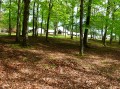
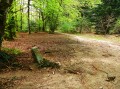
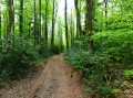
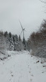
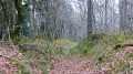
This is a forest walk where you’ll often find yourself between state-owned and privately-owned woodland, resulting in a variety of trees on either side of the path. Beech and coniferous trees share the space. You’ll always be on fairly wide paths.
Forestry work often alters the course of the paths. Don’t worry if the route doesn’t follow the map’s markings exactly. As long as you keep heading in the right direction, you won’t get lost!

Details

n°561185
Creation:
Last update:
Last review:
  • Walking
    Activity: Walking
  • ↔
    Distance: 3.98 mi
  • ◔
    Average duration: 2h 05 
  • ▲
    Difficulty: Easy

  • ⚐
    Back to start: Yes
  • ↗
    Ascent: + 312 ft
  • ↘
    Descent: - 302 ft

  • ▲
    Highest point: 2,470 ft
  • ▼
    Lowest point: 2,277 ft

Photos

Description of the walk

Access: You need to reach the village of Lacombe via the D53 or the D253. In the village, head towards La Galaube. Drive through the village and take the first left. After about one kilometre, stop at the entrance to a track that crosses the road.

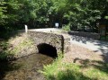
(S/E) Take the tarmac road on the left for 50 metres, cross the bridge and continue for a further 50 metres.

(1) At the junction with another road, climb slightly up the embankment on the left to take a narrow path. This will turn into a fairly wide track which used to be passable by vehicles but is now only suitable for large vehicles. Continue along this track until you reach a major junction.

(2) Carry on straight ahead in the same direction. At the first Fork in the road, keep right onto the main track.

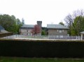
(3) At this second Fork in the road, veer off to the right again. Follow this track until you reach a well-maintained road, which you take to the right. Pass over a large, round, open area that was developed for a project as yet unknown. You’ll arrive at Ramondens, which is a holiday camp rather than a village. Walk alongside the buildings along the road, which has now become tarmac.

(4) Immediately after the last house, turn right onto a path and head round to the rear of the buildings. Walk alongside them and you will pass behind Ramondens Castle. The path turns into a forest track, but carry on straight ahead.

(2) Return to this crossroads and turn left onto the same track as on the way there. About 150 metres further on, leave this track to climb the embankment on the left and find a small ditch marking the boundary between the beech forest and the coniferous forest. You’ll notice that the ditch follows a green line on the map. These green lines mark the boundary between state-owned and private woodland. Follow this ditch, which is sometimes blocked by fallen trees, but which you can easily get round. When you reach the tarmac road, cross it. Continue along the track opposite.

(5) At the first junction, turn right and carry on until you reach the road, where you turn right.

(1) At the junction on the left, you’ll find yourself back at the starting point (S/E).

Waypoints

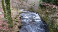
  1. S/E : mi 0 - alt. 2,283 ft - First left after La Galaube. Near the - Rougeanne (rivière)
  2. 1 : mi 0.08 - alt. 2,287 ft - A narrow path on the embankment to the left
  3. 2 : mi 0.63 - alt. 2,454 ft - Major junction, go straight on
  4. 3 : mi 1.02 - alt. 2,418 ft - At the fork in the road, take the right-hand path
  5. 4 : mi 2.16 - alt. 2,448 ft - Ramondens
  6. 5 : mi 3.48 - alt. 2,408 ft - Take the first right after the road and the river
  7. S/E : mi 3.98 - alt. 2,287 ft - Starting point

Worth a visit

Between points (3) and (4), enjoy the blueberry bushes that grow in abundance along this path.

Reviews and comments

4.2 / 5
Based on 2 reviews

Reliability of the description
4 / 5
Ease of following the route
4 / 5
Route interest
4.5 / 5
Entre2o
Entre2o

Overall rating : 3.3 / 5

Date of your route : Sep 30, 2019
Reliability of the description : ★★★☆☆ Average
Ease of following the route : ★★★☆☆ Average
Route interest : ★★★★☆ Good

Please note: the signposting isn’t always very clear and there was no mobile signal for quite a while.
Otherwise, we did manage to spot a fawn.

Machine-translated

adalen
adalen

Overall rating : 5 / 5

Date of your route : Aug 17, 2019
Reliability of the description : ★★★★★ Very good
Ease of following the route : ★★★★★ Very good
Route interest : ★★★★★ Very good

A very easy and relaxing walk
The forest is currently being logged, so in a while this route won’t be quite as appealing

Machine-translated

Other walks in the area

For more walks, use our search engine .

The GPS track and description are the property of this route's author. Please do not copy them without permission.