Sallèles-Cabardès – Marmorières – Limousis

A walk that takes you round the three villages. The second half is quite a steep climb almost right up to the finish.

Details

504155
Creation:
Last update:
Last review:
  • Walking
    Activity: Walking
  • ↔
    Distance: 3.41 mi
  • ◔
    Average duration: 2h 00 
  • ▲
    Difficulty: Moderate

  • ⚐
    Back to start: Yes
  • ↗
    Ascent: + 463 ft
  • ↘
    Descent: - 476 ft

  • ▲
    Highest point: 1,260 ft
  • ▼
    Lowest point: 771 ft
  • ⚐ Country: France
  • ⚐ City: Limousis (11600)
  • ⚑
    Start/End: N 43.330959° / E 2.407026°
  • ❏
    IGN map(s): Ref. 2344ET, 2345E
  • Hour-by-hour weather

Photos

Description of the walk

How to get there: Whichever village you’re coming from, head for Limousis. At the southern end of the village, you’ll find the D511 and, 500 metres further on, on the right, an old ruined mill. There’s a large car park at the foot of the mill where you can park.

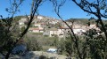
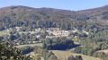
(S/E) Return to the road on the right. A hundred metres further on, turn left and head down the road through a low forest of holm oaks. On your left, you’ll see the very southern village of Sallèles-Cabardès. Continue straight on along the Chemin de la Coste.

(1) At the T-junction, turn left onto the Chemin de Lartigue. After a right-angle bend to the right, at the wayside cross, turn left onto the Rue de la Condamine. Follow this road uphill until you reach the second street on the right, the Rue de la Forge.

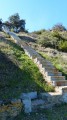
(2) Turn right and continue along Rue du Lavoir. Pass Rue du Barrenc on your left and turn left into the next street. 20 metres further on, take the hairpin bend to the right onto the small Rue du Fanal, pass a large concrete staircase and continue along this track, which becomes unpaved.

Carry on heading due north despite a few bends, and ignore all the paths on either side. You’ll reach the tarmac again on arrival in Marmorières and, at the Fork in the road, continue to the left.

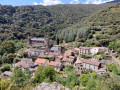
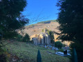
(3) At the T-junction, take the road on the left and follow it to the entrance to the village of Limousis. Walk past the cemetery and then the church, and head for the three-way junction shaped like a goose’s foot.

(4) Go round the war memorial and turn left. Keep to the left at the first junction, turn right at the next one, then cut across the field towards the ruined mill (S/E).

Waypoints

  1. S/E : mi 0 - alt. 1,198 ft - Car park at the ruined mill
  2. 1 : mi 1 - alt. 787 ft - T-junction; turn left at an acute angle
  3. 2 : mi 1.18 - alt. 820 ft - On the right: Rue de la Forge
  4. 3 : mi 2.3 - alt. 1,257 ft - T-junction, turn left
  5. 4 : mi 3.06 - alt. 1,201 ft - Three-way junction, to the left around the war memorial
  6. S/E : mi 3.41 - alt. 1,198 ft - Car park at the ruined mill

Worth a visit

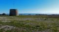
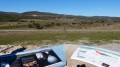
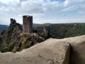
The ruined mill has been restored and a metal staircase allows you to climb up into the tower. A few information boards tell you what you can see all around you. If the weather is fine, you’ll be able to see Mont Canigou and Mont Tauch. And the Pic de Bugarach, which became famous in the year 2000.

Reviews and comments

4.2 / 5
Based on 3 reviews

Reliability of the description
4.3 / 5
Ease of following the route
4.3 / 5
Route interest
4 / 5
jp11
jp11

Overall rating : 4.7 / 5

Date of your route : Jan 15, 2022
Reliability of the description : ★★★★★ Very good
Ease of following the route : ★★★★★ Very good
Route interest : ★★★★☆ Good
Very busy route : No

A little detour between Salles and Marmorières: instead of leaving the large concrete staircase on your left, you can climb it (high steps), reach the water reservoir, go round it to the right, follow a narrow track due north to pass by the foot of the mill overlooking the village, and, walking alongside the mill on the right, you’ll come across a wide track. Turn left into a meadow and you’ll rejoin the GR.

Machine-translated

renometeo
renometeo

Overall rating : 4.3 / 5

Date of your route : Jan 04, 2018
Reliability of the description : ★★★★☆ Good
Ease of following the route : ★★★★☆ Good
Route interest : ★★★★★ Very good

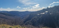
A lovely walk with beautiful panoramic views, particularly of the Pyrenees.

Machine-translated

scorpion11620
scorpion11620

Overall rating : 3.7 / 5

Date of your route : Apr 24, 2017
Reliability of the description : ★★★★☆ Good
Ease of following the route : ★★★★☆ Good
Route interest : ★★★☆☆ Average

Difficult for beginners

Machine-translated

Other walks in the area

For more walks, use our search engine .

The GPS track and description are the property of this route's author. Please do not copy them without permission.