Puichéric, along the Canal du Midi

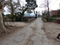
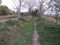
A walk on flat ground (less than 10 metres elevation gain), always in full sun. The ground is very clayey and should be avoided after heavy rain. Let’s not forget that the entire Marseillette and Puichéric basin used to be a lake that was drained for agricultural purposes. There’s water everywhere, and numerous canals and ditches criss-cross the area.

Details

n°411381
Creation:
Last update:
Last review:
  • Walking
    Activity: Walking
  • ↔
    Distance: 3.74 mi
  • ◔
    Average duration: 1h 45 
  • ▲
    Difficulty: Easy

  • ⚐
    Back to start: Yes
  • ↗
    Ascent: + 30 ft
  • ↘
    Descent: - 26 ft

  • ▲
    Highest point: 210 ft
  • ▼
    Lowest point: 171 ft
  • ⚐ Country: France
  • ⚐ City: Puichéric (11700)
  • ⚑
    Start/End: N 43.231434° / E 2.595464°
  • ❏
    IGN map(s): Ref. 2445O
  • Hour-by-hour weather

Photos

Description of the walk

Access: Whether you’re coming from the east or the west via the Minervoise (D610), take the eastern exit from Puichéric to join the D111, which heads north. Carry on along this road until you reach the bridge over the Canal du Midi and turn left immediately after the bridge. After about 1 km, you’ll come to a road on the right leading to a place called ‘Le Magasin’. You can park in front of these buildings.

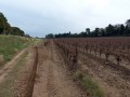
(S/E) Head back and cross the bridge over the Rigole de l’Étang. Turn left and walk down alongside the vineyards. Follow the road at the foot of the large embankment that runs alongside it. After 500 metres, turn right onto a wide path between the vineyards and head towards a corner marked by tall trees.

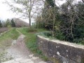
(1) When you reach this corner, pass between the tall trees and you’ll find yourself back at the edge of the Canal du Midi. Turn left and walk alongside the canal as far as the Aiguille lock. The two footbridges are closed to pedestrians, so you’ll need to walk down to the road.

(2) Turn right and cross the bridge. Immediately after the bridge, head back down to the other bank of the canal by turning left. Follow the canal for 300 metres until you reach the Canal Bridge.

Turn right immediately after the Pont Canal and continue along this wide, carriageable track. Take the first big bend to the left, then to the right, and continue along this road, which will become tarmac. You’ll reach a hedge of cypress trees.

(3) When you reach the hedge, turn right and walk alongside the cypress trees. At the end of the hedge, you’ll be on a road; take a left here. Continue until you reach the canal again.

(4) At the edge of the canal, turn left and follow either the narrow path right next to the water or the track a little further up. Both will take you to the Canal Bridge. Cross it in the opposite direction and retrace your steps along the route you took earlier until you reach the Aiguille lock. Cross the bridge.

(2) After the bridge, carry on a little further and head down to the left along the vineyards. Walk alongside the road and the Rigole de l’Étang at the top of the embankment that you followed on the way out. After 1 km, you’ll reach your cars (S/E).

Waypoints

  1. S/E : mi 0 - alt. 180 ft - Parking spaces at the hamlet known as “Le M”
  2. 1 : mi 0.41 - alt. 203 ft - Between two large trees - Canal du Midi
  3. 2 : mi 0.67 - alt. 197 ft - On the right, at the road
  4. 3 : mi 1.64 - alt. 174 ft - Turn right along the cypress hedge
  5. 4 : mi 2.12 - alt. 187 ft - At the canal, turn left
  6. S/E : mi 3.73 - alt. 184 ft - Parking spaces at the hamlet known as “Le M”

Notes

Wear sturdy shoes after rain, as the ground is often muddy.

Worth a visit

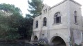
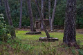
Around the Aiguille lock, you’ll see the lock-keeper’s amusing sculptures. Do feel free to go up to the house, as there are more there.

Reviews and comments

4.3 / 5
Based on 2 reviews

Reliability of the description
4.5 / 5
Ease of following the route
4.5 / 5
Route interest
4 / 5
ANNEMA59
ANNEMA59

Overall rating : 4 / 5

Date of your route : Apr 25, 2024
Reliability of the description : ★★★★☆ Good
Ease of following the route : ★★★★☆ Good
Route interest : ★★★★☆ Good
Very busy route : Yes

A lovely little walk along the banks of the Canal du Midi.

Machine-translated

dodeman gilles
dodeman gilles

Overall rating : 4.7 / 5

Date of your route : Mar 23, 2018
Reliability of the description : ★★★★★ Very good
Ease of following the route : ★★★★★ Very good
Route interest : ★★★★☆ Good

An easy and very pleasant walk where, over just a few kilometres, the natural surroundings treat us to some truly beautiful sights. Thank you.

Machine-translated

Other walks in the area

For more walks, use our search engine .

The GPS track and description are the property of this route's author. Please do not copy them without permission.