Salsigne, around the gold mine

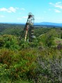
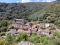
The villages of Salsigne and Villanière surround the gold mine site. This mine, which closed in 2004, was the subject of heated debate between the miners, who did not want to lose their jobs, and environmentalists, who were protesting against pollution. This walk takes you around the site, but you won’t be able to see anything as it is fenced off.
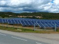
In 2017, Villanière opted for solar power. Two large solar farms have already been installed and a third is under discussion.

Details

n°592213
Creation:
Last update:
Last review:
  • Walking
    Activity: Walking
  • ↔
    Distance: 3.92 mi
  • ◔
    Average duration: 2h 15 
  • ▲
    Difficulty: Easy

  • ⚐
    Back to start: Yes
  • ↗
    Ascent: + 551 ft
  • ↘
    Descent: - 551 ft

  • ▲
    Highest point: 1,476 ft
  • ▼
    Lowest point: 925 ft

Photos

Description of the walk

At the eastern end of Salsigne, on a small street leading down towards the north, you’ll see the fire station. Walk down this street, past the fire station, and immediately afterwards you’ll find a large car park on the right where you can park.

(S/E) Leave the car park on the right or left and join the main road. Turn left and walk through the whole village along this road. Stay on the D111, Route de Villardonnel. As you leave the village, walk alongside a low wooden barrier.

(1) Before the end of the barrier, go over it and walk down 10 metres before immediately heading back up a very stony, narrow path. Walk past the water tower and carry on straight ahead. The path takes a sharp bend to the left. At the next junction, turn right for 50 metres.

(2) Turn right again. This track is usually closed off by a wire fence. Go through, but don’t forget to close the gate behind you. Follow this track, which is suitable for vehicles, until you reach the tarmac road leading to La Jordanne. Continue until you reach the T-junction formed by the D73 and this road.

(3) Cross the D73 and continue climbing northwards. When you reach the D411, turn right towards Villanière. Continue along this road, where the wide verges allow you to avoid the tarmac. Arrive at Villanière and enter the village.

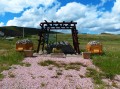
(4) Take the first right, Rue du Trop-Plein. Continue along Rue de la Cavaillère. At the Stop sign, take the first right, Route de Salsigne. Continue along this road, running alongside the solar power station. Stop briefly at the monument dedicated to the miners, then carry on down the road.

(5) At the end of the solar power station, opposite it, you’ll find a path branching off to the right. Follow it down to a road that has been gravelled with iron-rich stones, giving it a rather striking reddish-brown colour. Turn left onto it and you’ll reach the main road. Opposite, you’ll see the fire station.
You have now reached the car park (S/E).

Waypoints

  1. S/E : mi 0 - alt. 925 ft - Car park opposite the fire station
  2. 1 : mi 0.39 - alt. 994 ft - Low wooden barrier
  3. 2 : mi 0.91 - alt. 1,152 ft - End
  4. 3 : mi 1.62 - alt. 1,355 ft - North via the D73
  5. 4 : mi 2.69 - alt. 1,250 ft - On the right, Rue du Trop Plein
  6. 5 : mi 3.48 - alt. 1,099 ft - Path opposite the end of the solar panels
  7. S/E : mi 3.92 - alt. 925 ft - Car park opposite the fire station

Worth a visit

Reviews and comments

3.2 / 5
Based on 4 reviews

Reliability of the description
3 / 5
Ease of following the route
3.5 / 5
Route interest
3 / 5
ksagro1968
ksagro1968

Overall rating : 3.3 / 5

Date of your route : Nov 02, 2021
Reliability of the description : ★★★☆☆ Average
Ease of following the route : ★★★★☆ Good
Route interest : ★★★☆☆ Average
Very busy route : No

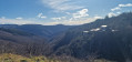
A lovely view of the Pyrenean mountain range on a clear day, and an interesting exhibition near the village of Villanière on the mine, its operation and the struggles surrounding it
However, a large part of the route between waymarks 3 and 5 runs alongside a tarmac road – albeit one with little traffic – which isn’t a particularly pleasant section.
There is no viewpoint overlooking the old mine
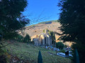
On the other hand, you can take a short detour (marker 5) to the little chapel surrounded by the cemetery

Machine-translated

Catherine D9.
Catherine D9.

Overall rating : 2.3 / 5

Date of your route : Aug 28, 2021
Reliability of the description : ★★★☆☆ Average
Ease of following the route : ★★★☆☆ Average
Route interest : ★☆☆☆☆ Very disappointing
Very busy route : No

The walk was entirely on tarmac,
As for point 2, there’s no path left before the little bridge; the vegetation has taken over everything, so we had to take the road.
It was a bit of a let-down; it was impossible to see the mine, even from a distance.

Machine-translated

francifour
francifour
• Edited:

Overall rating : 3.3 / 5

Date of your route : Jun 15, 2019
Reliability of the description : ★★★☆☆ Average
Ease of following the route : ★★★★☆ Good
Route interest : ★★★☆☆ Average

Moderately interesting as there’s a lot of tarmac, though fortunately there’s not much traffic.
At point 2, it could be clarified: turn 90° to the right at the rusty construction vehicle.
A bit of a rough patch here.
The route could have included a visit to the chapel, which would have added further interest to the walk.
It’s a shame not to see the mine itself. Please specify that the route passes close to the Castan shaft.
Not to be attempted in very hot weather.

Machine-translated

grandin
grandin ★

Thank you, fab4263, for clarifying that

Machine-translated

fab4263
fab4263

Overall rating : 3.7 / 5

Date of your route : Jul 22, 2018
Reliability of the description : ★★★☆☆ Average
Ease of following the route : ★★★☆☆ Average
Route interest : ★★★★★ Very good

It’s tricky to find the start of the route – you have to cross the tiny stone bridge visible from the roadside; it’s tucked away amongst the grass in a small meadow behind the house on the right. Cross just before the wooden safety barrier. I may have got it wrong, or perhaps it wasn’t signposted, but I headed up the hill towards the first wind farm. After the Jourdanne farm, the Visorando route is easy to follow. Beautiful scenery – best enjoyed when it’s not too hot. An easy walk with no difficulties.

Machine-translated

scorpion11620
scorpion11620

to be carried out in the fourth quarter of 2017

Machine-translated

Other walks in the area

For more walks, use our search engine .

The GPS track and description are the property of this route's author. Please do not copy them without permission.