Fraïsse-Cabardès, the Aiguebelle stream and the Cascailloux

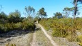
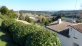
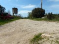
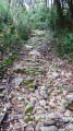
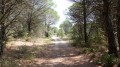
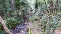
An easy walk through fields and woodland. Well signposted in yellow. Three signs reading ‘Entre puits et heaths’ indicate that you are on the right track.

Details

483245
Creation:
Last update:
Last review:
  • Walking
    Activity: Walking
  • ↔
    Distance: 3.46 mi
  • ◔
    Average duration: 1h 50 
  • ▲
    Difficulty: Easy

  • ⚐
    Back to start: Yes
  • ↗
    Ascent: + 269 ft
  • ↘
    Descent: - 236 ft

  • ▲
    Highest point: 1,184 ft
  • ▼
    Lowest point: 948 ft

Photos

Description of the walk

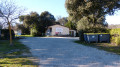
Access: if you’re coming from the north via Brousses, you’ll need to go through the whole village to reach the car park behind the cemetery. If you’re coming from the west via Montolieu or Aragon, you’ll find the car park before you even enter the village.

(S/E) As you leave the car park, turn immediately left into the street closed to vehicles. Cross the D203 and head up the stony path opposite. Stay on this path, which runs alongside a tarmac road.

(1) Take the path on the right which runs alongside a field before passing through a sparse woodland. The high-voltage power line in front of you serves as a landmark, as you’ll be passing underneath it. Shortly after the power line, turn right at a right angle to join a wider track. Take it to the right.

(2) Take the hairpin bend to the left. At the first junction, turn right at a right angle, then right again at the next junction.

(3) Cross the D148 to join a path through the low-lying woodland opposite. Continue along this path, keeping to the left.

(4) Please note: you’ll be leaving the tarmac road to take a path on the left.

(5) Just before the tarmac road, take the path on the right which runs alongside the road until you reach a track, which you take to the right. Turn slightly right again at the next junction, then turn left at the Fork in the road 200 metres further on.

(6) You’ll emerge from the forest and walk alongside fenced fields on your left. Continue along this wide track and, when it bends to the left, turn right onto a forest path. Follow this path to the village. Take the first tarmac road on the right, then the first on the left, and then the first on the left again. You’ll reach the car park via a long concrete descent (S/E).


Waypoints

  1. S/E : mi 0 - alt. 1,020 ft - Car park behind the cemetery
  2. 1 : mi 0.21 - alt. 1,040 ft - On the right, the path runs alongside a field
  3. 2 : mi 0.78 - alt. 1,037 ft - Hairpin bend to the left
  4. 3 : mi 1.42 - alt. 971 ft - Crossing the D148
  5. 4 : mi 1.62 - alt. 1,027 ft - Small path on your left
  6. 5 : mi 1.83 - alt. 1,070 ft - Path on the right before the tarmac road
  7. 6 : mi 2.44 - alt. 1,165 ft - Walk alongside a fenced-off field
  8. S/E : mi 3.46 - alt. 1,030 ft - Car park behind the cemetery

Reviews and comments

4.3 / 5
Based on 3 reviews

Reliability of the description
4.3 / 5
Ease of following the route
4.3 / 5
Route interest
4.3 / 5
karfro
karfro

Overall rating : 4.3 / 5

Date of your route : May 26, 2024
Reliability of the description : ★★★★☆ Good
Ease of following the route : ★★★★☆ Good
Route interest : ★★★★★ Very good
Very busy route : No

Varied landscape. Beautiful flower-filled meadows. Routes that avoid tarmac roads. It’s not possible to park in the village. Please use the car park below the cemetery.

Machine-translated

nicolara
nicolara

Overall rating : 4 / 5

Date of your route : Jul 09, 2022
Reliability of the description : ★★★★☆ Good
Ease of following the route : ★★★★☆ Good
Route interest : ★★★★☆ Good
Very busy route : No

A lovely walk. There wasn’t much shade apart from right at the start and end of the route. Just between 2 and 3, we turned right too early, as there are several paths leading to the D152 at that point. We turned back, which didn’t add too much to the walk...

Machine-translated

lippo
lippo

Hi Nanardu11.
It’s great to see you back on this site, as we’ve never had the chance to meet out on the trails. I’m still out walking, but I’m not creating any new trails as I’ve pretty much covered everything within a 25 km radius of my village. And anyway, new trails always end up overlapping with bits of the old ones...
Enjoy your walks, and maybe I’ll see you one of these days in the woods.

Machine-translated

nanarddu11
nanarddu11

Overall rating : 4.7 / 5

Date of your route : Oct 08, 2019
Reliability of the description : ★★★★★ Very good
Ease of following the route : ★★★★★ Very good
Route interest : ★★★★☆ Good

Hello Lippo
We’ve just been hiking along your route today with four friends and we really enjoyed this very picturesque walk.
There wasn’t much of a climb, and there were plenty of shaded sections – just what we needed for a gentle return to walking after a very hot summer that had put our favourite pastime on hold.
Thank you for all your hard work
Labidouille

Machine-translated

gazok54
gazok54 ★

Don’t worry, the server has plenty of capacity

Machine-translated

lippo
lippo

Hello.
I understand, but that might put a bit of a strain on the server.
Have a nice day

Machine-translated

gazok54
gazok54 ★

Good evening, lippo
When a hiker downloads a file, the software automatically sends them a message asking them to leave a comment about the walk once they’ve completed it. So in this case, the hiker is replying to the message to say that they haven’t done the walk yet

Machine-translated

lippo
lippo

Hello.
I’d like to understand what the point of this sort of comment is?
Or is this just a mistake?
Thank you, and see you soon.

Machine-translated

scorpion11620
scorpion11620

Not yet carried out

Machine-translated

Other walks in the area

For more walks, use our search engine .

The GPS track and description are the property of this route's author. Please do not copy them without permission.