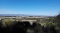
Grèzes, Herminis and Caux around the Las Sabartèzes stream

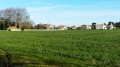
A route with absolutely no shade and very little elevation gain. Runs through fields and vineyards the whole way. Passes through three villages.
The route is occasionally marked with yellow FFR stripes, but these are only there to confirm that you are indeed on a path where it’s hard to get lost.

Details

440053
Creation:
Last update:
Last review:
  • Walking
    Activity: Walking
  • ↔
    Distance: 4.62 mi
  • ◔
    Average duration: 2h 15 
  • ▲
    Difficulty: Easy

  • ⚐
    Back to start: Yes
  • ↗
    Ascent: + 131 ft
  • ↘
    Descent: - 131 ft

  • ▲
    Highest point: 509 ft
  • ▼
    Lowest point: 377 ft
  • ⚐ Country: France
  • ⚐ City: Carcassonne (11000|11090)
  • ⚑
    Start/End: N 43.216571° / E 2.287265°
  • ❏
    IGN map(s): Ref. 2345O
  • Hour-by-hour weather

Photos

Description of the walk

At the eastern exit of Grèzes, next to the cemetery, you’ll find a car park where there’s always space available.

(S/E) Leave the car park via the western exit and take Rue des Saumes. Continue along Chemin de Caux, then turn left onto Rue Albert Maissonnier. This tarmac road will turn into a tractor track.
Carry on straight ahead through the vineyards and fields. Pass a large green shed and you’ll come out onto a road; turn left onto it to reach the first houses in Caux.

(1) Turn right onto Rue des Cerisiers. Continue past the villas until you reach a T-junction. Turn left onto Avenue de Saint-Marc, then, a little further on, turn right onto Avenue Michel Maurette. Continue until you reach Avenue d’Herminis.

(2) Turn right onto this avenue. As soon as you’ve passed the last house, carry on along this tarmac road, which is in very poor condition in places. You’re still amongst vineyards and fields and will pass a vineyard hut. You can already see the D33 and its traffic in the distance, as well as the first houses of Herminis.

(3) Leave this track and turn right onto a tractor track that runs alongside a field. Continue parallel to the road, alongside vineyards and fields. After the last vineyard, turn left towards the road. Cross the road and take the first turn right then left to join the track running alongside the “Colombies” estate. At the next T-junction, turn right onto Rue du Canal, then take Rue du Faubourg almost directly opposite. Pass the first street on your right.

(4) At the next junction, turn right onto Rue du Préfet Eugène Poubelle to reach the D33 (Route de Bram). Walk about twenty metres to the right, then turn left onto Chemin de Grèzes. Follow this road straight on. After a left-hand bend, walk alongside the stadium.
Immediately after the stadium, you can leave the road for a few dozen metres by entering a wasteland. Pass the access road to the dairy farm on your right and continue for about ten metres.

(5) Turn left onto the path between the vineyards, then turn right at the first path, still between the vineyards. When you reach the cemetery, turn right and walk alongside it. You’ll arrive at the starting car park (S/E).


Waypoints

  1. S/E : mi 0 - alt. 397 ft - Car park to the east of the village (cemetery)
  2. 1 : mi 1.46 - alt. 482 ft - On the right, Rue des Cerisiers
  3. 2 : mi 1.91 - alt. 482 ft - On the right, Avenue d’Herminis
  4. 3 : mi 2.84 - alt. 453 ft - Path on the right between fields and vineyards
  5. 4 : mi 3.58 - alt. 413 ft - Turn right at the crossroads
  6. 5 : mi 4.27 - alt. 381 ft - On the left, a path between the vineyards
  7. S/E : mi 4.62 - alt. 397 ft - Car park to the east of the village (cemetery)

Reviews and comments

4.2 / 5
Based on 3 reviews

Reliability of the description
4.7 / 5
Ease of following the route
4.7 / 5
Route interest
3.3 / 5
karfro
karfro

Overall rating : 3.7 / 5

Date of your route : Mar 02, 2020
Reliability of the description : ★★★★☆ Good
Ease of following the route : ★★★★☆ Good
Route interest : ★★★☆☆ Average

Nothing much to see apart from a walk. We crossed the very busy and dangerous Bram road twice with a group.

Machine-translated

mflabadie
mflabadie

Overall rating : 4.3 / 5

Date of your route : Dec 14, 2017
Reliability of the description : ★★★★★ Very good
Ease of following the route : ★★★★★ Very good
Route interest : ★★★☆☆ Average

A short, easy walk with views of the Montagne Noire and the Pyrenees. At one point, you can see the city of Carcassonne very clearly.
The only downside is the return journey from Herminis to Grezes, which at times takes you along a fairly busy road.

Machine-translated

nanarddu11
nanarddu11
• Edited:

Overall rating : 4.7 / 5

Date of your route : Feb 27, 2017
Reliability of the description : ★★★★★ Very good
Ease of following the route : ★★★★★ Very good
Route interest : ★★★★☆ Good

Hello
A rather pleasant walk, apart from the final stretch between Herminis and Grèze. The section along the road is dangerous, so caution is advised.
However, a visit to the Grèze cemetery offers the chance to see the grave of Prefect Poubelle, who introduced the collection of household rubbish in bins in Paris. The lesser-known François Paul Alibert is also laid to rest there.

Kind regards

Machine-translated

Other walks in the area

For more walks, use our search engine .

The GPS track and description are the property of this route's author. Please do not copy them without permission.