


A. M. I. S Rando Aubagne

 Association / Club / Walk leader
PRO  Premium user
Premium user Sign up:
Published route(s)
 Summit of Brigou and Mont Cruvelier
 5.05 mi
 +1,260 ft
 -1,260 ft
 3h 50
3h 50
 Moderate
 Departure from Cuges-les-Pins (Bouches-du-Rhône)
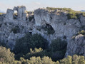
Starting from Col de l'Ange, this hike climbs to the summit of Du-Brigou and then Mont Cruvelier, offering magnificent views of the region and the Sainte-Baume mountain.
Circular starting from Col de l'Ange
 4.00 mi
+932 ft
-915 ft
3h 05
Moderate
Departure from Cuges-les-Pins (Bouches-du-Rhône)
4.00 mi
+932 ft
-915 ft
3h 05
Moderate
Departure from Cuges-les-Pins (Bouches-du-Rhône)
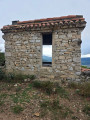
A lovely hike with beautiful panoramic views, ideal for groups or families. There are a few narrow passages, so take care. There is nothing dangerous, but be careful on the narrow passages to enjoy this beautiful hike.
The Aiguille de Gémenos starting from Aubagne
 4.95 mi
+1,109 ft
-1,296 ft
3h 15
Moderate
Departure from Gémenos (Bouches-du-Rhône)
4.95 mi
+1,109 ft
-1,296 ft
3h 15
Moderate
Departure from Gémenos (Bouches-du-Rhône)
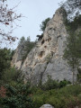
A hike of less than three hours on a wide path from start to finish. A very pleasant outing for groups or families. Fairly easy after an initial steep climb. Keep dogs on a leash.
Barres de Font Blanche - Tête de Nige - Vallon de Carafa
 5.35 mi
+879 ft
-856 ft
3h 15
Moderate
Departure from Roquefort-la-Bédoule (Bouches-du-Rhône)
5.35 mi
+879 ft
-856 ft
3h 15
Moderate
Departure from Roquefort-la-Bédoule (Bouches-du-Rhône)
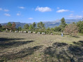
Hike through beautiful, semi-shaded woodland, which is very pleasant in summer. Some of the climbs are a little steep but short, requiring a few breaks, especially at the start of the route. Two sections, in the form of treasure hunts, are on very varied terrain, but overall very passable with beautiful views.
Gorges de la Petite Sainte-Baume
 6.29 mi
+1,588 ft
-1,588 ft
4h 15
6.29 mi
+1,588 ft
-1,588 ft
4h 15
 Easy
Departure from Gémenos (Bouches-du-Rhône)
Easy
Departure from Gémenos (Bouches-du-Rhône)
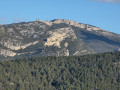
Most of the hike is on wide, clear paths offering beautiful views of Sainte-Baume, the Dents de Roque Forcade, Pic de Bertagne, Garlaban and other mountains that I cannot name in their entirety.
Vallons Dausserand and Sainte-Madeleine via the Chapel of Saint-Antoine
 6.00 mi
+1,270 ft
-1,270 ft
3h 50
Moderate
Departure from Cuges-les-Pins (Bouches-du-Rhône)
6.00 mi
+1,270 ft
-1,270 ft
3h 50
Moderate
Departure from Cuges-les-Pins (Bouches-du-Rhône)
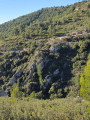
Most of the hike takes place on wide paths (DFCI) offering beautiful unobstructed views of the mountains and the Dausserand valley. The descents consist of fairly steep single tracks, making walking sticks particularly useful. The Saint-Antoine chapel is absolutely beautiful.
 From Monêtier-les-Bains to La Salle-les-Alpes
 7.89 mi
+420 ft
-413 ft
6h 28
Easy
Departure from Le Monêtier-les-Bains (Hautes-Alpes)
7.89 mi
+420 ft
-413 ft
6h 28
Easy
Departure from Le Monêtier-les-Bains (Hautes-Alpes)
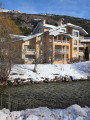
A round trip hike to be done during the snowy season (no snowshoes required as there are sections on tarmac), accessible to all ages. The route is flat and only starts to climb from Chemin des Crozes, in La Salle-les-Alpes (three-quarters of the way along the route).There is a single trail along the entire route, which runs alongside the cross-country ski trail. This is groomed and regularly maintained by the resort, making for a pleasant walk.
Le Télégraphe starting from the Vieux Chemin de Cassis, in Aubagne
 3.84 mi
+1,063 ft
-1,060 ft
2h 40
Moderate
Departure from Aubagne (Bouches-du-Rhône)
3.84 mi
+1,063 ft
-1,060 ft
2h 40
Moderate
Departure from Aubagne (Bouches-du-Rhône)
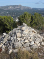
A pleasant, easy hike with 160° views of the region, including the mountains and the town of La Penne-sur-Huveaune. Very pretty paths and a few minor challenges add spice to this hike, which offers magnificent views without having to turn your head.
Le Télégraphe de Ceyreste, le Cabanon des Gendarmes starting from Ceyreste
 8.92 mi
+2,228 ft
-2,211 ft
6h 00
8.92 mi
+2,228 ft
-2,211 ft
6h 00
 Difficult
Departure from Ceyreste (Bouches-du-Rhône)
Difficult
Departure from Ceyreste (Bouches-du-Rhône)
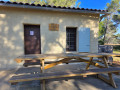
This hike is suitable for groups or families and is of moderate difficulty, but requires a minimum level of fitness given the cumulative elevation gain. It is mostly on wide, easy paths with a few trails to add variety to the route, offering beautiful views of La Ciotat, Pic de Bertagne and Dents de Roque Fourcade.After about two hours of walking, you arrive at the Cabanon des Gendarmes, a very friendly place where you can have a barbecue. Tables and benches are provided, with beautiful views of La Ciotat.Note: it is possible to make a circular pattern; see the chapter on practical information for details.
Via the Col des Seignors
 3.53 mi
+1,949 ft
-1,929 ft
3h 20
Moderate
Departure from Auriol (Bouches-du-Rhône)
3.53 mi
+1,949 ft
-1,929 ft
3h 20
Moderate
Departure from Auriol (Bouches-du-Rhône)
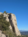
This isan easy hike with stunningly beautiful views. Overall, you will walk along long stretches of mountainside, some of which are a little tricky and require you to take your time, but which offer truly breathtaking views.
The Hermits' Cave
 4.96 mi
+1,280 ft
-1,299 ft
3h 25
Moderate
Departure from Allauch (Bouches-du-Rhône)
4.96 mi
+1,280 ft
-1,299 ft
3h 25
Moderate
Departure from Allauch (Bouches-du-Rhône)
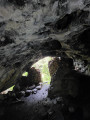
This is more of a walk to enjoy with family or friends. The route follows a DFCI (firebreak), so the paths are very wide and very pleasant for children to cycle on or for pushing pushchairs. The path is wide, practically along the entire length of the route, but gently sloping. This is the Chemin de Mimet. When you arrive near Notre-Dame-des-Anges, below, there is a narrow, rocky and picturesque path for experienced walkers. It leads to the Grotte des Ermites, some 100 metres below. You then have to retrace your steps. Children will be safe during this descent to the Grotte des Ermites, which will leave them with a very nice memory. It's not very long, but it's really very pretty.
Pey Gros and Les Auber
 5.62 mi
+1,365 ft
-1,352 ft
3h 45
Moderate
Departure from Cuges-les-Pins (Bouches-du-Rhône)
5.62 mi
+1,365 ft
-1,352 ft
3h 45
Moderate
Departure from Cuges-les-Pins (Bouches-du-Rhône)
This is a very pleasant hike, partly along DFCI-type tracks, but not only. There are also narrow paths where you will have to make your own way. It is quite unique and on other sections you will feel as if you are entering the vegetation. It is truly spectacular. The hike is mostly easy to walk, but some parts are quite steep, which creates diversity with varied and diverse landscapes. The hike is recommended for groups of walkers.The GPX track may be useful.
La Vigie via the Vallon des Gendarmes and the refuges
 9.51 mi
+1,926 ft
-1,942 ft
6h 05
Moderate
Departure from Ceyreste (Bouches-du-Rhône)
9.51 mi
+1,926 ft
-1,942 ft
6h 05
Moderate
Departure from Ceyreste (Bouches-du-Rhône)
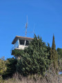
This is a nice hike to do. Most of it climbs a moderate slope. Once you reach La Vigie, you will find Refuge de Roquefort, La Bédoule and it takes just under two hours to get there at a leisurely pace. At the top, you can stop and enjoy the barbecue and outdoor table. There are beautiful views from the lookout point behind the refuge. There are also some lovely wooded paths with no particular difficulty other than the elevation. The path is very easy to walk on from start to finish.
Bau Trauqua Mountain on the Chemin des Crêtes
 3.57 mi
+896 ft
-1,047 ft
2h 25
Moderate
Departure from Mimet (Bouches-du-Rhône)
3.57 mi
+896 ft
-1,047 ft
2h 25
Moderate
Departure from Mimet (Bouches-du-Rhône)
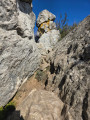
This is a very beautiful, short hike with a good climb for a while, and plenty of excitement with almost constant panoramic views for more than half of the hike. There is an orientation table, benches along the ridge and beautiful single-track trails with a slightly difficult section on the mountainside, but with good footing.
From the Fond Blanche car park to the parish of Cuges
 9.24 mi
+1,532 ft
-1,529 ft
5h 35
Moderate
Departure from Roquefort-la-Bédoule (Bouches-du-Rhône)
9.24 mi
+1,532 ft
-1,529 ft
5h 35
Moderate
Departure from Roquefort-la-Bédoule (Bouches-du-Rhône)
This is a pleasant hike with very pretty single-track trails. The rest of the route is mostly on DFCI tracks to reach the village of Cuges-Les-Pins, visit its parish church and shops, and return in a circular fashion to the car park.
The Côte Bleue seen from above from Sausset-les-Pins
 7.58 mi
+558 ft
-404 ft
4h 00
Moderate
Departure from Sausset-les-Pins (Bouches-du-Rhône)
7.58 mi
+558 ft
-404 ft
4h 00
Moderate
Departure from Sausset-les-Pins (Bouches-du-Rhône)
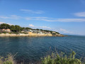
This is a very pleasant hike, with around a third of the route along the coast, which is very relaxing. The rest of the route is on very passable paths. The elevation gain is very modest: 160 m over a distance of 13 km. There is just one slightly tricky section on rocks for about ten metres, but it's nothing too difficult. It is located in the highest part of the walk, dominated by a cross. There is a beautiful spot for a lunch break with a panoramic view of Sausset-les-Pins. The view is impressive on a clear day.
In the footsteps of Marcel Pagnol from the Mas de Massacan
 7.45 mi
+2,808 ft
-2,792 ft
5h 10
Difficult
Departure from Aubagne (Bouches-du-Rhône)
7.45 mi
+2,808 ft
-2,792 ft
5h 10
Difficult
Departure from Aubagne (Bouches-du-Rhône)
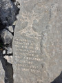
This is a fairly comprehensive hike that passes through the Col d’Aubignane and the Pas du Loup (which rises to 543 m). The walk then passes the Grosibou Cave, the Pic du Taoumé and the Baume Sourne or Bat Cave. It is a protected, fenced-off area, but you can see it and take photos; it is very pretty. The hike also passes the Puits du Mûrier, the Col du Garlaban, the Croix du Garlaban, Louis Douard’s rock carvings (over 100 rock carvings) and, finally, the Grotte du Plantier, also known as the Grotte du Cerf or the Grotte de Manon.
Grottes du Védi or Grotte des Oiseaux, as well as an unlisted cave
 8.84 mi
+1,631 ft
-1,601 ft
5h 30
8.84 mi
+1,631 ft
-1,601 ft
5h 30
 Very difficult
Departure from Plan-d'Aups-Sainte-Baume (Var)
Very difficult
Departure from Plan-d'Aups-Sainte-Baume (Var)
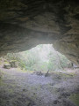
This hike is particularly suited to those with a good sense of direction who enjoy off-trail walking. It is very difficult in the sense that a large part of the paths are unmarked or have been overgrown by nature. Consequently, the paths have virtually disappeared in places. You’ll need to rely on your GPS a bit more; there are some fairly steep climbs, one of which is particularly challenging, rising by around 150 metres in elevation over a distance of 500 to 800 metres. That’s how steep and long it is. Otherwise, the Grotte de Védi is very beautiful, and not far from it there is a second cave which isn’t listed but is just as beautiful, though it needs some maintenance. You also pass along the lovely ‘Chemin des Sources’ (Path of the Springs), and almost the entire walk is in the shade. This walk is perfectly suitable for summer.
Grotte des Infernets and walk through the Bois de la Lare
 8.30 mi
+2,073 ft
-2,083 ft
5h 35
Difficult
Departure from Auriol (Bouches-du-Rhône)
8.30 mi
+2,073 ft
-2,083 ft
5h 35
Difficult
Departure from Auriol (Bouches-du-Rhône)
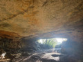
As soon as you enter the park, you immediately tackle a steep climb. You’ll encounter much narrower paths, as well as unmarked paths and paths that are barely there: it’s a bit like a treasure hunt. So this is for experienced hikers. There will also be DFCI tracks. The off-track sections are no longer than 300 metres, so nothing to worry about. However, you will needto use the GPX track on your GPS. It is a physically demanding but lovely hike. It follows the ridges. It’s a great experience with magnificent scenery. For much of the way, there are also areas of undergrowth to cross, such as the Bois de la Lare, which the route passes through on the descent. The route also takes in the Grottes des Infernets, with views of the spring bubbling up, depending on the time of year.
La Vigie and the Pilon du Roi via the ridges of the Montagne du Bau Trauqua
 6.77 mi
+2,110 ft
-2,264 ft
4h 55
Moderate
Departure from Mimet (Bouches-du-Rhône)
6.77 mi
+2,110 ft
-2,264 ft
4h 55
Moderate
Departure from Mimet (Bouches-du-Rhône)
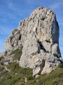
It is a very beautiful hike with a few sections that are a bit tricky for those with sensitive feet and for those who are afraid of heights. It climbs at the start to reach the lookout point via the ridges of Bau Trauqua. It passes by the Tête du Grand Puech and has a circular route that takes it around the Pilon du Roi. Much of the route is exposed, offering stunning scenery, especially on a clear, sunny day.
Dreamy woodland and ridges from the Grand Caunet
 11.07 mi
+1,923 ft
-1,903 ft
6h 45
Difficult
Departure from Ceyreste (Bouches-du-Rhône)
11.07 mi
+1,923 ft
-1,903 ft
6h 45
Difficult
Departure from Ceyreste (Bouches-du-Rhône)
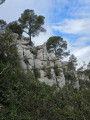
An easy walk that won’t put too much strain on your ankles. Much of the route follows a DFCI track, and a lovely section takes you through the woodland on a narrow but very passable path, without the risk of getting scratched. Those who love the woods will be in their element. You can see the Bédoule watchtower, the Cabanon du Marquis and the Cabanon des Gardes (with opportunities for barbecues over a wood fire in the huts).
Circular route around Simiane-Collongue
 7.69 mi
+994 ft
-1,014 ft
4h 25
Moderate
Departure from Simiane-Collongue (Bouches-du-Rhône)
7.69 mi
+994 ft
-1,014 ft
4h 25
Moderate
Departure from Simiane-Collongue (Bouches-du-Rhône)
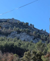
This is a mixed hike, with a large section on tarmac and a section through the forest to explore a cave, the Fontaine de Venel and the Fontaine des Vaches. It passes through the old village and goes past the Château de Gui, but unfortunately it is on private property so it is not possible to see it.
Under the Cross of Provence
 5.17 mi
+1,270 ft
-1,250 ft
3h 30
Moderate
Departure from Saint-Antonin-sur-Bayon (Bouches-du-Rhône)
5.17 mi
+1,270 ft
-1,250 ft
3h 30
Moderate
Departure from Saint-Antonin-sur-Bayon (Bouches-du-Rhône)
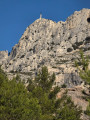
A short hike, but with a decent bit of elevation gain nonetheless, beneath the Croix de Provence. It’s a good warm-up before tackling the Croix de Provence, which stands on the Sainte-Victoire ridge at an altitude of 948 m above the Priory, restored and maintained by the Friends of Sainte-Victoire since 1955.
La Croix de Provence via La Marbrière and back via Le Pas du Berger
 6.76 mi
+3,205 ft
-3,219 ft
5h 55
Difficult
Departure from Saint-Antonin-sur-Bayon (Bouches-du-Rhône)
6.76 mi
+3,205 ft
-3,219 ft
5h 55
Difficult
Departure from Saint-Antonin-sur-Bayon (Bouches-du-Rhône)
It is a superb, very enjoyable hike with magnificent views, though it remains quite technical with tricky sections; there are always people at the Croix de Provence and the Prieuré de la Sainte-Victoire.
Bau de la Saoupe viewpoint and the Grotte des Espagnols
 3.40 mi
+751 ft
-768 ft
2h 15
Moderate
Departure from Cassis (Bouches-du-Rhône)
3.40 mi
+751 ft
-768 ft
2h 15
Moderate
Departure from Cassis (Bouches-du-Rhône)
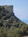
Somewhere between a hike and a stroll, given its distance, this route offers a wealth of panoramic views over the Cassis and La Ciotat areas and the sea with its coves. It starts on a hiking trail, then follows a partly tarmac-surfaced path until reaching the viewpoint just past the transmission mast. There is no option for a circular route.
Mont Gibaou via the Grotte des Janots
 6.67 mi
+1,355 ft
-1,345 ft
4h 15
Moderate
Departure from Cassis (Bouches-du-Rhône)
6.67 mi
+1,355 ft
-1,345 ft
4h 15
Moderate
Departure from Cassis (Bouches-du-Rhône)
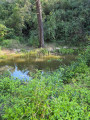
This hike allows you to explore the Grotte des Janots, which is no small affair: it is truly impressive in size and is one of the largest caves to visit in the region to date. The hike involves some climbing and a section of rocky terrain that is somewhat difficult, even technical, with a risk of slipping. Mont Gibaou offers some lovely views of the region. It’s a fairly short hike and a very enjoyable one to do.
Pic de Bertagne via the old ice house and the three passes
 10.23 mi
+3,556 ft
-3,543 ft
7h 50
Difficult
Departure from Gémenos (Bouches-du-Rhône)
10.23 mi
+3,556 ft
-3,543 ft
7h 50
Difficult
Departure from Gémenos (Bouches-du-Rhône)
This is a fairly challenging hike, though much less so than the Croix de Provence via La Marbrière and the return via the Pas du Berger, which has 200 metres less elevation gain but is much more technical.
This hike remains relatively easy in terms of difficulty, which is essentially just the elevation gain. Easily accessible, the hike starts on the left, about fifteen metres past the park office, leading first to the old ice house, then to the Pic and the Col de Bertagne. It then continues towards the Col de l’Espigoulier and, finally, passes through the Col de Brest. The path is marked almost entirely in yellow (freshly painted). There is a beautiful, deep cave to explore. The views are each as stunning as the next.
La Ciotat Bay seen from above via the Carrière du Loin
 6.30 mi
+2,982 ft
-2,982 ft
5h 30
Moderate
Departure from La Ciotat (Bouches-du-Rhône)
6.30 mi
+2,982 ft
-2,982 ft
5h 30
Moderate
Departure from La Ciotat (Bouches-du-Rhône)
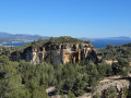
This is a walk that follows the ridges, overlooking the whole of La Ciotat Bay with stunning panoramic views. The walk allows you to walk for a long time whilst enjoying the view of La Ciotat Bay. Discover a cave on the ridge, at the highest point, with a double open cavity – it’s really lovely and not to be missed.
Aiguilles de Valbelle via the Porte de Valbelle
 6.17 mi
+919 ft
-938 ft
3h 40
Easy
Departure from Signes (Var)
6.17 mi
+919 ft
-938 ft
3h 40
Easy
Departure from Signes (Var)
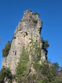
A short, pleasant hike or walk along a very straightforward route, offering a chance to discover the Aiguilles de Valbel and its gateway. Three-quarters of the hike is on a dirt track, followed by a short, pleasant, slightly uphill single track. Otherwise, there are no difficulties on this very easy hike.
Tête de Roussague and the Vallon des Seignors
 8.88 mi
+2,100 ft
-2,077 ft
5h 55
Difficult
Departure from Gémenos (Bouches-du-Rhône)
8.88 mi
+2,100 ft
-2,077 ft
5h 55
Difficult
Departure from Gémenos (Bouches-du-Rhône)
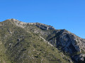
Overall, this is a very pleasant hike. Especially after passing Cistern 52, where you’ll find a series of outstanding single tracks. The hike takes you along the ridges to discover magnificent scenery.
Through the woodland around the Ruisseau de Saint-Pierre
 6.16 mi
+1,152 ft
-1,155 ft
3h 50
Moderate
Departure from Gardanne (Bouches-du-Rhône)
6.16 mi
+1,152 ft
-1,155 ft
3h 50
Moderate
Departure from Gardanne (Bouches-du-Rhône)
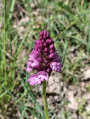
A walk that starts in a woodland that feels more like a park. It has a few tarmac sections and is relatively shaded. It’s a lovely summer stroll along very easy-to-walk paths.
A family-friendly and festive route from Le Grand Caunet
 2.01 mi
+322 ft
-167 ft
1h 10
Easy
Departure from Ceyreste (Bouches-du-Rhône)
2.01 mi
+322 ft
-167 ft
1h 10
Easy
Departure from Ceyreste (Bouches-du-Rhône)
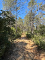
This is a very short hike leading to a refuge with a fireplace, along a ‘DFCI’ track. It is suitable for everyone, including children on bikes. It takes you to the Refuge des Gardes, which offers a stunning view of La Ciotat. The spot is very peaceful and welcoming. The short distance means you can pack plenty of food to enjoy a feast in the heart of nature.
Tête Ronde via the Vallon des Escourtines
 4.61 mi
+2,339 ft
-2,343 ft
4h 10
Moderate
Departure from La Penne-sur-Huveaune (Bouches-du-Rhône)
4.61 mi
+2,339 ft
-2,343 ft
4h 10
Moderate
Departure from La Penne-sur-Huveaune (Bouches-du-Rhône)
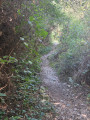
This is a lovely walk, just a few kilometres from Aubagne, which is straightforward but features a significant climb over a short distance to reach Tête Ronde. From the top, there are stunning panoramic views of Marseille and Notre-Dame-de-La-Garde. The route passes through very pretty, well-wooded single-track paths in the undergrowth, which offer a bit of cool relief.
Tête Ronde from La Penne-sur-Huveaune via La Millière
 5.20 mi
+2,011 ft
-2,011 ft
4h 10
Moderate
Departure from La Penne-sur-Huveaune (Bouches-du-Rhône)
5.20 mi
+2,011 ft
-2,011 ft
4h 10
Moderate
Departure from La Penne-sur-Huveaune (Bouches-du-Rhône)
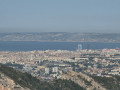
A lovely, short but fairly challenging hike, featuring technical sections over rocky terrain and some lovely single tracks. At the highest point, La Tête Ronde, there are views of the Marseille region, Sainte-Beaume, La Millière and Aubagne.
Carnoux via the Old Cassis Path to Aubagne
 7.13 mi
+1,184 ft
-1,168 ft
4h 20
Moderate
Departure from Aubagne (Bouches-du-Rhône)
7.13 mi
+1,184 ft
-1,168 ft
4h 20
Moderate
Departure from Aubagne (Bouches-du-Rhône)
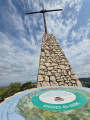
This is a pleasant little walk starting from the Vieux Chemin de Cassis, near the Château des Cresseau. It passes through the village of Carnoux to reach the Croix de Carnoux, a vantage point offering lovely views.
Tête Ronde from Les Bellons
 2.20 mi
+630 ft
-630 ft
1h 35
Moderate
Departure from Allauch (Bouches-du-Rhône)
2.20 mi
+630 ft
-630 ft
1h 35
Moderate
Departure from Allauch (Bouches-du-Rhône)
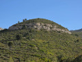
This is a hike over somewhat challenging terrain that ends off-track to reach the summit of Tête Ronde. You can enjoy beautiful scenery and visit the Bauxite Cave on the way back. It is a short, well-trodden route
Walk at Font de Mai
 4.73 mi
+843 ft
-830 ft
2h 55
Easy
Departure from Aubagne (Bouches-du-Rhône)
4.73 mi
+843 ft
-830 ft
2h 55
Easy
Departure from Aubagne (Bouches-du-Rhône)
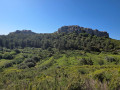
This is a short, pleasant and easy walk, with very wide paths throughout the route. This route takes you away from the most popular paths to explore Fond de Mai. The area is very green and there are lovely family-friendly areas at the very start of the walk.
The Grande Tête circuit starting from Saint-Pons
 5.05 mi
+1,683 ft
-1,696 ft
3h 45
Difficult
Departure from Gémenos (Bouches-du-Rhône)
5.05 mi
+1,683 ft
-1,696 ft
3h 45
Difficult
Departure from Gémenos (Bouches-du-Rhône)
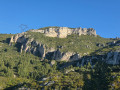
This is a hike that is very challenging at the start. The route is rocky with a steep climb to reach the Col de Bres. The climb is mainly in the first third of the route. The descent is gentle compared to the climb. There are some lovely DFCI tracks for the descent as well as single tracks through the undergrowth. The climb is over barren rock.
The Barres de Font Blanche Circuit
 5.97 mi
+728 ft
-728 ft
3h 25
Moderate
Departure from Roquefort-la-Bédoule (Bouches-du-Rhône)
5.97 mi
+728 ft
-728 ft
3h 25
Moderate
Departure from Roquefort-la-Bédoule (Bouches-du-Rhône)
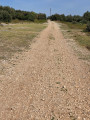
This is an easy walk, mostly along DFCI tracks, offering beautiful scenery and stunning views. The route is clear, with a few short single tracks on the terrain. Part of the walk is almost flat. The path is a little slippery and even slightly technical.
Hermitage of St-Jean du Puy and Pas de la Couelle
 6.08 mi
+1,690 ft
-1,824 ft
4h 15
Moderate
Departure from Trets (Bouches-du-Rhône)
6.08 mi
+1,690 ft
-1,824 ft
4h 15
Moderate
Departure from Trets (Bouches-du-Rhône)
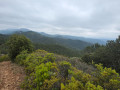
This is a hike that reaches a height of 648 metres, with lovely views. There may be mist. This hike features some lovely single tracks, but also a good stretch of tarmac road; however, it is a hike without any particular significant difficulty.
The Carnoux Plateau via Le Charrel
 8.18 mi
+1,142 ft
-1,119 ft
5h 50
Moderate
Departure from Aubagne (Bouches-du-Rhône)
8.18 mi
+1,142 ft
-1,119 ft
5h 50
Moderate
Departure from Aubagne (Bouches-du-Rhône)
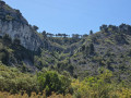
This is a lovely walk starting at Le Charrel, passing stables and Camp de Lambert, an organic farm, before finishing on the Carnoux plateau. The walk follows some very pretty, easy-to-walk, flat paths with splendid views. It is a popular spot. The return journey takes you along some lovely single tracks on the mountainside.
On the Grand Rouvière Plateau
 5.68 mi
+804 ft
-791 ft
3h 20
Moderate
Departure from Gémenos (Bouches-du-Rhône)
5.68 mi
+804 ft
-791 ft
3h 20
Moderate
Departure from Gémenos (Bouches-du-Rhône)
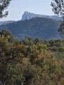
This is a mixed hike that begins with about 2 km of climbing. Then it’s flat, through woodland and with very open views. The landscape is very green. The descent is gentle, whereas the climb is a bit steep, but it only lasts about 2 km. The hike mainly stays on the main, clearly marked paths.
Col de l'Espigoulier via the Vallon de la Galère and back via the abbey
 8.65 mi
+2,359 ft
-2,346 ft
6h 00
Difficult
Departure from Gémenos (Bouches-du-Rhône)
8.65 mi
+2,359 ft
-2,346 ft
6h 00
Difficult
Departure from Gémenos (Bouches-du-Rhône)
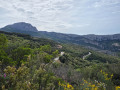
This is a fairly challenging hike that begins with an elevation gain of around 700 metres. This is covered over the first six kilometres. The hike climbs steeply with some technical sections. The descent features sections along the mountainside, so you mustn’t be afraid of heights. Otherwise, give it a miss. It’s a very beautiful hike with sections through woodland, lovely single tracks and sections over steep rocks. It offers a fine variety of paths with some very pretty views.
In Bruyères Park
 2.94 mi
+1,047 ft
-1,063 ft
2h 15
Moderate
Departure from Marseille (Bouches-du-Rhône)
2.94 mi
+1,047 ft
-1,063 ft
2h 15
Moderate
Departure from Marseille (Bouches-du-Rhône)
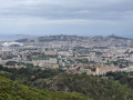
This is a short, challenging hike that runs along the mountainside with magnificent views of Marseille and some lovely single tracks. Overall, it is a very short route, but with a good level of difficulty. It is a good way to test yourself before tackling more complex routes
La Croix de la Barasse via the Vallon de la Vigie
 5.63 mi
+1,388 ft
-1,365 ft
3h 50
Moderate
Departure from Marseille (Bouches-du-Rhône)
5.63 mi
+1,388 ft
-1,365 ft
3h 50
Moderate
Departure from Marseille (Bouches-du-Rhône)
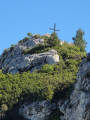
It’s a short but somewhat strenuous hike, offering magnificent views of Marseille. It consists largely of DFCI trails and a few single tracks, but overall it’s very easy to walk. The hike includes a few short technical sections, but nothing too difficult. There’s also a short tarmac section with some steep gradients.
Saint-Jean Chapel via Les Hautes Bâties de Cousson
 5.36 mi
+1,509 ft
-1,539 ft
3h 45
Moderate
Departure from Digne-les-Bains (Alpes-de-Haute-Provence)
5.36 mi
+1,509 ft
-1,539 ft
3h 45
Moderate
Departure from Digne-les-Bains (Alpes-de-Haute-Provence)
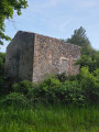
This hike is best done in summer to avoid paths overrun by the torrent of hot water. It is a very easy hike along well-maintained paths, with the only difficulty being a descent that may put some people off. There are also a few dizzying sections. Those with a fear of heights should avoid this hike. The start of the walk is somewhat overgrown with wild vegetation that has taken over a little. In places, the paths are covered in water for a few metres before the path reappears shortly afterwards. Then begins a steady, unbroken climb with no obstacles.
Pounche des Escaouprés and Col de l'Amandier
 5.68 mi
+1,234 ft
-1,224 ft
3h 40
Moderate
Departure from Allauch (Bouches-du-Rhône)
5.68 mi
+1,234 ft
-1,224 ft
3h 40
Moderate
Departure from Allauch (Bouches-du-Rhône)
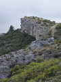
This is a hike that climbs quite steeply on a tarmac road right at the start, then continues to climb quite steeply for a few kilometres. You then descend gently, with a few sections over rock that are a bit tricky, but not too much. The route takes you across pleasant plateaus with unobstructed views of the Vallon des Amandiers and Sainte-Baume, with Marseille in the background.
The Carnoux-en-Provence Plateau Circuit
 3.06 mi
+121 ft
-125 ft
1h 30
Easy
Departure from Aubagne (Bouches-du-Rhône)
3.06 mi
+121 ft
-125 ft
1h 30
Easy
Departure from Aubagne (Bouches-du-Rhône)
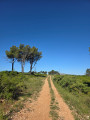
This is more of a stroll than a hike. It takes place on very easy-going terrain with very little elevation gain. Relatively busy, it circles the plateau with beautiful, unobstructed views of the region.