Country:

 City:
City:


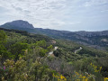

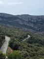
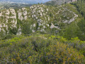
Park at the Saint-Pons car park.
(S/E) Go through the forest gate at the end of the car park. Walk past the park office and turn left. Keep to the left again to cross a small bridge. Turn left after the bridge and go through a forest gate. You’ll reach a large tarmac area with a forest gate on the right. Continue along the path behind this gate.
(1) At the junction, take a sharp right-hand bend onto a small, climbing single track. Then change sides of the slope whilst staying on the same path. There is a short technical section on the mountainside and you mustn’t be afraid of heights to reach the top. There is a lovely little clearing with views of the Garlaban and Gémenos opposite. Change sides of the mountain once more, whilst staying on the path. There is a pretty stone heart on the ground.
(2) At the junction, follow the DFCI track to the right. On the left, you’ll see an army-green transmission mast. Pass a light-green container. At the first large bend, look out for a small path on the left. Leave the DFCI track and take this small, ascending path. At a small junction, follow it to the left where the slope is less steep. The markings are mostly navy blue.
(3) Cross a DFCI track and take it to the left as it climbs. The markings are yellow. Pass water tank number 54 and arrive at a large junction with a signpost on the right. On its left, look for the path that runs diagonally. Take this to leave the DFCI track. The path descends slightly. It is technical and slippery.
(4) At the end of the descent, you’ll reach a bend with a small clearing on the left. You’ll see a concrete water trough for animals; on the right, directly opposite, follow a small, well-hidden path. You’ll need to push aside the foliage a little to see the path that emerges a little further on. It soon splits into two sections. Keep to the right, staying on the more clearly marked path and continuing in the same direction. This path is not used very often, as the vegetation is starting to take over. It doesn’t take long before you come to a clear path again.
(5) You’ll come to a bend in the path (junction) and turn left.
(6) Cross a DFCI track, which you should follow to the left to reach a major junction marked SB 102. Turn right towards the Col de l’Espigoulier and the Pic de Bertagne. At a signpost on the right, go through a forest gate to pass water tank number 55. The path is marked in red and yellow.
(7) Cross the Route de Gémenos at the Col de l'Espigoulier. Continue to the right for a few metres and look for a path that runs diagonally across to the other side of the road. Follow this path. It is clearly marked in red and yellow (GR®2013) and climbs steadily towards the Col de Bertagne along a very pleasant single track through the woodland. Caution: a false path branches off to the left. Make sure you stay on the right, following the yellow markings.
(8) Be careful when emerging from the woodland; at a small bend, you must leave the path and head right onto a path that is not very visible. Then, a few metres further on, as you pass between two large deciduous trees, the path becomes clearer. It runs through a very wide, lovely and well-shaded woodland and arrives at what looks like a house, with a forest gate to its right. The path then passes a second small concrete hut. This belongs to a local association; you must walk past it to find a small dirt track continuing on. The route takes you through some slightly overgrown woodland, then very quickly reaches a Fork in the road. Keep to the right on the descending path, which opens out.
(9) Cross a small path and head down to the right. At a large Fork in the road, take the right-hand path to join a very wide track, which you should follow to the right. It is marked in yellow. Turn left and follow the markings, then continue to follow a second sign to turn left. Continue to follow the yellow markings until you reach a technical rocky ridge with a steep slope over a long distance. Follow the markings (recent yellow markings, with very frequent markings). Caution: at one point, a trail suggests the path veers off to the right, but no, you must stay on the left and very soon you will see the yellow markings again.
(10) Cross a path and continue straight ahead, slightly to the right, following yellow and red markings. A signpost indicates that you should head towards Gémenos to reach the D2, a tarmac road which you should take on the left. Then, a little further on, at the side of the road on the left, you will see large stones marked in yellow and red. Take this path.
(11) At the junction, turn right and you will come to a Fork in the road with signposts. Continue straight on until you reach the Allée des Platrières.
(12) Take this on the left, pass cistern number 69 and follow the lane down to the junction. Turn left, crossing the small bridge.
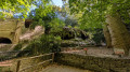
(13) At the former Abbey of Saint-Pons, continue to the right along Allée du Gour de Loule. Follow this long-distance hiking trail straight ahead.
(14) You will then pass a beautiful sculpture of a marmot on a tree trunk. Continue along the GR®2013 and pass close to the Chapelle Saint-Martin, then turn left onto the newly renovated section (there are toilets). Follow the path; there is only one. Cross the Route de Saint-Pons and go straight ahead or zigzag as you please. You will arrive at the Saint-Pons car park (S/E).
 Association / Club / Walk leader

 Visorando Member
 Moderate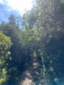
 Easy
Easy