Country:
 City:
City:


Park in the car park at the top of the road (Rue Val Chaumery) which runs alongside the Lycée Camille Julian on the left. There are about a dozen spaces.
(S/E) From the car park, continue on and look for the open wall. There is a small gap to go through a few metres further on. You’ll cross a DFCI track and see a forest gate on the left. Turn right, heading up onto the CQ 123. Cross a path on the right, then continue left onto the wide path marked in yellow and red “GR®2013”.
(1) Then, cross the DFCI track CQ 229, which you should take to the right. This is a descending path, still marked in yellow and red. Pass a forest gate and arrive at the tarmac road.
(2) Follow it uphill to the left. Take the first right at the signpost marked "DFCI". Leave the tarmac road at the "dead end" sign and head left at a forest gate, which you must go through to follow the CQ 203.
(3) At the junction with a DFCI track, continue uphill to the right. Pass tank number 440 to reach the white tank marked number 666.
(4) Walk alongside the tank on the left, leaving the DFCI track. Go behind this tank along a lovely, easily passable single track marked in sky blue. Head towards La Croix and pass the Col de Galvaudan. You will then reach a Fork in the road. Keep to the right.
(5) You’ll reach a junction with three directions. Turn right, passing between two mountains to change sides. This is a path that descends along a fairly narrow single track, but remains very rideable despite the vegetation that scratches your legs and arms a little. The descent is quite steep with some banked sections that can be a bit rough. You’ll cross a path heading uphill to the left, but stay on the path, which continues to descend and is still clearly marked in sky blue.
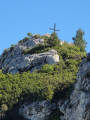
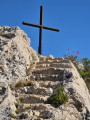
(6) Pass a wall, still following the blue markings, which you must follow all the way to the Croix de la Barasse.
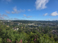
(7) Take in the view, then return along the same path until you come to a sky-blue marker with three dots and a sign to turn right. Take this lovely, well-maintained single track.
(8) At the junction, continue straight ahead, veering slightly to the left
(9) When you reach the DFCI track, take it on the left. Stay on this track until you reach the junction from the outward journey.
(3) Then follow the path on the right, retracing your steps from the outward journey, until you reach the car park (S/E).
 Visorando Member

 Easy
Easy