


 Country:

 City:
City:


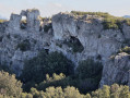
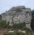
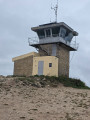
Access by car is via the N8, between Aubagne and Cuges-les-Pins. Park at Col de l'Ange, in the dirt car park opposite the Bistro et Grill and the Moulin de Sophie bakery.
(S/E) At the far end of the car park, with your back to the road, take the path on the right that leads up to a forest barrier. Stay on the widest path, following several bends, until you reach a crossroads.
(1) Turn left onto a path that seems to take you back the way you came, which is a little steeper and rockier. You will reach a three-way junction marked by a cairn in the middle.
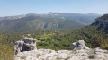
(2) Keep to the right and continue climbing along the ledge path, marked in white and red, which offers beautiful views of the region's lovely landscapes on the left. Pass an abandoned house to immediately reach a track.
(3) Turn right to continue climbing, following the red and white markings. The terrain flattens out and then descends slightly before reaching a large hairpin bend.
(4) Head left, walk about thirty metres, then turn left again onto an uphill path. At the next junction, keep right on the path that descends into the undergrowth and you will reach a junction with a path coming from the right, marked GRP® Yellow and Red and PR® Yellow.
(5) Keep left and join a track at a signpost indicating Le Cuvelier 500 metres ahead.
(6) Turn left and follow this uphill track with a clear view to the right.
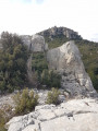
(7) Take the very narrow path on the right that climbs up to the Sommet du Brigou.
(8) Return to the fork.
(7) Continue the route to the left and head straight on, keeping to the track that leads to Mont Cruvelier and its lookout point.
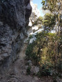
(9) Turn back and, a few dozen metres before the junction with the path leading to the summit of Brigou, turn right onto a small , well-hidden path. This path is very narrow and descends very steeply to rejoin the track you took on the way up.
(10) Follow it, turning right.
(11) Turn left towards a green skip to take a small path that goes up and then down, ignoring the poor starts: follow the GPS track carefully at this point. The path becomes narrower and goes up a little before reaching the point where it turns sharply to the right: very clear view of the mountains.
(12) Keep to the left and continue downhill to rejoin the outward path.
(2) Turn right and retrace your steps uphill to return to Col de l'Ange and the car park (S/E).

 Association / Club / Walk leader

 Visorando Member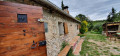
 Easy
Easy 
