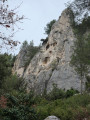
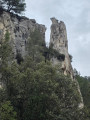
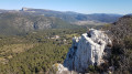
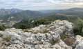
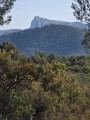
The Aiguille de Gémenos starting from Aubagne

A hike of less than three hours on a wide path from start to finish. A very pleasant outing for groups or families. Fairly easy after an initial steep climb. Keep dogs on a leash.

Details

89413278
Creation:
Last update:
Last review:
  • Walking
    Activity: Walking
  • ↔
    Distance: 4.95 mi
  • ◔
    Average duration: 3h 15 
  • ▲
    Difficulty: Moderate

  • ⚐
    Back to start: Yes
  • ↗
    Ascent: + 1,109 ft
  • ↘
    Descent: - 1,296 ft

  • ▲
    Highest point: 1,417 ft
  • ▼
    Lowest point: 387 ft

Photos

Description of the walk

Park in the unpaved car park with about ten spaces near the forest barrier on Chemin du Chèvrefeuille.

(S/E) Continue along Chemin du Chèvrefeuille, take an easy climb and, via a series of hairpin bends, reach the foot of the Aiguille de Gémenos.

(1) Continue along this wide path and, at the crossroads with the green water tank marked 409, keep left to finish the climb at the crossroads of two tracks.

(2) Take the left-hand track downhill and you will soon come to the GRP® Montagne Sainte-Baume crossroads.

(3) Here you have two options:
- either turn left and follow the yellow and red markings to marker SB 106,
- or cross it, continue straight ahead (this is the route shown on the map) and join the GRP® at marker SB106.

(4) Leave the GRP® here by turning left onto a wide road that climbs slightly. You will then reach a cistern and continue downhill on the left. You will come to a crossroads just before a hairpin bend.

(5) Turn left, where two overlapping blue and orange crosses mark the path to follow. This path is wide and climbs quite steeply before descending again. Follow a large circular route to the right to reach a crossroads with several directions.

(6) Keep left to go around the Aiguille de Gémenos and, via this wide path, join the Chemin du Chèvrefeuille. Take it to the left to return to the car park (S/E).


Waypoints

  1. S/E : mi 0 - alt. 574 ft - Chemin du Chèvrefeuille car park
  2. 1 : mi 0.79 - alt. 1,076 ft - Under the Aiguille de Gémenos
  3. 2 : mi 1.48 - alt. 1,414 ft - Crossroads - Fauge (cours d'eau) - Affluent de la Huveaune
  4. 3 : mi 1.86 - alt. 1,263 ft - GRP
  5. 4 : mi 2.53 - alt. 902 ft - Marker SB106
  6. 5 : mi 3.87 - alt. 702 ft - Trail junction
  7. 6 : mi 4.42 - alt. 577 ft - Crossroads with several directions
  8. S/E : mi 4.95 - alt. 400 ft - Chemin du Chèvrefeuille car park

Notes

An easy hike, mainly following a wide, easy path from start to finish.
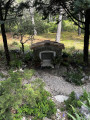
(4) There is a water source to see as you pass, but it was too overgrown with vegetation, so I didn't stop.
Be careful at (5): there are two overlapping blue and orange double crosses, but this is the right path.

Worth a visit

The best thing about this hike is how easy it is in every way. I really enjoyed it.

Reviews and comments

4.5 / 5
Based on 4 reviews

Reliability of the description
4.5 / 5
Ease of following the route
4.5 / 5
Route interest
4.5 / 5
inoxinable
inoxinable

Overall rating : 4.7 / 5

Date of your route : Feb 24, 2026
Reliability of the description : ★★★★★ Very good
Ease of following the route : ★★★★★ Very good
Route interest : ★★★★☆ Good
Very busy route : No

A wonderful discovery

Machine-translated

phildaix
phildaix

Overall rating : 4 / 5

Date of your route : Feb 11, 2026
Reliability of the description : ★★★★☆ Good
Ease of following the route : ★★★★☆ Good
Route interest : ★★★★☆ Good
Very busy route : No

A pleasant little hike among the trees, with beautiful cliffs and scenery. Wide, easy paths despite a few slightly steep climbs. The arrival on the outskirts of Gémenos is not particularly exciting.

Machine-translated

EricJacquot
EricJacquot

Overall rating : 4.7 / 5

Date of your route : Feb 02, 2026
Reliability of the description : ★★★★☆ Good
Ease of following the route : ★★★★★ Very good
Route interest : ★★★★★ Very good
Very busy route : No

Pleasant route. Note that the first 2.5 km section is very steep, which is good for cardio.

Machine-translated

GarlabanTaoume
GarlabanTaoume

Overall rating : 4.7 / 5

Date of your route : Jan 06, 2026
Reliability of the description : ★★★★★ Very good
Ease of following the route : ★★★★☆ Good
Route interest : ★★★★★ Very good
Very busy route : Yes

A very wooded route that can be completed in a morning. Be very careful after point 5: turn and climb up to the left on the small track, as there are no landmarks.

Machine-translated

AUDO13
AUDO13

Hello, please do not cross private property on unmarked sections. Thank you.

Machine-translated

Other walks in the area

For more walks, use our search engine .

The GPS track and description are the property of this route's author. Please do not copy them without permission.