Country:

 City:
City:


Park in the car park on the edge of Avenue des Thermes (D20).
(S/E) Take the D20 on the right. Continuing along this road, pass the Haute-Provence Thermal Spa and then, before reaching the bend in the road which turns left, look out for a car park on the right. Cross the car park and follow the yellow markings to pass through a metal gate, which is always open. When you reach an open space, head left. At the last street lamp on the left, take a path marked in yellow with wooden steps.
(1) Cross the Torrent des Eaux Chaudes and follow the path that continues on the other side, slightly to the right. Marked by a few stones, it is a lovely single track with somewhat overgrown vegetation. You need to follow a rock on the right. If there is too much water, you must cross once, make a small circular loop and return by crossing again to go round this rock and continue along the path.
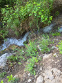
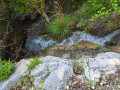
(2) Cross a small wooden footbridge. The path is occasionally overgrown for a few metres due to a spring. Continue with your feet in the water before crossing another small footbridge. It is somewhat overgrown with moss; a little further on, you must take another footbridge, which is slightly longer and in poor condition. This does not, however, prevent you from crossing. Pass two large rocks in the middle of the path, situated on the right. The path then widens and enters a lovely wood.
(3) At the junction, turn right onto a lovely, clear single track with a gentle, steady gradient. It is full of flowers and passes through lovely, cool woodland.
(4) You then reach a dizzying section, secured by ropes and an orange net, offering magnificent, vertiginous views over the woods. Further on, you’ll spot a cistern.
(5) Go to the top of the cistern and look for a yellow pipe with a junction. Directly opposite is a fountain. Continue behind it, to the left of the fountain, along a path marked in white and red. You’ll come to a signpost; follow the signs to the right towards the Chemin de Saint-Jean and Digne. The route follows some lovely single tracks along very pleasant, earthy paths, giving the impression of walking on a soft, cosy carpet.
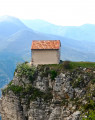
(6) At the crossroads, turn right, following the signposts. Head towards the Chapelle Saint-Jean, cross the path and head into the woods, following the yellow markings. The descent is a little tricky. The path descends and climbs quite steeply to reach a junction with, on the right, a sign for the Chapelle Saint-Jean, a chapel carved into the rock.
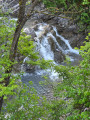
(7) Head towards the chapel then return to this junction to continue the descent to the right. Cross a stream then walk a short distance through the water of the torrent to continue to the right. The path continues to descend. Follow the stream on the right. You’ll sometimes be walking with your feet in the water, then the path reaches a wide wooden footbridge. Cross this and pass a very pretty waterfall at the end of the descent. Walk past a tennis court to reach the road, which you should take on the left. You’ll then come to another junction.
(8) Turn right onto Avenue des Thermes. Continue straight ahead along the fitness trail, with the archery range on your right. Stay on the path, cross a small metal bridge and continue to the right along the road, passing a caravan park on your left. You will then reach the tarmac road and the car park (S/E).

 Visorando Member
 Easy
Easy 
 Difficult