Country:
 City:
City:


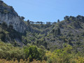
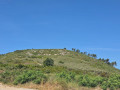
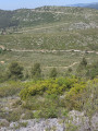
Park at the car park on Allée de la Garenne, opposite Impasse des Fauvettes.
(S/E) Look out for a sign with a horse (stable). Just behind it, there is a narrow dirt track which you should take, keeping to the left-hand path that runs alongside the houses. You will come to a small concrete structure covered in graffiti (photo attached). Then cross a small path on the right and continue almost straight on, following the path as it continues. Walk along the canal, which is covered with concrete slabs, and follow the agricultural fields (Camp de Lambert and its organic farming). You’ll come to a crossroads.
(1) Head straight on, veering slightly to the right. The path then bends to the right: cut across to go straight on, passing a house on your right. Then continue along the main path, which is clearly marked.
(2) At the crossroads, cross over to go straight on and follow the horse paddocks. On the left is a forest track: take the path on the left downhill and you’ll reach a crossroads. Go straight on, passing close to the electricity pylon.
(3) At the junction with the Vieux Chemin de Cassis, turn left towards cistern 197. Pass it and take the second path on the left a little further on, following the markings on the ground. Look out for a post with yellow and red markings. Leave the Vieux Chemin de Cassis and take a path on the left, following the yellow markings which lead down to a bend in the dirt track.
(4) Take a path on the left, still very well marked in yellow and red. Continue until you reach the tarmac road. This is the Chemin de Carpiagne.
(5) Turn left onto it, go under the railway bridge and you will soon come to a concrete pylon on the right, marked in yellow. Following the yellow markings, go up the path on the right.
(6) At the fork, turn right, following the yellow markings. When you reach the bend, you’ll see a forest gate on the right. Continue straight on, climbing up the valley, still following the yellow markings. Pass a small junction on the right and keep straight on, veering slightly to the left. The climb ends in a narrow single track, which then narrows considerably as the vegetation takes over. You’ll reach a major junction.
(7) Look out for the yellow markings indicating a left turn. Follow the markings and, a few metres further on, on the left, take the path marked in yellow on the left. You’ll come to a junction and continue straight on, following the power pylons. Further on, a yellow route marks you to turn left, but you must continue straight on along the path with a Yellow Cross to pass under the power lines. You’ll cross several paths; stay on the main path, which is the widest.
(8) At the sharp junction on the right, turn right, walking past the houses and following the sky-blue markings. Cross the Carnoux Plateau along a very wide path that descends gently. Pass a first green container, then a second, and continue to the end of this very passable and busy path. You will reach a junction.
(9) Make a slight zigzag to the right (straight ahead, slightly to the right) then turn left towards two street lamps. You will then come to a forest gate and then the tarmac road. Keep to the right as you follow the road, staying on the sky-blue marked path. The path then moves away from the road into the heart of the heath (enjoy the scenery). Continue to the end of the path.
(10) Turn right, leaving the blue markings, and head towards Sainte-Baume and Garlaban, which can be seen from this path. The path is clear. Pass a small junction on the right to reach a very wide path.
(11) Turn left, following the yellow markings.
(12) At the junction, turn right. Look out for a stone on the ground marked with several directions. Follow the sign for Le Charel to pass a graffiti-covered stone cistern (photo attached). The path, still clearly marked in yellow, continues diagonally. Go straight on, passing the electricity pylon on your right. Look for a path leading downhill and take it. You’ll see Camp de Carpiagne straight ahead. Follow the path, which is still clearly marked in yellow, as it descends. Keep to the right until the end of the path, then turn left onto the path you took on the way there. Continue straight on until the second junction.
(6) Pass this junction, keeping to the right, and very soon you’ll be following the railway line along a lovely single track on the mountainside. The path then becomes a concrete track. You’ll come to a junction with a crossed-out arrow on the right; head down to the left. Go under the railway bridge and continue until you reach the Chemin de Carpiagne
(13) Follow it to the left. Stay on the tarmac road marked in yellow. Then look out for a small junction on the right at a canal covered with concrete slabs (this is the second junction on the right). Turn right and stay on this path which goes straight on. Walk alongside the Camp de Lambert, pass two small junctions on the left and stay on the main path which goes straight on, veering slightly to the right, to reach the Vieux Chemin de Cassis. Take this path to the right, which you took on the way out, to reach the junction.
(3) Head straight ahead and continue to the car park along the same path you took on the way there (S/E).
 Association / Club / Walk leader

 Easy
Easy 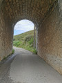
 Visorando Member