Country:
 City:
City:


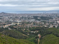
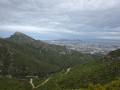
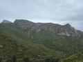
Start from the car park on Chemin des Prud’hommes, opposite No. 180.
(S/E) Facing the wall of a property, turn right, leaving the Clos des Oliviers on your right. Continue along the path and take the “dead-end road” on the left. After a DFCI sign, the road splits into two.
(1) Head right downhill to pass between two low wire-mesh walls and reach a junction. Turn left towards the entrance to Parc des Bruyères. Start with the HC 330. Reach the first junction with a picnic table.
(2) Leave the return path on your left and turn right onto the wide path that climbs. You’ll reach a large open space with the CQ 222. Don’t take it; turn left instead. Cross a path on the left and continue straight ahead, veering slightly to the right, following the yellow markings. Ignore the path coming from the left in the opposite direction. Pass a red fire hydrant and arrive at a tarmac section with a small path branching off to the right.
(3) Ignore this and stay on the wide path that veers slightly left at the two water tanks. At the junction, turn right to follow sky-blue markings, which are visible if you look back after passing them. You will then come to a small path branching off to the far right.
(4) You’ll need to climb a small rocky outcrop to reach it, then follow the path that passes under a high-voltage power line, turns left and joins a junction.
(5) Leave the path and take the one on the left that goes downhill. Just after that, you’ll see a small path on the right. Follow it; it’s a lovely single track leading down to a junction.
(6) Keep left, continuing downhill, and pass a ruined house on the left. Follow the path to reach another fork.
(7) Turn left and, a few metres further on, go through a forest gate to meet a wide path at a bend. Keep going straight on, keeping to the right. You’ll come to a T-junction.
(8) Turn sharply right. There is a well on the left. Pass a red fire hydrant with a path on the left and continue to the right to reach the junction you passed on the way out.
(2) Turn right onto the path you took on the way there, heading in the opposite direction to the car park (S/E).
 Visorando Member


 Easy
Easy 
 Association / Club / Walk leader