


Refine your search for walks in Roche-d'Or
Roche-d'Or walks
 On Les Roches via Vacherie Dessus (Swiss Jura)
 Visorando Member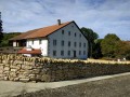
 8.79 mi
 +1,467 ft
 -1,463 ft
 5h 20
5h 20
 Moderate
 Departure from Chevenez (Canton of Jura)
This is a beautiful hike that has the advantage of being in Switzerland, where hunting is closed on Sundays.
The upper part of the route is on a wide ridge with sunny pastures and a picnic area with two tables.
There are a few viewpoints on the north side overlooking the L'Ajoie plain with the Vosges mountains in the background.
On the other side, you can see the Haut-Doubs and the Jura mountains, including the famous Chasseral.
In between, there is plenty of nature to enjoy, with a good portion of the walk taking place in the shade of the trees, which is very pleasant in hot weather.
A circular route through the Val d’Ajoie and the Faux d’Enson, starting from Damvant
10.40 mi
+1,598 ft
-1,614 ft
6h 10
Moderate
Departure from Damvant (Canton of Jura)
Starting from the centre of Damvant, this figure-of-eight route follows the French-Swiss border, running alongside the Prehistoric Park and the Reclère Caves. The route passes through the charming village of Roche d’Or before climbing up to La Faux d’Enson and its panoramic tower. Return via the ridge forming the border before passing through the two Swiss farms at La Vaux and Montavon and returning via the entrance to the Reclère Prehistoric Park and Caves. In fine weather, there are stunning views as far as the Bernese Alps from the Faux d’Enson observation tower, as well as across the Doubs valley on the French side whilst following the border on the return journey.
The Réclère Caves (Swiss Jura)
 9.52 mi
+1,476 ft
-1,470 ft
5h 40
Moderate
Departure from Damvant (Canton of Jura)
9.52 mi
+1,476 ft
-1,470 ft
5h 40
Moderate
Departure from Damvant (Canton of Jura)
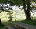
Circular hike (figure of 8) with a shared section to the Réclère caves.
The Réclère Caves
 8.60 mi
+1,772 ft
-1,781 ft
5h 30
Moderate
Departure from Montjoie-le-Château (Doubs)
8.60 mi
+1,772 ft
-1,781 ft
5h 30
Moderate
Departure from Montjoie-le-Château (Doubs)
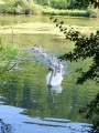
From the castle ruins, you will climb up to the ledges where, like tightrope walkers from one border marker to the next, you will walk along the ridge line, neither in France nor in Switzerland. You will reach the Réclère Caves, considered the most beautiful in the world by the first explorers in 1886. From Journey to the Centre of the Earth by Jules Verne to Conan Doyle's The Lost World, you will squeeze between dinosaur feet. The return journey, via the old farmhouse at Montavon, will be less adventurous.
The source of the Doue
 10.60 mi
+1,460 ft
-1,434 ft
6h 10
Moderate
Departure from Glay (Doubs)
10.60 mi
+1,460 ft
-1,434 ft
6h 10
Moderate
Departure from Glay (Doubs)
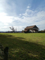
A peaceful, shaded walk with two routes of varying lengths and elevation gains available around Glay and Dannemarie.
The source of the Doue and the boundary stones of the principality in Abbévillers
 6.72 mi
+669 ft
-650 ft
3h 40
Moderate
Departure from Abbévillers (Doubs)
6.72 mi
+669 ft
-650 ft
3h 40
Moderate
Departure from Abbévillers (Doubs)
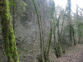
This is a pleasant hike starting from Abbévillers near the Swiss border, 20 km south-east of Montbéliard and 30 km from Belfort.
You will enjoy beautiful countryside and forest landscapes and stunning views of the Swiss Jura.
Halfway along the route, you can admire the source of the Doue, which is a resurgence at the bottom of a cliff. The site is very well laid out with a mill currently undergoing renovation and numerous information panels.
At the end, you can admire the border markers.
The Tante Airie cave and the Blamont fountains
 3.31 mi
+525 ft
-545 ft
2h 00
3.31 mi
+525 ft
-545 ft
2h 00
 Easy
Departure from Blamont (Doubs)
Easy
Departure from Blamont (Doubs)
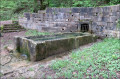
A walk along the water, springs and fountains in the valleys surrounding the promontory of the ancient castle of Blamont. Discover the cave of Tante Airie, the legendary Mother Christmas of the Pays de Montbéliard.
A varied route on the Circuit des Bornes starting from Blamont
10.81 mi
+1,982 ft
-2,001 ft
6h 40
Moderate
Departure from Blamont (Doubs)
The section of the Circuit des Bornes between Blamont, Pierrefontaine-lès-Blamont and Villars-lès-Blamont takes in heritage sites, numerous water fountains, the Tante Airie cave, gun emplacements near Fort du Lomont, and then runs alongside the Franco-Swiss border with its boundary markers, as well as the source of the Creuse and its wash house. There may be views of the Chasseral and the Bernese Alps in good weather,
Short circular walk to the Grotte du Château de la Roche from Soulce-Cernay
 3.40 mi
+860 ft
-873 ft
2h 20
Moderate
Departure from Soulce-Cernay (Doubs)
3.40 mi
+860 ft
-873 ft
2h 20
Moderate
Departure from Soulce-Cernay (Doubs)
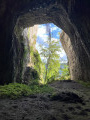
Discover a cave that was once temporarily transformed into a castle and has since become a paradise for cavers. A hike best enjoyed on fine summer days, making the most of the cool air of the Doubs Valley.
The swing wells at the start of Croix
 4.15 mi
+164 ft
-167 ft
2h 05
Easy
Departure from Croix (Territoire de Belfort) (Territoire-de-Belfort)
4.15 mi
+164 ft
-167 ft
2h 05
Easy
Departure from Croix (Territoire de Belfort) (Territoire-de-Belfort)
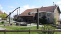
A beautiful hike 30 km from Belfort, 10 km from Delle and 20 km from Montbéliard. Croix is a small village south of the Territoire de Belfort on the border with Switzerland and the Doubs. There you can see some very pretty swing wells and an unusual cross-shaped water tower. A very pleasant walk with beautiful countryside and forest scenery.
The route is marked with a Green Ring.
Vautenaivre millstream leat
 6.89 mi
+951 ft
-945 ft
4h 00
Moderate
Departure from Goumois (Canton du Jura) (Canton of Jura)
6.89 mi
+951 ft
-945 ft
4h 00
Moderate
Departure from Goumois (Canton du Jura) (Canton of Jura)
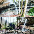
Coming from Goumois (Switzerland), park at the end of the Vautenaivre leat, next to a small rest area (with barbecue).
Welcome to Villars-le-Sec on the Franco-Swiss plateau of Ajoie.
 6.59 mi
+509 ft
-505 ft
3h 30
Moderate
Departure from Villars-le-Sec (Territoire-de-Belfort)
6.59 mi
+509 ft
-505 ft
3h 30
Moderate
Departure from Villars-le-Sec (Territoire-de-Belfort)
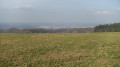
This is a pleasant hike on the French-Swiss border, starting from Villars-le-Sec near Delle, 30 km south-east of Belfort. It is very easy to access via the 1019 expressway.
You will enjoy cultivated countryside and forest landscapes with beautiful views of Saint-Dizier-l'Evêque, the Vosges and the Swiss plateau. You will discover a natural curiosity, "les Pas du Diable" (the Devil's Steps), and numerous border markers engraved with the Bernese bear and the fleur-de-lis.
The route is signposted.
Le Lomont via Brisepoutot
 7.31 mi
+1,053 ft
-1,037 ft
4h 15
Moderate
Departure from Montécheroux (Doubs)
7.31 mi
+1,053 ft
-1,037 ft
4h 15
Moderate
Departure from Montécheroux (Doubs)
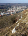
At the start of the walk, there is a south-facing view of the Haut-Doubs mountains. Then, superb views of the town of Pont-de-Roide from the Haut des Roches, followed by views of the Montbéliard region, with the Belfort Gap and the Vosges as a backdrop.
Porrentruy - Saint-Ursanne
 10.59 mi
+1,932 ft
-1,913 ft
6h 35
Moderate
Departure from Porrentruy (Canton of Jura)
10.59 mi
+1,932 ft
-1,913 ft
6h 35
Moderate
Departure from Porrentruy (Canton of Jura)
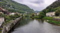
During this third stage, you will cross the historic town of Porrentruy. As you leave the town, the path runs along the edge of the woods before starting the climb to the Chalet des Chainions (Chalet des Amis de la Nature). The route then continues along a ridge before descending towards the hamlet of Seleute. As you approach Saint-Ursanne, you can admire the Clos du Doubs and its rocky massifs. You will enter the historic town of Saint-Ursanne through the Porte Saint-Paul.
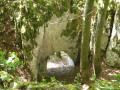
The Bisontin Cave
 4.10 mi
+889 ft
-906 ft
2h 40
Moderate
Departure from Chamesol (Doubs)
4.10 mi
+889 ft
-906 ft
2h 40
Moderate
Departure from Chamesol (Doubs)
A short walk, suitable for families although the elevation gain may be daunting for very young children (at least 6 years old), best enjoyed on sunny days as the route is very shaded.
Make sure you wear sturdy shoes as the route is also very stony
Circular route to the west of Saint-Dizier-l’Évêque
3.16 mi
+423 ft
-417 ft
1h 50
Easy
Departure from Saint-Dizier-l'Évêque (Territoire-de-Belfort)
A pleasant walk on the western side of the village of Saint-Dizier-l’Évêque. It runs mainly through woodland, but the final, open section offers superb panoramic views. On a clear day, you can see the Vosges, the Black Forest and the foothills of the Swiss Jura.
Montécheroux, Grotte du Bisontin, Les Essarts Diot
 6.09 mi
+794 ft
-807 ft
3h 30
6.09 mi
+794 ft
-807 ft
3h 30
 Difficult
Departure from Montécheroux (Doubs)
Difficult
Departure from Montécheroux (Doubs)
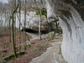
Walk offering multiple views of Saint-Hippolyte, exploring the Grotte du Bisontin, the Liebvillers Spring teeming with trout, and the Essarts Diot with another lovely viewpoint.
Please note: parts of this route follow a ridge line, so you need to be careful!
In the lands of Desiderius in Saint-Dizier-l'Évêque
 5.12 mi
+633 ft
-617 ft
2h 55
Easy
Departure from Saint-Dizier-l'Évêque (Territoire-de-Belfort)
5.12 mi
+633 ft
-617 ft
2h 55
Easy
Departure from Saint-Dizier-l'Évêque (Territoire-de-Belfort)
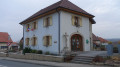
A very pretty hike that allows you to discover this small village with its superb church and beautiful vineyard.
The historical past is well highlighted with numerous information panels: in the church, at Au pas du Diable and at the small chapel.
The route is marked with a yellow ring.
La légende de l'Évêque Désidérius au départ de Saint-Dizier-l'Évêque
7.94 mi
+892 ft
-925 ft
4h 25
Moderate
Departure from Saint-Dizier-l'Évêque (Territoire-de-Belfort)
Cette randonnée se distingue des deux autres proposées en ce qu'elle ne comporte que très peu de tronçons sur la route. Elle permet de rallier tous les hauts lieux de la légende de Saint-Dizier dont des extraits sont rapportés en italique dans le paragraphe À proximité, dans l'ordre du circuit mais pas dans l'ordre chronologique qui est : Pas du Diable - Oratoire de Saint-Martin (l'église) - Butte de Croix.
The Clémont cliff and Belle Roche
 4.13 mi
+213 ft
-217 ft
2h 05
Easy
Departure from Montécheroux (Doubs)
4.13 mi
+213 ft
-217 ft
2h 05
Easy
Departure from Montécheroux (Doubs)
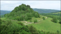
Easy walk along the Clémont cliff.
Viewpoints over Motte de Clémont and Liebvillers.
Access to a small, unusual cave.
Mont Écheroux
 5.29 mi
+633 ft
-633 ft
3h 00
Easy
Departure from Montécheroux (Doubs)
5.29 mi
+633 ft
-633 ft
3h 00
Easy
Departure from Montécheroux (Doubs)
Easy hike through pastures and undergrowth to the highest point that gave the village its name.
Wide views of the French-Swiss Jura mountain range, the site of Clémont and the Doubs valley.
Pass by the small monument to the Lomont maquis.
Walk to the viewpoints in Montbouton
 3.73 mi
+482 ft
-479 ft
2h 10
Easy
Departure from Montbouton (Territoire-de-Belfort)
3.73 mi
+482 ft
-479 ft
2h 10
Easy
Departure from Montbouton (Territoire-de-Belfort)
A superb hike in the south of the Belfort area in the foothills of the Jura. Exceptional views over the Bas Pays de Montbéliard and the southern Vosges mountains. You will also discover the charming village of Montbouton, 25 km from Belfort and 7 km from Audincourt.
This hike is signposted.
Sentier des Passeurs in Saint-Dizier-l'Évêque
 9.81 mi
+791 ft
-758 ft
5h 10
Moderate
Departure from Montbouton (Territoire-de-Belfort)
9.81 mi
+791 ft
-758 ft
5h 10
Moderate
Departure from Montbouton (Territoire-de-Belfort)
This is a very pleasant hike that alternates between forest and countryside landscapes. There are lovely views of the Swiss Jura and the Southern Vosges.
The paths you will take are steeped in history. In fact, you will be walking along the paths where smugglers accompanied fugitives during the Second World War.
The route is marked with a blue disc.
Circular route via “Chez le Bolé” to Goumois
 7.51 mi
+2,369 ft
-2,343 ft
5h 30
Difficult
Departure from Goumois (Canton du Jura) (Canton of Jura)
7.51 mi
+2,369 ft
-2,343 ft
5h 30
Difficult
Departure from Goumois (Canton du Jura) (Canton of Jura)
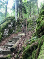
Circular hike starting from Goumois for a short but intense hike, mainly through woodland.
As you cross the bridge, look out for the Rocher du Singe on your left – it’s incredible.
The climb up to “Chez le Bolé” follows a challenging (but not dangerous) path – expect chains and ladders along the way!
Return via Muriaux, along lovely paths and some lovely, steep descents!
Château de la Roche
 6.59 mi
+1,598 ft
-1,572 ft
4h 25
Moderate
Departure from Saint-Hippolyte (Doubs) (Doubs)
6.59 mi
+1,598 ft
-1,572 ft
4h 25
Moderate
Departure from Saint-Hippolyte (Doubs) (Doubs)
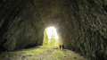
The route offers views of the Doubs Valley and ends with a descent to Saint-Hippolyte from La Chapelle du Mont, passing close to the site of the Château de la Roche.
Chez les Damas, from La Damassine to Pont Sarrazin
 3.00 mi
+492 ft
-505 ft
1h 50
Easy
Departure from Vandoncourt (Doubs)
3.00 mi
+492 ft
-505 ft
1h 50
Easy
Departure from Vandoncourt (Doubs)
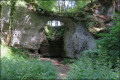
In Les Damas,the ‘village of 600 mayors’, you’re always welcomed with a smile and a warm hello.They suggest a lovely little walk through the village streets to discover their fountains, their listed natural site and a sweeping panorama of the village, the Pays de Montbéliard and the Vosges.
Route de découverte de Saint-Hippolyte
1.28 mi
+66 ft
-72 ft
0h 40
Easy
Departure from Saint-Hippolyte (Doubs) (Doubs)
Saint-Hippolyte is located at the confluence of the Doubs and Dessoubre rivers in Franche-Comté. It is a small, picturesque tourist village at the gateway to the Pays Horloger (Watchmaking Country). The setting is enchanting: surrounded by the Jura mountains, the Dessoubre to the west and the Doubs to the north. The narrow streets are picturesque and the buildings are examples of the architecture of the Pays Horloger. It is of course possible to combine this short route with another discovery in the region.
Les Roches du Château
 9.65 mi
+1,762 ft
-1,768 ft
6h 00
Moderate
Departure from Saint-Hippolyte (Doubs) (Doubs)
9.65 mi
+1,762 ft
-1,768 ft
6h 00
Moderate
Departure from Saint-Hippolyte (Doubs) (Doubs)
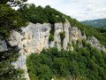
From the heart of Saint-Hyppolyte, nestled in the Revirot valley (where the Doubs and Dessoubre rivers meet), along its narrow streets lined with medieval houses, you will climb boldly towards the Chamesol plateau, a balcony overlooking the valley, to reach the viewpoint on the rocks and the vast cave where our ancestors built a castle that was unfortunately destroyed. Through beautiful forests and secret clearings, you will return via Soulce and its salt well, the Ursulines farm at the foot of the rocks and the tufa cave.
The Damassine
 3.21 mi
+299 ft
-292 ft
1h 45
Easy
Departure from Dasle (Doubs)
3.21 mi
+299 ft
-292 ft
1h 45
Easy
Departure from Dasle (Doubs)
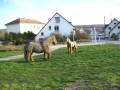
This short 1½-hour hike will take you to La Damassine in Vandoncourt. Enjoy superb views of the Vosges, the Salbert towards Belfort and the Lomont wind turbines. The route mostly follows marked paths.
The Arch Trail
 4.70 mi
+863 ft
-860 ft
2h 55
Moderate
Departure from Liebvillers (Doubs)
4.70 mi
+863 ft
-860 ft
2h 55
Moderate
Departure from Liebvillers (Doubs)
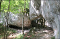
Geological and scenic hike offering numerous views of the Doubs valley and amazing natural sites to discover!
From Fort des Roches to Pont-de-Roide
 1.54 mi
+249 ft
-249 ft
0h 55
Easy
Departure from Pont-de-Roide (Doubs)
1.54 mi
+249 ft
-249 ft
0h 55
Easy
Departure from Pont-de-Roide (Doubs)
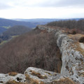
A lovely circular walk along the cliffs overlooking the Doubs valley. Breathtaking views and distant panoramas (you can see the Ballon d'Alsace 50 km to the north).
At the fort, the League for the Protection of Birds organises an annual monitoring of migratory birds.
This walk is best enjoyed in good weather for the exceptional views and the feeling of being in another world, far from the valley below.
The Châtillon loop, starting from Liebvillers
 3.35 mi
+525 ft
-525 ft
2h 00
Easy
Departure from Liebvillers (Doubs)
3.35 mi
+525 ft
-525 ft
2h 00
Easy
Departure from Liebvillers (Doubs)
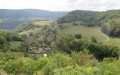
A short, peaceful and quiet walk, towards the heights of Liebvillers and from one viewpoint to another.
The route follows the village’s old paths and a pleasant ridge trail.
Well-marked paths but not signposted.
Caution is advised along the ridges and when approaching the promontories at the viewpoints.
Circular Three valleys in Lebetain
 6.98 mi
+925 ft
-909 ft
4h 00
Moderate
Departure from Lebetain (Territoire-de-Belfort)
6.98 mi
+925 ft
-909 ft
4h 00
Moderate
Departure from Lebetain (Territoire-de-Belfort)
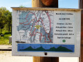
This superb hike allows you to discover the village of Lebetain and the surrounding valleys with their typical Jura landscape. The starting point is near the Swiss border, close to Delle, 25 km from Belfort via the expressway.
My favourite part: a very pretty section through the middle of a pasture in a narrow valley with a small stream and numerous little waterfalls. However, there is a fairly difficult section with a steep path for about 50 metres.
The hike is signposted
.
The Sentier des Bornes trail in Beaucourt
 Local authority
 4.41 mi
+653 ft
-679 ft
2h 35
4.41 mi
+653 ft
-679 ft
2h 35
 Extremely difficult
Departure from Beaucourt (Territoire-de-Belfort)
Extremely difficult
Departure from Beaucourt (Territoire-de-Belfort)
This idyllic, often shaded walk will take you past a myriad of carved stone boundary markers adorned with inscriptions from days gone by.The route is signposted.
Welcome to Beaucourt, following in the footsteps of Frédéric Japy
 4.51 mi
+531 ft
-525 ft
2h 30
Moderate
Departure from Beaucourt (Territoire-de-Belfort)
4.51 mi
+531 ft
-525 ft
2h 30
Moderate
Departure from Beaucourt (Territoire-de-Belfort)
Located 25 km from Belfort and 15 km from Montbéliard, Beaucourt is a town with a rich historical past.
This remarkable walk combines countryside scenery with the magnificent castles of the Japy era.
You’ll discover a beautiful forest, a garden with trees dating back several centuries, the former typewriter factory and a lovely, friendly town.
This walk is signposted.
The banks of the Doubs, Les Chapelles and the Corniche de Goumois viewpoint
 13.42 mi
+2,320 ft
-2,320 ft
8h 10
Difficult
Departure from Damprichard (Doubs)
13.42 mi
+2,320 ft
-2,320 ft
8h 10
Difficult
Departure from Damprichard (Doubs)
Set off to explore these magnificent trails, which are very pleasant along the River Doubs. The Leat d’Étoz and its Notre-Dame-des-Ermites Chapel, steeped in history and legend. Magnificent wooden sculptures in Urtière and its Saint-Roch Chapel. A walk through woodland, forest and meadows.
Bourguignon
 5.39 mi
+479 ft
-489 ft
2h 55
Easy
Departure from Bourguignon (Doubs)
5.39 mi
+479 ft
-489 ft
2h 55
Easy
Departure from Bourguignon (Doubs)
A sandpit, ponds, viewpoint over Bourguignon and the new power station.
Mandeure - Pont-de-Roide
 8.30 mi
+876 ft
-814 ft
4h 35
Moderate
Departure from Mandeure (Doubs)
8.30 mi
+876 ft
-814 ft
4h 35
Moderate
Departure from Mandeure (Doubs)
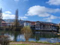
This stage is the first stage of the Grande Traversée du Jura (or GTJ). It is the easiest. It can be done in a morning and can be combined with the next stage, which goes to Saint-Hippolyte. Most of the route is through forest. The starting point is in Mandeure. A detour to the Gallo-Roman theatre allows you to start with a touch of history. After an hour's walk, the stage passes near the Mandeure viewpoint before continuing through the forest. There are a few open spaces, but they are rare. The descent to Pont-de-Roide is then short and quick.
The Yésotte Cave, the Bénéton Cross, the Pierre qui vire
 3.87 mi
+840 ft
-853 ft
2h 30
Moderate
Departure from Fleurey (Doubs)
3.87 mi
+840 ft
-853 ft
2h 30
Moderate
Departure from Fleurey (Doubs)
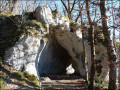
A ridge walk in the combe, with several geological features to discover and a wide view over the town of Saint-Hippolyte and the Doubs valley.
Côte de Champvermol in Mandeure
 5.69 mi
+594 ft
-584 ft
3h 10
Moderate
Departure from Mandeure (Doubs)
5.69 mi
+594 ft
-584 ft
3h 10
Moderate
Departure from Mandeure (Doubs)
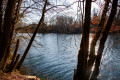
This short hike will take you to the Roman Theatre and the Mathay plain via a path with views over the Doubs and all the biodiversity associated with this coastline: dry and wet forests, cliffs, scree and ponds are home to many protected species. Play areas, picnic areas and facilities are dotted along the route.
Route around Fêche-l'Église
 6.90 mi
+682 ft
-712 ft
3h 45
Moderate
Departure from Fêche-l'Église (Territoire-de-Belfort)
6.90 mi
+682 ft
-712 ft
3h 45
Moderate
Departure from Fêche-l'Église (Territoire-de-Belfort)
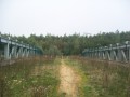
A superb, easy walk to do in spring, featuring a wash house and a view of the new customs post at Boncourt (Switzerland).
Tour du Bois Brûlé in Mathay
 5.63 mi
+846 ft
-817 ft
3h 20
Moderate
Departure from Mathay (Doubs)
5.63 mi
+846 ft
-817 ft
3h 20
Moderate
Departure from Mathay (Doubs)
Short walk around the Bois Brûlé in Mathay.
Pass through the hamlet of Lucelans with beautiful views of Ecot and the Pays de Montbéliard.
Discover the Ecot motocross track.
17 February 2023: problem starting from (2) ==> continue along the road and go directly to (4).
The Fêchoise Walk around Fêche-l'Église
 3.45 mi
+243 ft
-253 ft
1h 50
Easy
Departure from Fêche-l'Église (Territoire-de-Belfort)
3.45 mi
+243 ft
-253 ft
1h 50
Easy
Departure from Fêche-l'Église (Territoire-de-Belfort)
A short walk through fields and woodland, just a stone’s throw from Switzerland and about twenty kilometres from Belfort.
It will take you through lovely countryside and offer some very pretty views of the Jura and Fêche-l’Église.
.
The Enchanted Forest in Boncourt
 2.16 mi
+377 ft
-377 ft
1h 20
Easy
Departure from Boncourt (Canton du Jura) (Canton of Jura)
2.16 mi
+377 ft
-377 ft
1h 20
Easy
Departure from Boncourt (Canton du Jura) (Canton of Jura)
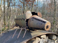
The ‘Enchanted Forest’ walk and the ‘Sentier des Faînes’ in Boncourt, a border village in the Swiss Jura, is a short walk through the forest featuring wooden sculptures depicting famous cartoon characters. A fun little walk to enjoy with the family.
The Smugglers’ Trail in Delle
 3.46 mi
+213 ft
-207 ft
1h 45
Easy
Departure from Delle (Territoire-de-Belfort)
3.46 mi
+213 ft
-207 ft
1h 45
Easy
Departure from Delle (Territoire-de-Belfort)
A lovely walk that takes you through the centres of Delle and Boncourt, with some very pretty old buildings.You’ll also walk through a forest with a stunning view.If you have a little time to spare, take a short detour to enjoy the tranquillity of the ‘Sentier des Faines’ and the ‘Enchanted Forest’.This walk is signposted.
Delle and the Mazarin Fountain in Fêche-l'Église
 10.83 mi
+860 ft
-853 ft
5h 45
Difficult
Departure from Delle (Territoire-de-Belfort)
10.83 mi
+860 ft
-853 ft
5h 45
Difficult
Departure from Delle (Territoire-de-Belfort)
A very beautiful walk that allows us to discover the historical heritage of the town of Delle, the surrounding countryside and also the superb Mazarin Fountain in Fêche-l'Église.
The route is marked with Yellow Rings.
Les Sommêtres via La Goule
 9.04 mi
+2,254 ft
-2,267 ft
6h 05
Moderate
Departure from Le Noirmont (Canton of Jura)
9.04 mi
+2,254 ft
-2,267 ft
6h 05
Moderate
Departure from Le Noirmont (Canton of Jura)
This is a challenging walk, best done in dry weather, with a steady climb followed by a fairly technical descent through undergrowth with roots and stones.
Nature lovers will be delighted by the Doubs valley and its banks, the views from the Roches des Sommêtres and the architecture of the churches and houses in the village of Le Noirmont.
Damprichard on the banks of the Doubs
 8.85 mi
+1,949 ft
-1,952 ft
5h 45
Moderate
Departure from Damprichard (Doubs)
8.85 mi
+1,949 ft
-1,952 ft
5h 45
Moderate
Departure from Damprichard (Doubs)
Views of the Chassera and the wind turbines in Switzerland, with the landscapes of the Haut Doubs.
Walk around the Étang de la Gruère
2.01 mi
+56 ft
-56 ft
1h 00
Easy
Departure from Saignelégier (Canton of Jura)
Situated at an altitude of 1,000 metres, the Étang de la Gruère was created as a result of peat extraction. Restored by the Jura government, this exceptional environment has become a nature reserve. Set amongst the magnificent pastoral landscapes of the Franches-Montagnes, the site offers a chance to escape into the very Scandinavian atmosphere of the pond and its surroundings. The route around the lake is extremely easy, and consists largely of a wooden boardwalk where you needn’t worry about mud.
Bambe Wood - La Prusse - Mathay
 6.02 mi
+420 ft
-430 ft
3h 10
Easy
Departure from Voujeaucourt (Doubs)
6.02 mi
+420 ft
-430 ft
3h 10
Easy
Departure from Voujeaucourt (Doubs)
A short walk with views of Voujeaucourt, Mathay, Mandeure and, at the end, the Côte Roux fun trail, which will delight young and old alike.
Mont-Miroir, Roche de Ruan, Faux Verger, starting from Maîche
11.86 mi
+1,834 ft
-1,821 ft
7h 05
Difficult
Departure from Maîche (Doubs)
From the centre of Maîche, head up via the Étang de la Goule to Mont Miroir and its ski lift, then continue to the Roche de Ruan viewpoint. Descend towards the town, then climb back up the hill to the Saint-Michel Chapel overlooking Maîche. Then head downhill, passing through the Château du Désert park, before following the Faux Verger circular route, and returning via La Lizerne and the Château de Mérode. This pleasant circular route offers numerous viewpoints, including the one at Faux Verger, which provides a truly 360° view of the surrounding landscape, from the Vosges to the Swiss Jura, and even as far as the Bernese Alps, weather permitting.
Route de découverte de Maîche
4.21 mi
+272 ft
-285 ft
2h 10
Easy
Departure from Maîche (Doubs)
This short circular route allows you to visit the small town of Maîche, located in the Pays Horloger (Watchmaking Country). This short walk allows you to see much of the town's heritage, such as the Church of Saint-Pierre, the Château du Désert and its park, and the Chapelle des Anges. The route also passes in front of the châteaux of Montalembert and Mérode, which are private properties. Finally, the hike ends with a botanical trail that winds its way through the Côteau Saint-Michel.
Rocher du Bourbet, Waroly caves and waterfalls from Maîche
10.97 mi
+1,555 ft
-1,529 ft
6h 25
Moderate
Departure from Maîche (Doubs)
Starting from Maîche, pass through Les Bréseux to see, in particular, its Comtois-style church with magnificent modern stained glass windows, then on to Rochet du Bourbet, a viewpoint over the Dessoubre valley and picnic area. Return via the QuatreGrottes de Waroly, the Waroly waterfalls and the hamlet of La Lizerne. Several interesting viewpoints: Rochet du Bourbet, on the way down to the Château de l'Ermitage, then on the way back up to the hamlet of La Lizerne, among others.
Mont Miroir
 4.93 mi
+853 ft
-863 ft
3h 00
Easy
Departure from Maîche (Doubs)
4.93 mi
+853 ft
-863 ft
3h 00
Easy
Departure from Maîche (Doubs)
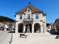
From Montalembert Castle, built by the Guyot de Malseigne family from 1574 onwards, you will climb to various viewpoints: the Notre-Dame des Anges Chapel at the top of the beautiful Saint-Simon hill; then the Roche de Ruan via paths lined with majestic fir trees, forming a guard of honour; the pastures of Mont Miroir and its concert of cowbells with its view of Lomont and the Saint-Hyppolite valley; and finally, the Mont Joie viewpoint overlooking the city and Saint-Pierre Church.
The Belvédère du Bourbet and the Waroly Waterfall
 7.18 mi
+1,388 ft
-1,401 ft
4h 30
Moderate
Departure from Mancenans-Lizerne (Doubs)
7.18 mi
+1,388 ft
-1,401 ft
4h 30
Moderate
Departure from Mancenans-Lizerne (Doubs)
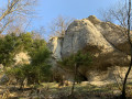
A picnic area with tables overlooks the Dessoubre valley at an altitude of nearly 750 metres. Old farms dating back to the 1960s cling to the mountainside. A wild valley where, perhaps, our Comtois Gauls performed their druidic rituals in sacred clearings. A natural rock known as the Devil's Castle overlooks the Waroly waterfall. Finally, caves carved out over centuries.
In the shadow of the Florimont towers
 3.66 mi
+161 ft
-148 ft
1h 50
Easy
Departure from Florimont (Territoire-de-Belfort)
3.66 mi
+161 ft
-148 ft
1h 50
Easy
Departure from Florimont (Territoire-de-Belfort)
A very pleasant walk to discover the village of Florimont and its surroundings in the lush countryside.
At the end, I suggest a short alternative route to reach the foot of the two towers.
Florimont is situated in the foothills of the Jura, 30 km from Belfort and a stone’s throw from Switzerland.
The route is marked with a Green Ring
Fort Lachaux par la face Sud
4.13 mi
+282 ft
-272 ft
2h 10
Easy
Departure from Sochaux (Doubs)
Hiking route starting from the Town Hall. It takes you to the beer museum; near Place de l'Europe, the Peugeot Adventure Museum, the temple and the Prince's house. Then the Citédo and the sports park. It leads you towards Fort Lachaux, where you can enjoy the scenery. Next, you will cross the undergrowth and an educational farm. On the way back, you will discover the church of Sochaux and the redesigned Avenue du Général Leclerc.
Around the Vendeline in Réchésy
2.52 mi
+144 ft
-141 ft
1h 15
Easy
Departure from Réchésy (Territoire-de-Belfort)
A short walk that allows you to discover the charming village of Réchésy, situated 24 km south-east of Belfort, very close to the Swiss border.You’ll discover its church, the old tramway, the River Vendeline, an old mill, beautiful half-timbered houses and the ‘Académie de Réchésy’.This walk is signposted.
The Sentier des Bornes in Rechesy
 10.15 mi
+797 ft
-791 ft
5h 20
Difficult
Departure from Réchésy (Territoire-de-Belfort)
10.15 mi
+797 ft
-791 ft
5h 20
Difficult
Departure from Réchésy (Territoire-de-Belfort)
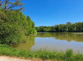
This long hike through fields and forests allows you to discover the peaceful Sundgau region of Belfort, walk along ponds and flirt with the Swiss Jura.
The trail is marked with a yellow ring.
Route de découverte de Montbéliard
 3.67 mi
+66 ft
-66 ft
2h 00
Easy
Departure from Montbéliard (Doubs)
3.67 mi
+66 ft
-66 ft
2h 00
Easy
Departure from Montbéliard (Doubs)
Located in Franche-Comté, the town of Montbéliard has a strong heritage. Its most famous site remains its castle. But there is also artistic and natural heritage, such as the Près-la-Rose. This route passes close to numerous museums, such as the Pavillon des Sciences and its workshop, as well as Montbéliard Castle. This walk also allows you to discover Saint-Martin’s Temple, Saint-Maimbœuf Church, and Saint-Georges Lutheran Church. Of course, before returning to the car, don’t hesitate to pick up the famous Montbéliard sausage.