The Fêchoise Walk around Fêche-l'Église

A short walk through fields and woodland, just a stone’s throw from Switzerland and about twenty kilometres from Belfort.
It will take you through lovely countryside and offer some very pretty views of the Jura and Fêche-l’Église.

.

Details

1675228
Creation:
Last update:
Last review:
  • Walking
    Activity: Walking
  • ↔
    Distance: 3.45 mi
  • ◔
    Average duration: 1h 50 
  • ▲
    Difficulty: Easy

  • ⚐
    Back to start: Yes
  • ↗
    Ascent: + 243 ft
  • ↘
    Descent: - 253 ft

  • ▲
    Highest point: 1,385 ft
  • ▼
    Lowest point: 1,161 ft

Photos

Description of the walk

Start from the car park at Fêche-l'Église church.
The route is signposted with a Red Ring.

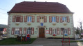
(S/E) Walk to Grande Rue and turn right onto it. Walk past the town hall.

(1) Turn right onto Rue de l’Abreuvoir and, 100 metres further on, turn right onto Rue des Cantons.

(2) Head slightly diagonally along Rue des Vosges. Continue straight on, crossing several streets, until you reach the Rayfold Forest.
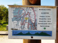
Pass the trail marking the historic boundary stones of the Principality of Montbéliard on your left. Head uphill through the forest, passing three forest tracks on your right.

(3) At the next junction, turn right. To avoid getting lost in this area, keep a close eye on the signposting, which is very clear. Carry on straight ahead.

(4) Cross the D36 road and carry on straight ahead.
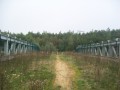
Turn right at the wildlife crossing overlooking the Belfort–Delle expressway (N1019) and follow the expressway for about 300 metres. Turn right and, at the D463, turn left.

(5) At the roundabout, cross the D463 with care. Be careful – cars travel fast and do not expect to see pedestrians.
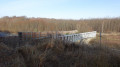
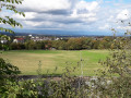
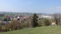
Take the first path on the right, then a few metres further on, turn right again at the hairpin bend. The stony path is in fact the old Route de Delle, which will take you across the fields to the top of the Côte des Greppes. There you’ll be treated to a panoramic view of the villages of Fêche-l’Église and Badevel.
Walk down Rue des Greppes, then along the Grande Rue.

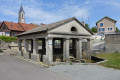
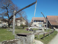
(6) Turn left onto Rue des Combes. Walk past the schools on your right. Turn right again at Impasse de la Fontaine. Admire the Mazarin Fountain. Climb the steps and return to the car park where you started (S/E).

Waypoints

  1. S/E : mi 0 - alt. 1,211 ft - Car park at the church in Fêche-l'Église
  2. 1 : mi 0.11 - alt. 1,181 ft - Rue de l’Abreuvoir
  3. 2 : mi 0.27 - alt. 1,211 ft - Rue des Vosges
  4. 3 : mi 0.85 - alt. 1,332 ft - Crossroads in the forest
  5. 4 : mi 1.12 - alt. 1,263 ft - Crossing the D36
  6. 5 : mi 2.15 - alt. 1,325 ft - Roundabout near the expressway
  7. 6 : mi 3.16 - alt. 1,194 ft - Rue des Combes
  8. S/E : mi 3.45 - alt. 1,211 ft - Car park at the church in Fêche-l'Église

Notes

The route starts at the car park by the church in Fêche-l'Église. It is situated almost directly opposite the town hall, at 16 Grande Rue, 90100 Fêche-l'Église.

The route is marked with a Red Ring.

Visorando was provided with this information by Mr Chevalley, a volunteer with Balisage90, based on leaflets published by the Sud Territoire community of communes.

Worth a visit

At the entrance to the Rayfold Forest, you’ll come across the trail marking the historic boundary stones of the Principality of Montbéliard. This is a multi-day hike that can be tackled in sections. It beautifully showcases the boundary stones that marked the borders of the Principality of Montbéliard before the Revolution.

Fêche-l’Église

The inhabitants are known as Fêchois. The name Fêche is thought to derive from ‘ficus’ or ‘fisca’, meaning ‘treasure’ or ‘property of the state or the church’.
The earliest recorded mention of the village dates from 1303. Until 1520, there was also a village called Fêche-Moulin, which has since been destroyed; it was situated between Fêche-l’Église and Badevel on the River Fêchotte.
In the second half of the 17th century, Gaspard de Barbaud, a Lutheran burgher from Héricourt and an ironmaster, decided to mine the iron ore that outcrops in ‘la Combe’, situated to the south of the commune. This ore, which takes the form of black pellets, is embedded in a clay matrix and must be washed with large volumes of water. To this end, the Mazarin Fountain was built at the Source du Breuil. The spring feeding it is the Fêche, a small stream which flows into the Feschotte at Badevel. The ore was then transported by cart to the blast furnaces at Châtenois-Les-Forges, to be smelted into pig iron, iron or steel.
This mine remained in operation until 1684. The mine shafts are now permanently sealed, but the Mazarin Fountain, a listed historic monument situated in the centre of the village, was restored in 1886. As you stroll through the fields of La Combe, you may still come across small black pellets coated in clay at the top of a molehill.
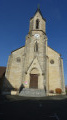
The neo-Gothic Saint-Valère Church, built in 1862, stands on the site of a 12th-century church destroyed by fire. Inside, visitors can admire a pulpit, a high altar and some fine artefacts.
Today, Fêche-l’Église is a village known for its charming Auberge du Tournedos and for a local charcuterie speciality, ‘la fêchoise’ – a delicious little smoked sausage.

Reviews and comments

3.8 / 5
Based on 4 reviews

Reliability of the description
4.3 / 5
Ease of following the route
4.5 / 5
Route interest
2.8 / 5
nici25
nici25

Overall rating : 3.3 / 5

Date of your route : Feb 12, 2026
Reliability of the description : ★★★☆☆ Average
Ease of following the route : ★★★★☆ Good
Route interest : ★★★☆☆ Average
Very busy route : No

A rather uninteresting route, especially the section running alongside the motorway before joining a busy road heading towards Switzerland – which you have to cross! The rest of the way, through the fields back to the village, is more pleasant.

Machine-translated

nicjy25
nicjy25
• Edited:

A short, easy walk of moderate interest, particularly the section running alongside the motorway and then crossing a very busy road (heading towards Switzerland) with the ground littered with rubbish... The return to the village is more peaceful, through meadows.
Completed in February 2026

Machine-translated

Praïa25
Praïa25

Overall rating : 4.3 / 5

Date of your route : Aug 16, 2025
Reliability of the description : ★★★★★ Very good
Ease of following the route : ★★★★★ Very good
Route interest : ★★★☆☆ Average
Very busy route : No

hike completed under a blazing sun and therefore shortened by us: we turned back at the "animal crossing" on the N19 and enjoyed the section through the woods on the way back

Machine-translated

Valérie90
Valérie90

Overall rating : 3 / 5

Date of your route : Sep 18, 2022
Reliability of the description : ★★★★☆ Good
Ease of following the route : ★★★★☆ Good
Route interest : ★☆☆☆☆ Very disappointing
Very busy route : No

A rather uninteresting walk, with long stretches along the roadside before points 5 and 6, on very busy roads.
We were very disappointed and do not recommend this route.

Machine-translated

Other walks in the area

For more walks, use our search engine .

The GPS track and description are the property of this route's author. Please do not copy them without permission.