Country:

 City:
City:


Start at the free car park at the “Les Bisons du Sachuron” farm on the Route de Roichenoz Damprichard.
(S/E) Walk down the road, past a small monument, then take the path leading uphill to the left towards the Belvédère du Kiosque, with a view over Damprichard. Then continue uphill towards “La Crête du Côtard”. You’ll come to a road; follow it to the left, taking care, until you reach the start of a path on the right
(1) Cross the road carefully and turn onto the path leading uphill to the right. About 150 metres further on, take the path leading uphill on your right; it is clearly signposted. Further up, at the crossroads, carry on straight ahead towards “La Crête”. (There is a sign pointing towards the trees). Stay on the main path, and at the next junction, carry on straight ahead towards “La Montée”, then keep left until the next junction.
(2) Turn left towards the house and leave it on your right. The path becomes a track until it reaches the road. Follow the road to the right for about a hundred metres and look out for the signs on your left to cross the field, heading towards “le sentier de Talus”.
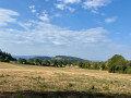
(3) Cross the fence via the designated gap (Canadian gate), then follow the hedge until you reach the next gap. Keep an eye out for the successive gaps in the distance as you continue until you reach the forest entrance. Carry on through the forest heading east; this section is quite wild, but the markings are clearly visible. You’ll come to a junction.
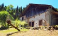
(4) Turn sharply right onto a path leading to the “Creux Gernet” farm. Look out for the slightly hidden passageway, near a small embankment on the right, then head down towards the farm, keeping close to the fence so as not to miss the passageway at the forest entrance on the right. Walk down to the road and you’ll arrive at a place known as “Sous Creux Gernet”.
(5) Cross the road carefully and continue towards “Sentier de Talus”. Please note: the signposting is less frequent on this section, so follow the track closely. Cross the field (do not go down it!) straight on to the trees, take the path that leads down and then keep to the right. The path becomes more clearly defined. You’ll reach a place called “Talus”; head down and take the path – the signposting becomes clearer here, and it’s a superb trail. You’ll come to a crossroads (elevation 587).
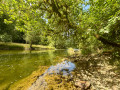
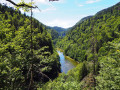
(6) Turn left towards “La Goule” onto a descending path which quickly reaches the left bank of the Doubs. Follow the Doubs to the next junction at the “Virage de la Verrerie” bend on the GR®5.
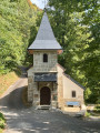
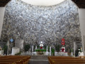
(7) Carry on to the left along this small, ascending road, towards “Le Bief d’Étoz”. Keep going straight on until you reach the Notre-Dame des Ermites Chapel. The door is always open; you are welcome to go inside.
(8) After your visit, leave the small road and take the path leading downhill towards “Goumois”, staying close to the riverbank on the GR®. As you come out of a left-hand bend, you’ll reach a Y-junction near a hut (which was open when I passed by, elevation 512).
(9) The path leaves the riverbank and heads left, climbing towards Valorielle. Continue along this path until it joins a forest track. Turn left onto this track, then right shortly afterwards to reach a tarmac section at a place called Valoreille.
(10) Carry on straight ahead until you reach the D437a road. Follow this carefully to reach the Goumois viewpoint and its Corniche at the end of a sharp left-hand bend.
(11) Continue carefully down this departmental road for about 1 km until you reach the junction – just after a slight left-hand bend – where the road meets a track that veers off to the left.
(12) Leave the D437a and head up to the left along this rather overgrown track; at the junction, continue uphill, then descend, keeping to the right, until you rejoin a road. Take care, and head up along this road.
(13) Look out for a small gap on the left, to ‘cut across’ the bend, through the fields. Rejoin the road and carry on to the left. Then, after about 150 m, before the farm, take the path leading uphill to the right, towards ‘Urtière’. At the next signpost, turn right onto the “Route d’Urtière” path, which climbs through the Grépi woods heading north-east. After a hairpin bend to the left, head south-west and leave the woods. Carry on straight ahead to see the old “Beurion” well, and join the D342 road (signposting is sparse).
(14) Turn left along the D342 to reach Urtière and its magnificent wooden sculptures, dotted around various spots. Stay on the D342 until you see the Saint-Roch Chapel on your left. See Practical Information.
(15) Turn left, go through the gate (which was open when I passed through) and enjoy the visit – it’s superb.
Walk through the village until you reach the road. Turn right, towards Damprichard. On leaving Urtière, cross the D342 with care, and continue straight ahead onto the forest track. A little further on, ignore the sign for ‘Le Chalet’ on your left; stay on the main track until you reach a junction at a left-hand bend.
(16) Turn left onto a footpath. It leads to The Buffalo Saloon Farm Inn; the signposting is clear. As you pass, take note of the bison in the meadows, then head to the car park (S/E).
 Visorando Member
 Moderate
 Easy
Easy