Walk around the Étang de la Gruère

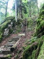
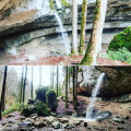
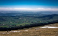
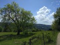
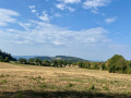
Situated at an altitude of 1,000 metres, the Étang de la Gruère was created as a result of peat extraction. Restored by the Jura government, this exceptional environment has become a nature reserve. Set amongst the magnificent pastoral landscapes of the Franches-Montagnes, the site offers a chance to escape into the very Scandinavian atmosphere of the pond and its surroundings. The route around the lake is extremely easy, and consists largely of a wooden boardwalk where you needn’t worry about mud.

Details

n°2189616
Creation:
Last update:
Last review:
  • Walking
    Activity: Walking
  • ↔
    Distance: 2.01 mi
  • ◔
    Average duration: 1h 00 
  • ▲
    Difficulty: Easy

  • ⚐
    Back to start: Yes
  • ↗
    Ascent: + 56 ft
  • ↘
    Descent: - 56 ft

  • ▲
    Highest point: 3,340 ft
  • ▼
    Lowest point: 3,274 ft

Description of the walk

The starting point is on the road between Saignelégier and Tramelan. You can park at the side of the road opposite a clearly recognisable sawmill (with logs and planks in stock). If this car park is full, see point (2) on the route for an alternative car park.

(S/E) From the car park – where you’ll be parked at right angles to the road – cross the road and take the path that leads straight ahead through the sawmill’s stock, to the left of the sheds.

(1) About 200 metres further on, you’ll reach the edge of the pond. From there, you can start your walk around the pond in either direction, as it forms a circular route. The route heads off to the right. The well-maintained path (this is Switzerland, after all!) will take you through woods and meadows amidst stunning scenery, and a large footbridge will take you across the marsh.

(2) This is another car park to use if the one at the sawmill is full. It is also the closest one when coming from Saignelégier. You can park here, cross the road at the junction and reach the pond by taking the Chemin de la Theure eastwards, past the farm gate. The pond trail begins 100 metres after the gate, on the right. The map shows the route between this car park and the pond.

Of course, once you’ve completed the circular path, return along the same path you took on the way there until you reach the sawmill (S/E) or (2), depending on where you’ve parked.

Waypoints

  1. S/E : mi 0 - alt. 3,284 ft - Sawmill car park
  2. 1 : mi 0.14 - alt. 3,287 ft - Walk around the pond
  3. 2 : mi 1.15 - alt. 3,340 ft - Alternative car park
  4. S/E : mi 2.01 - alt. 3,284 ft - Sawmill car park

Reviews and comments

5 / 5
Based on 1 review

Reliability of the description
5 / 5
Ease of following the route
5 / 5
Route interest
5 / 5
Racoleski
Racoleski
• Edited:

Overall rating : 5 / 5

Date of your route : May 22, 2023
Reliability of the description : ★★★★★ Very good
Ease of following the route : ★★★★★ Very good
Route interest : ★★★★★ Very good
Very busy route : Yes

Good footwear recommended. We are on peat and some parts are quite wet. We saw a lady duck and her 9 ducklings! Super cute. Parking costs CHF 4 for 2 hours and the Jura police are on the lookout! All car parks in the Jura have to be paid for.

Machine-translated

Other walks in the area

For more walks, use our search engine .

The GPS track and description are the property of this route's author. Please do not copy them without permission.