Around the Vendeline in Réchésy

A short walk that allows you to discover the charming village of Réchésy, situated 24 km south-east of Belfort, very close to the Swiss border.
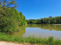
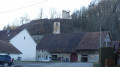
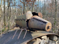
You’ll discover its church, the old tramway, the River Vendeline, an old mill, beautiful half-timbered houses and the ‘Académie de Réchésy’.
This walk is signposted.

Details

1609184
Creation:
Last update:
Last review:
  • Walking
    Activity: Walking
  • ↔
    Distance: 2.52 mi
  • ◔
    Average duration: 1h 15 
  • ▲
    Difficulty: Easy

  • ⚐
    Back to start: Yes
  • ↗
    Ascent: + 144 ft
  • ↘
    Descent: - 141 ft

  • ▲
    Highest point: 1,480 ft
  • ▼
    Lowest point: 1,322 ft

Description of the walk

The route starts at the car park by the community hall.
The trail is marked with a Red Ring.

(S/E) Head along the Route de Courcelles north-west towards the stadium. Turn right at the wayside cross and follow the old Tacot track to the River Vendeline. After the bridge, take a sharp right-hand turn and arrive in the village via the Route de Courtelevant.

(1) Continue to the right towards the village centre, pass through the Place de la Mairie and follow the Route de Pfetterhouse. 100 metres further on, turn right onto the Rue de l’Église and turn right again as you follow it.

(2) Walk up to the Church of Saint John the Baptist. The church houses the Verschneider organ, a listed historical monument dating from 1865.
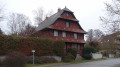
Walk along the south side of the church and turn left onto Rue de l’École. After 100m, turn left onto Rue sous les Haies and, 100m further on, turn right onto Rue des Boucheries. At the end of the street, turn right onto Route de Pfetterhouse and follow it for about 700m. Take a look at the beautiful half-timbered house with a balcony dating from the 17th century.

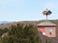
(3) Turn right onto Rue du Haut de la Côte, where you can admire the view of the village, as well as the Trouée de Belfort and the Vosges in the distance.
Head back down to the right along Rue de la Côte, then turn left onto Chemin de la Douane opposite the bakery. Below, you’ll see the Vendeline valley with the old mill, which was completely rebuilt following a fire.

(4) Turn right onto the Route de la Suisse (D13).
Pass Rue du Vieux Moulin on your left. Just after that, on the left, you’ll see an 18th-century house which served as the military intelligence office during the First World War and was known as ‘l’Académie de Réchésy’. Turn left at the next street. Continue to Rue de la Rivière, turn right and return to the centre of Réchésy.

(5) At the Route de Courcelles, turn left, walk past the last wash house along the Vendeline and the old lock on the diversion canal, and return to the starting car park (S/E).

Waypoints

  1. S/E : mi 0 - alt. 1,358 ft - Car park at the multi-purpose hall in Réchésy
  2. 1 : mi 0.54 - alt. 1,358 ft - Route de Courtelevant
  3. 2 : mi 0.74 - alt. 1,401 ft - Church of Saint John the Baptist
  4. 3 : mi 1.24 - alt. 1,434 ft - Rue du Haut de la Côte
  5. 4 : mi 1.75 - alt. 1,375 ft - Route de la Suisse D13
  6. 5 : mi 2.28 - alt. 1,342 ft - Route de Courcelles
  7. S/E : mi 2.52 - alt. 1,362 ft - Car park at the community hall in Réchésy

Notes

Starting point: car park at the multi-purpose hall in Réchésy, 24 km south-east of Belfort, located at Route de Courcelles, 90370 Réchésy.

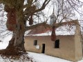
(1) Bonus: if you have a little time, do visit the cemetery chapel, which houses an 18th-century Baroque altarpiece. To do so, take the steps running alongside the cemetery.

Visorando was provided with information by Mr Chevalley, a volunteer member of Balisage90, based on leaflets published by the Sud Territoire community of communes.

Worth a visit

Réchésy
Situated 10 km east of Delle, through which the Vendeline river flows, on the edge of the Haut-Rhin department and on the border with Switzerland, Réchésy takes its name from the Old French ‘Rec’ (meaning ‘stream’) and ‘Chesal’ (meaning ‘house’).
The working population is employed in businesses in the region on both sides of the border. The six remaining farms preserve the village’s rural character.
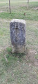
First mentioned in 1291, Réchésy is a village situated at the junction of three countries – France, Switzerland and Germany – symbolised by the “Borne des trois puissances” (Three Powers’ Boundary Stone), a legacy of the War of 1870.
Magnificent half-timbered houses bear witness to its affiliation with the Sundgau region. Strolling through the streets, visitors can discover the Church of Saint John the Baptist as well as the splendid 18th-century Baroque altarpiece in the cemetery chapel.

The Maison de l’Académie
On 14 September 1915, the President of the Republic, Raymond Poincaré, visited Réchésy at the house known as ‘the Academy’. It was, in fact, a military intelligence centre set up to monitor the German press and intercept enemy correspondence.
For further details, see the following link from France3 Bourgogne-Franche-Comté

Other walks in the area

For more walks, use our search engine .

The GPS track and description are the property of this route's author. Please do not copy them without permission.