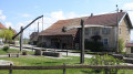
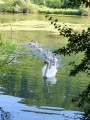
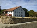
The source of the Doue

A peaceful, shaded walk with two routes of varying lengths and elevation gains available around Glay and Dannemarie.

Details

2215175
Creation:
Last update:
Last review:
  • Walking
    Activity: Walking
  • ↔
    Distance: 10.60 mi
  • ◔
    Average duration: 6h 10 
  • ▲
    Difficulty: Moderate

  • ⚐
    Back to start: Yes
  • ↗
    Ascent: + 1,460 ft
  • ↘
    Descent: - 1,434 ft

  • ▲
    Highest point: 1,965 ft
  • ▼
    Lowest point: 1,329 ft

Photos

Description of the walk

Parking is easy at the Source de la Doue car park; the route is signposted from Glay.

(S/E) Take the shaded path that runs alongside the forest and meadows and you’ll soon reach theGR®5junction.

(1) Take the path opposite, follow the edge of the forest and cross the stream via a small bridge to reach the junction with the Sentier de la Doue.

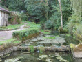
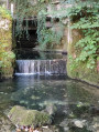
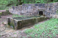
(2) Take the path on the right to reach this spring.

(3) Return to the previous junction.

(2) Turn right onto the GR®. Follow the stream again, then veer away from it to reach a junction in a clearing directly below the Coteau behind.

(4) Turn right, walk alongside the edge of the forest again at a short distance to reach a Y-junction.

(5) Take the path leading down to the right and join a quiet tarmac road.

(6) Turn right onto it and keep following it. You’ll come to a junction near a pumping station.

(7) Here, take the path on the left – be careful: it is partially hidden. Follow this main path, ignoring all side paths to the left or right. After a wide circular loop to the left, you’ll reach the hamlet of La Queudrotte. Here, you’ll rejoin the Historic Trail of the Boundary Stones of the Principality of Montbéliard.

(8) Turn right onto it, then turn right again a few hundred metres after passing the housing estate; rejoin the path further on.

(9) Pick it up again to reach boundary markers 375 and 378 very quickly.

(10) Pass boundary marker 378. Continue along the border via the GRP®. Leave the Historical Trail of the Boundary Markers of the Principality of Montbéliard on your right.

(11) At border marker 406, leave the border and turn right onto the road leading to the entrance to Dannemarie.

(12) Turn right onto the D247 with care, heading towards Glay. Continue to the bridge over the Doue.

(13) Do not cross the bridge but turn right, follow the banks of the Doue, then cross the river to return to the original junction.

(1) Turn left and follow the route taken on the way there to return to the Doue car park (S/E).

Waypoints

  1. S/E : mi 0 - alt. 1,385 ft - La Doue car park
  2. 1 : mi 0.15 - alt. 1,411 ft - Junction of the circular loop
  3. 2 : mi 0.48 - alt. 1,407 ft - Wooden gate, access to the source of the Doue
  4. 3 : mi 0.7 - alt. 1,457 ft - Source of the > - Doue (ruisseau) - Jura
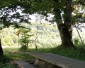
  5. 4 : mi 1.73 - alt. 1,824 ft - Clearing with a bench
  6. 5 : mi 2.25 - alt. 1,854 ft - Turn right at the fork
  7. 6 : mi 2.66 - alt. 1,847 ft - Access route to the resort
  8. 7 : mi 3.76 - alt. 1,542 ft - Pumping station
  9. 8 : mi 4.93 - alt. 1,923 ft - The old farm
  10. 9 : mi 5.86 - alt. 1,818 ft - The hut
  11. 10 : mi 6.28 - alt. 1,765 ft - Marker 378
  12. 11 : mi 7.77 - alt. 1,965 ft - Marker 406
  13. 12 : mi 8.95 - alt. 1,539 ft - Dannemarie
  14. 13 : mi 9.8 - alt. 1,329 ft - Crossroads by the bridge over the Doue
  15. S/E : mi 10.6 - alt. 1,385 ft - La Doue car park

Notes

Most of the walk is in the shade. As in many places in the region, the presence of ticks is no myth – check your legs from time to time and take a tick remover with you; it’s very handy and inexpensive, and it’s better to be safe than sorry.

Including a lunch break and travelling at an average speed of 4.5 km/h, it took us just over 4 hours.
There are no major difficulties apart from a fairly steep climb of about a hundred metres with a steep gradient.

Please note that the paths can be very slippery (stones, mud), so make sure you wear suitable walking shoes.
The trail can be tackled by mountain bike, but you’ll need to carry your bike over certain sections, and it’s more challenging.

Worth a visit

(Between 8 and 10) Look out for the signs put up by the Hérimoncourt walkers, who do a brilliant job of marking the route – many thanks to them.

Always be cautious and plan ahead when you're outdoors. Visorando and the author of this route cannot be held responsible for any accidents occurring on this route.

The GR® and PR® markings are the intellectual property of the Fédération Française de Randonnée Pédestre.

Reviews and comments

3.3 / 5
Based on 5 reviews

Reliability of the description
3 / 5
Ease of following the route
3.6 / 5
Route interest
3.4 / 5
lemarcheur65
lemarcheur65 ★
• Edited:

Hello luckyri, fredmotard
Did you reply when the pop-up window appeared by writing your comment?
https://sentinelles.sportsdenature.fr
This is useful: you just need to be specific when locating the place.
You can even attach files (photos).
Of course, you won’t get an immediate reply.
Thank you in advance

Machine-translated

fredmotard
fredmotard

Yes, I was surprised that the Herimoncourt club was so negligent when it came to signposting; I’d taken a group from Belfort on a similar walk. Very disappointed with the signposting
I won’t be recommending this walk.
Kind regards
Mr Oubre

Machine-translated

luckyri
luckyri
• Edited:

I’m sorry you didn’t enjoy the walk.
I no longer live in the area.
Since I created it five years ago, the landscape has inevitably changed 😐

Machine-translated

fredmotard
fredmotard

Overall rating : 1.3 / 5

Date of your route : Jul 01, 2024
Reliability of the description : ★★☆☆☆ Disappointing
Ease of following the route : ★☆☆☆☆ Very disappointing
Route interest : ★☆☆☆☆ Very disappointing
Very busy route : No

Hello – this is a walk to avoid: very poorly signposted, very poorly maintained, with sections where you have to make your way through brambles, and once again, the signposting is non-existent.

Machine-translated

Colbert61
Colbert61

Overall rating : 3.3 / 5

Date of your route : Jun 06, 2024
Reliability of the description : ★★★☆☆ Average
Ease of following the route : ★★★☆☆ Average
Route interest : ★★★★☆ Good
Very busy route : No

We lost the path between points 9 and 10, despite following the GPS and the signposts. It’s overgrown with brambles, stinging nettles and tall grass, particularly where the hay hasn’t been cut. So we took a detour via Switzerland.
Perhaps worth trying again later in the season, as the source of the Doue is a lovely spot and the clearings are inviting.

Machine-translated

Jean-Marc R
Jean-Marc R

Overall rating : 4.3 / 5

Date of your route : Jul 02, 2022
Reliability of the description : ★★★★☆ Good
Ease of following the route : ★★★★★ Very good
Route interest : ★★★★☆ Good
Very busy route : No

A lovely walk. 90 per cent of the route is in the shade.
Pleasant in hot weather.
It’s a shame that the last part is on tarmac.

Machine-translated

juju2583
juju2583

Overall rating : 4.5 / 5

Date of your route : Nov 01, 2021
Reliability of the description : Not used / Not applicable
Ease of following the route : ★★★★★ Very good
Route interest : ★★★★☆ Good
Very busy route : Yes

A lovely walk around the source of the Doue; please note that this walk is not suitable for beginners without any fitness training, as the distance combined with the numerous steep inclines makes it quite a challenging hike.
I really enjoyed the variety of scenery along this route in autumn (woodland, meadows and the various viewpoints); it’s a route that flows well despite some slippery sections, some good climbs, and quite a few fallen trees along the way (a bit of work for the Hérimoncourtoise walking group!).
I didn’t use the route description but just the GPX track, which, I must say, is very well put together.
One slight downside: the final stretch on the road spoils the idyllic feel of this ride a little, though I can understand that, given the fatigue, the person who designed this route might have wanted to shorten it.
To conclude, I have very fond memories of it, and I’d recommend this walk (provided, of course, you’ve done a bit of training).

Machine-translated

Tchaiky
Tchaiky

Overall rating : 3.7 / 5

Date of your route : Aug 24, 2020
Reliability of the description : ★★★☆☆ Average
Ease of following the route : ★★★★☆ Good
Route interest : ★★★★☆ Good
Very busy route : No

The route is pleasant and shaded, and the source of the Doue is very pretty. The only downside is the D247, which you follow for quite a while towards the end.
However, the route description is brief and could do with more detail. A map or the Visorando app on a smartphone is essential to find your way! I got lost between points 8 and 10: the path and the boundary markers were hidden by tall grass. Between points 10 and 11, it would have been helpful to mention that you need to head towards Villars-lès-Blamont (which is well signposted).
At point 11, you do not leave the border at marker 406, but at marker 405. However, the path you need to take is blocked by a padlocked gate (private property at the end of the path). I had to crawl under the barbed wire to reach the path leading to Dannemarie.

Machine-translated

Other walks in the area

For more walks, use our search engine .

The GPS track and description are the property of this route's author. Please do not copy them without permission.