Country:
 City:
City:



Park at the Les Pins Cemetery car park, Chemin des Fossés, Beaucourt.
This walk is signposted with a Red Ring.
(S/E) Walk to the far end of the car park, where an information board provides details of this walk.
Just after the sign, turn right and follow the path running alongside Chemin Trépoux. As you emerge from the woods, walk along the left-hand side of the stadium, then, staying on the ‘ridge’, pass between the two sports facilities. Join Rue de la Carrière (Champ de Mars) and follow it to the left. Cross the D57 – take care – and climb up the Grammont.
Ignore one path on the right and one on the left. A sign indicates the summit at an altitude of 57m; turn right at this sign. Descend the path, which has around fifty steps (be careful, it’s slippery in wet weather).
At the bottom of the steps, a short 50-metre detour to the left takes you to a superb shelter. Then continue along the path which descends more gently.
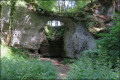
(1) At this junction, note the hollow in the limestone. The limestone has collapsed: this is a sinkhole. At this point, turn right
(2) After 150 metres, look out for the signpost to take the path on the left.
Shortly afterwards, a sign suggests a short 150m detour to admire the view from the Charme picnic area, which offers a view of the town, its heritage and the peaks of the Vosges.
(3) Retrace your steps and continue along the path to the right, following the signposts. Turn right to reach the Montbouton–Beaucourt junction. Cross the D39 – take care – and head right towards Beaucourt. After 100 metres, take the path on the left.
At the entrance to the village, before the first houses, take the path to the left and then to the right. You’ll arrive at the Grands Champs housing estate via Allée du Grammont. An information board indicates the location of Koechlin Castle, built around 1810 and destroyed in 1970 in a fire.
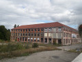
Head straight down the bridle path, which leads to the former Fonteneilles factory, now an old building with broken windows. About 200 metres further on, on the right, is the Frédéric-Japy Museum.
(4) Turn left into Rue Frédéric Japy (D40). On your left is Bornèque-Warnery Castle and, 100 metres further on, the magnificent lodge of the caretaker of Monsieur Jules’s castle.
Retrace your steps and enter the municipal park through the Cuvier gate. Admire the trees, many of which are several centuries old, particularly the majestic cedars.
(5) As you continue along the Allée des Tilleuls, there’s a viewpoint overlooking the Lomont mountain range. Nearby is Château Fernand, which is currently home to a restaurant. Leave the park via the Frédéric Japy gate.
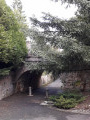
(6) Cross the Pont des Soupirs, turn right immediately afterwards and then right again to pass under the bridge. 100 metres further on, admire Château Edouard on your left.
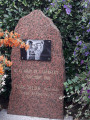
(7) Cross Rue des Déportés and follow Passage Salengro opposite. On your left is the Fontaine du Loup. On your right, you can see Allée du Souvenir Français, where the P. Sellier memorial stone stands. Near the Town Hall, you’ll notice the Coq Japy, the Salengro Music School and, opposite, the Georges Brassens Hall. Cross Place Salengro by first turning right then left, then turn right onto Rue Alfred Pechin.
(8) Then head up the Passage Châtelot on the right and, opposite, slightly set back to the right, the Impasse des Combasles.
Cross Rue P. Beucler and follow Rue des Vertillots straight ahead, then turn right onto Rue du Rosier d’Amour. Turn left onto Rue Maréchal de Lattre de Tassigny. After a right-hand bend, the road becomes a path through the countryside (Chemin des Charmottes).
Carry on straight ahead to reach the cemetery and the starting point (S/E).


 Local authority
 Extremely difficult
 Visorando Member

 Easy
Easy