Country:

 City:
City:


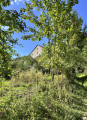
The starting point is in Soulce-Cernay. You should park your car near the bridge over the Doubs, either on the church side (depending on your chosen route) or on the other side, to the left after the bridge, where there is a small car park available for everyone.
(S/E) Return to the departmental road, cross at the pedestrian crossing and go over the bridge spanning the River Doubs.
(1) Turn left onto Rue de la Saulnerie to follow the Doubs along its right bank; this is also the route of the GR®5: marked with red and white signs.
(2) Walk through the hamlet of La Saunerie, then begin the climb, staying on the road. At the last house on the right, after the beehives, cross a stream via a small wooden bridge. You’ll reach La Grosse Roche, near a ruined house visible on the left.
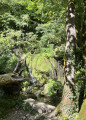
(3) Take the path on the right, leaving the GR®, which heads off to the left, to follow the GR® de Pays Monts du Lomont; marked in yellow and red. The path crosses a field where you need to pay a little attention so as not to miss the path that climbs up to the left towards the forest. Carry on until you see the waterfall on the left. Don’t hesitate to take a short detour towards the waterfall to get a better view
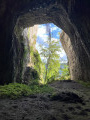
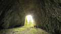
(4) Retrace your steps and resume the walk to the left for about 150 metres. Stay focused, as the path on the left leading up to the cave is not signposted; you’ll need to spot the track that winds steeply upwards in tight hairpin bends and leads to the cave.It’s easy to see why it’s called a ‘castle’, as the remains of ancient fortifications are still visible on the ground. To venture deeper into the cave, you’ll need a torch: a mobile phone torch isn’t powerful enough.
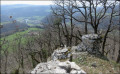
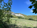
(5) Before beginning the descent, as you leave the cave, follow the path on the left which leads to a viewpoint overlooking the cliffs.
(6) Return to the cave, then to the path that forms part of the GR® de Pays: be careful, the descent is difficult. Resume the route by heading left. At the first junction, carry on straight ahead, leaving a path on your left, and join a road at a place called Les Côtes: there is a stable on the left.
(7) Head down to the right. Pass the hairpin bend and carry on straight ahead to reach the bridge over the Doubs.
(1) Cross the bridge again and return to the car park in front of the church (S/E).
 Visorando Member

 Easy
Easy 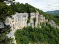
 Difficult