


Refine your search for walks in Martigny-Combe
Martigny-Combe walks
 7th stage of the Tour du Mont Blanc (TMB)
 Visorando Member
 8.88 mi
 +3,461 ft
 -4,012 ft
 7h 05
 Moderate
 Departure from Valais
7th stage of the TMB: from Forclaz pass to Montroc
Along the Bisse du Trient
 4.16 mi
+1,667 ft
-1,690 ft
3h 20
 Easy
Departure from Valais
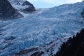
Starting from Col de la Forclaz (1527m), a short and easy out-and-back walk along the Bisse du Trient (irrigation channel) to the Chalet du Glacier (1583m), which offers a fine view of the Glacier du Trient and the Petite Pointe d'Orny (3187m).
⚠️ Part of the trail has been damaged by a landslide. Bypassing is possible, but the walk is not accessible for baby carriages and wheelchairs (see practical info).
Trient to Tré-le-Champ - Tour Monte Blanc
 Association / Club / Walk leader8.54 mi
+3,760 ft
-3,392 ft
7h 10
 Difficult
Departure from Valais
This 9th stage of the Tour Mont Blanc (TMB) offers three options, the North-West one that climbs up almost to the summit of Carraye (t 2,132m) and drops down to Valorcine, the South-West past Col de Balme (at 2,191m) then drops to Le Tour or the middle option that goes over Col de Balme and Aiguilette des Posettes (at 2,210m) to drop down to Tré-le-Champ. Here's the description of the classic middle option. Let's do it!The TMB is a classic long-distance footpath that goes around Mont Blanc, passing from France into Italy and through Switzerland before returning to France.
Trient – Finhaut
9.04 mi
+3,875 ft
-3,973 ft
7h 30
Difficult
Departure from Valais
This fourth stage will take you from Trient to the village of Finhaut. The route begins with a challenging climb to the Pas des Moutons, which offers a view of the Trient Glacier. The ascent continues to the Alpe de Catogne, from where the Emosson Dam is clearly visible. A long descent leads to Le Chatelard. As there is no accommodation in Le Chatelard or at the Emosson Dam, the final section of the route leaves the Chemin des Cols Alpin to reach the village of Finhaut.
Tête Noire
1.88 mi
+1,404 ft
-1,434 ft
2h 05
Moderate
Departure from Valais
Short loop to visit the Grotte aux Nymphes.
Well-equipped and mainly shaded trail.
The descent to the Grotte aux Nymphes is steep. The climb back up is gentler. You can do this hike in the opposite direction if you prefer a slow descent and a steep climb.
Please note: in summer 2025, the Grotte aux Nymphes was not accessible due to construction work.
Finhaut – Cabane du Vieux Emosson
6.52 mi
+4,045 ft
-1,024 ft
6h 30
Difficult
Departure from Finhaut (Valais)
This fifth stage will take you from Finhaut to the Cabane du Vieux Emosson. From Finhaut, the route follows the small road to Giétroz to rejoin the Chemin des Cols Alpins. From Giétroz, a fairly steep climb leads to the Col de la Gueulaz. The route continues with a descent to the Emosson Dam, which offers a magnificent panoramic view of the Mont Blanc massif. The stage ends at Vieux Emosson, following a geological trail in the footsteps of the dinosaurs.
Circular Marecot from Salvan
 2.15 mi
+623 ft
-604 ft
1h 30
Easy
Departure from Salvan (Valais)
A circular route around Salvan, passing through Le Marecot.
Follow the route with the Visorando app
Salvan - Auberge de Salanfe
 5.21 mi
+3,504 ft
-646 ft
5h 25
Difficult
Departure from Salvan (Valais)
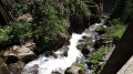
From the hamlet of Les Granges to Van d’en Bas, you’ll make your way up through the Dailley Gorges via daring structures, footbridges, tunnels and vertiginous staircases. The Salanfe river cascades down the steep gorges in a series of terraces. The view is breathtaking. You’ll enjoy numerous vantage points overlooking the Alpine peaks.You’ll cross the magnificent Vallon de Van. In the evening in Salanfe, you’ll already be able to admire the Dents du Midi standing out against the backdrop of the lake
Tour of the Dents du Midi and Petits Perrons
 47.88 mi
+21,716 ft
-21,296 ft
7 days
Difficult
Departure from Salvan (Valais)
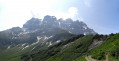
Starting in Salvan and finishing in Les Marécottes (VS, Switzerland), this hike is almost circular. The route combines several circuits. In the Val de Trient, you’ll discover the Dailley Gorges and the Vallon de Van.You will complete the entire Tour des Dents du Midi and enjoy this magnificent mountain range as well as the Sauflaz Gorges.You’ll make a short detour onto the Tour des Dents Blanches, which you can admire from the Barme plateau.
Le Luisin from La Creusaz
3.80 mi
+3,051 ft
-3,041 ft
4h 25
Difficult
Departure from Salvan (Valais)
Less frequented than the Haute Cime opposite, the Luisin is a superb viewpoint and a lovely hiking destination in a high mountain setting. This hike offers an original approach to this beautiful summit, starting from high up in a wild setting.
Champex-Lac to Trient -Tour Mont Blanc
8.96 mi
+2,953 ft
-3,461 ft
6h 40
Difficult
Departure from Orsières (Valais)
This 8th stage of the Tour Mont Blanc (TMB) offers two options, the tough one via Fenetre D'Arpette and the somewhat easier option over Porte à l'Ô. Here's the second version, past Plan de L' au, over Alpage de Bovine and Porte à l'Ô, past the Col de la Forclaz to drop down to Trient. Let's do it!
The TMB is a classic long-distance footpath that goes around Mont Blanc, passing from France into Italy and through Switzerland before returning to France.
A circular walk through the Dailley Gorges starting from Les Granges
 2.60 mi
+1,263 ft
-1,260 ft
2h 20
Moderate
Departure from Salvan (Valais)
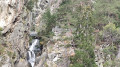
This is a short but picturesque walk. You’ll climb 656 steps alongside a waterfall, using several wooden staircases of excellent quality. You’ll then pass through a charming little valley before descending much more gently back to the starting point.
Col de Balme - Champex-Lac
 10.94 mi
+4,327 ft
-6,673 ft
8h 50
 Very difficult
Departure from Haute-Savoie
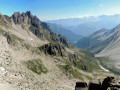
This second stage begins with a pleasant trail towards the "Des Grands" mountain pasture. Once you reach this chalet, the trail descends to the torrent, which you must cross at the Chalet du Glacier (1583 m). The view of the nearby Trient Glacier is magnificent. The long climb to the Fenêtre d'Arpette begins just after the Chalet Buvette. The landscape is chaotic at the pass and in the Arpette valley. The landscape becomes greener again from the Arpette refuge. The path then follows a bisse (irrigation channel) to Champex.
Champex to Cabane d'Orny and return via La Breya summit and ski lift.
 7.85 mi
+5,551 ft
-3,284 ft
8h 25
Difficult
Departure from Orsières (Valais)
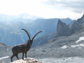
A circular walk from Champex Lac; ascending the tranquil and beautiful Combe d'Orny and joining the path to the Cabane d'Orny where there are refreshments available. The descent is via the path back to the La Breya ski lift taking in an optional ascent of La Breya. (It is also possible to descend by foot via the Val d' Arpette or from the ski lift, similarly the walk can be shortened and height gain reduced by taking the ski lift up.)
Champex to Cabane d'Orny via the Col de la Breya.
 7.01 mi
+5,509 ft
-3,251 ft
8h 00
Difficult
Departure from Orsières (Valais)
A circular walk from Champex Lac; ascending via the Bisses to the Arpette valley and then taking the path uphill through forest to the Col de la Breya. Then descending and joining the path to the Cabane d'Orny (refreshments available). The descent is via the path back to the La Breya chair lift taking in an optional ascent of La Breya.
6th stage of the Tour du Mont Blanc (TMB)
 7.75 mi
+4,652 ft
-4,564 ft
7h 35
Difficult
Departure from Orsières (Valais)
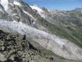
6th stage of the Mont Blanc tour: from the Relais d'Arpette to the Forclaz Pass via la Fenêtre d'Arpette.
Col de Balme - Source de l'Arve - Col des Posettes from Le Tour
2.88 mi
+82 ft
-1,204 ft
1h 25
Easy
Departure from Chamonix-Mont-Blanc (Haute-Savoie)
A short summer hike with exceptional panoramic views over the Chamonix valley and its massifs. There are several ways to approach it from Le Tour: the one shown is from the East, using the Charamillon cable car and the Autannes chairlift. The return journey is via the Charamillon cable car.
Refuge Albert 1er - Glacier du Tour
 5.15 mi
+1,939 ft
-3,048 ft
4h 05
Moderate
Departure from Chamonix-Mont-Blanc (Haute-Savoie)
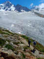
Located above the Tour glacier, on its right bank, it is the only refuge managed by the Chamonix CAF that can be reached without crossing a glacier in summer. Its location is ideal, with views over a wide range of peaks: Aiguille du Tour, Chardonnet, Aiguille d'Argentière, la Verte and les Drus, les Aiguilles Rouges. It was named after Albert 1st, King of the Belgians. Considered the only high-mountain refuge accessible to families.
The Emosson lakes in the footsteps of the dinosaurs
 14.03 mi
+5,886 ft
-5,869 ft
12 hrs
Very difficult
Departure from Vallorcine (Haute-Savoie)
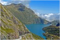
A superb circular French-Swiss for experienced walkers.The beauty of the landscapes in absolute silence will make you forget everything.Add to that a leap back in time several million years and you'll feel like you're walking on air.
⚠️ 16/12/2025: closure of a section of the Barberine forest (between (S/E) and (1)). See decree. Detour possible.
Loop between the lakes of Emosson and Salanfe.
 17.42 mi
+9,701 ft
-9,688 ft
2 days
Difficult
Departure from Finhaut (Valais)
Lac de Salanfe is located in a large cirque, which is most easily accessed from the east via the Vallon de Van d'En Haut. From the Emosson dam, two passes offer access to this magnificent lake.
In a high mountain setting, you can admire the Ruan massif to the south-west and the Dents du Midi massif to the north-west. During these two days, you will cross the Barberine, Emaney and Fenestral passes.
Emosson Dam - Auberge de Salanfe
 8.25 mi
+4,167 ft
-4,711 ft
7h 25
Difficult
Departure from Finhaut (Valais)
For this first stage, after skirting Lake Emosson opposite the Mont Ruan massif, the Col de Barberine and Col d'Emaney passes will take you to the shores of Lake Salanfe. You will appreciate the contrast between the Ruan massif and the Dents du Midi massif.
Le Cheval Blanc on the French-Swiss border
9.63 mi
+4,587 ft
-4,583 ft
8h 25
Difficult
Departure from Finhaut (Valais)
A truly beautiful walk along the French-Swiss border, set in magnificent scenery, between large lakes and mountains, with varied landscapes along the route. The presence of fossilised dinosaur footprints along the path adds an extra element of interest to this walk. Finally, a sublime 360° view, including Mont Blanc, the Matterhorn and the Grand Combin, awaits us at the summit of the Cheval Blanc.
Sentier du Bisse
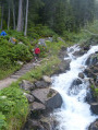 2.55 mi
+525 ft
-522 ft
1h 40
Easy
Departure from Orsières (Valais)
A short and easy walk from Champex Lac, taking the well signposted and good paths beside the Bisse. These are the water channels made to control and route the flow of water for irrigation purposes. The path returns to Champex via part of the Tour du Mont Blanc (TMB) path.
Le Belvedere
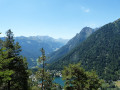 4.53 mi
+2,110 ft
-2,093 ft
3h 55
Moderate
Departure from Orsières (Valais)
This is a variation on the Sentier Le Belvedere walk which is described in the Pays du St-Bernard tourist booklet.
Ascending journey to the heights of Vallorcine
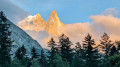 5.59 mi
+961 ft
-2,986 ft
3h 25
Difficult
Departure from Finhaut (Valais)
An easy hike overlooking the Trient and Vallorcine valleys, with superb views of the surrounding mountains such as the Mont Blanc massif and the 4,000-metre peaks of Valais. Caution for those prone to vertigo or fear of heights: there is a section with handrails, which is not dangerous but requires particular attention
Pointe d'Orny : out and return from the La Breya ski lift.
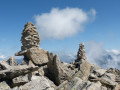 8.35 mi
+4,577 ft
-4,564 ft
7h 50
Difficult
Departure from Orsières (Valais)
An ascent of an easy alpine peak starting from the La Breya ski lift and via the Orny and Trient mountain huts. Superb views over the Trient Plateau.
Champex - Trient
 10.17 mi
+3,022 ft
-3,573 ft
7h 20
Moderate
Departure from Orsières (Valais)
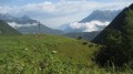
stage 7 of the Tour du Mont Blanc from Champex (Switzerland) to Trient via the Col de la Forclaz.
The Pierre Avoi from the Col des Planches
 12.93 mi
+4,957 ft
-4,948 ft
10h 15
Difficult
Departure from Vollèges (Valais)
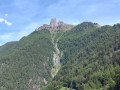
Pierre Avoi is the local dialect term for ‘rock worth seeing’: that certainly makes you want to go there! It is an isolated rocky peak on the Verbier ridge, making it an iconic summit. The route suggested here, starting from the Col des Planches, is a slightly less busy alternative to the one from Verbier or Savoleyres.
Col des Planches - La Tzoumaz
 8.55 mi
+3,048 ft
-2,720 ft
6h 35
Difficult
Departure from Vollèges (Valais)
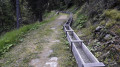
During this first stage, you will discover part of the Old Saxon Bisse (the longest of the bisse: 26 km from its water source in Siviez to La Boveresse). The bisse starts at the point (6). Built in the 1850s, the pipes no longer exist, so you will have to wait until you reach La Tzoumaz to finally see water flowing along the path. The bisse is currently being restored in sections.
From Col des Planches to Grimentz via the bisses trail
 62.19 mi
+17,077 ft
-16,499 ft
6 days
Difficult
Departure from Vollèges (Valais)
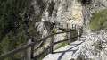
The word ‘bisse’ is used in Valais to refer to an irrigation channel carrying water from the mountains to farmland. They may be buried underground, carved into the rock or suspended from cliffs. Some bisses date back over 500 years and their channels have deteriorated or even ceased to exist following rockfalls. Water is therefore not available everywhere, despite efforts to restore this precious heritage.Over the course of six days, you will explore these trails steeped in history.
Vernayaz – Le Trétien via the Route des Diligences
 5.90 mi
+2,936 ft
-981 ft
5h 15
Moderate
Departure from Vernayaz (Valais)
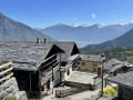
This beautiful route follows part of the “Route des Diligences”, which, in themid-19th century, alongside the arrival of the railway, led to the boom in tourism in the Trient Valley. The hike also offers the chance to admire the historic chalets in the villages of Les Granges, Les Marécottes and Le Trétien.Accessible by public transport.
Vernayaz Waterfalls Circular Path
 11.65 mi
+5,085 ft
-5,072 ft
9h 45
Very difficult
Departure from Vernayaz (Valais)
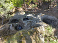
This route, starting from Vernayaz, takes in some of the most iconic sites from the early days of tourism in Valais: the Route des Diligences, the Dailley Gorges and the Pissevache Waterfall. To complete a circular route, take a lovely balcony path beneath the Dent du Salentin. This allows you to enjoy the spectacular route through the Dailley Gorges as part of a day’s walk, rather than just a return trip from the car park.
A circular walk from Van d’en Bas to Sex des Granges and Lake Salanfe
 9.98 mi
+5,784 ft
-5,758 ft
9h 35
Very difficult
Departure from Salvan (Valais)
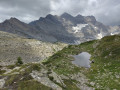
Le Sex des Granges (2,082 m) is the first peak on the ridges surrounding Lake Salanfe. This circular walk takes you along the ridges, offering superb views, as well as a stroll along the lakeshore.
Champex-Lac - Liddes
 7.28 mi
+1,923 ft
-2,441 ft
5h 00
Moderate
Departure from Orsières (Valais)
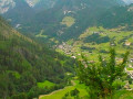
This third stage is fairly short and relaxing. It allows you to enjoy Champex and its lake a little longer. After the village of Orsières, you will follow a forest path on the left bank of the Dranse d'Entremont, then on its right bank before climbing up to the village of Liddes.
Champex – Trient
10.29 mi
+2,844 ft
-3,507 ft
7h 15
Difficult
Departure from Orsières (Valais)
This third stage will take you from Champex-Lac to Trient. The start of the route passes through a beautiful forest before beginning to climb from Plan d’en Haut. The ascent becomes steeper after passing Durnand de la Jure, leading to Alpe de Bovine and then on to Col de Portalo or Porte à l’Ô. A good path descends towards Col de la Forclaz, then on to the village of Trient
This stage is also part of the TMB ‘Tour du Mont Blanc’.
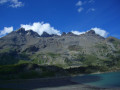
Susanfe Pass and the Salanfe Lake circuit
 11.55 mi
+6,831 ft
-6,831 ft
11h 15
Difficult
Departure from Salvan (Valais)
The Salanfe valley allows you to immerse yourself in the heart of the Dents du Midi massif. Whilst the ascent to Lac de Salanfe is a walk accessible to all, its extension to the Col de Susanfe is more alpine in character but well-marked and signposted, offering more sweeping views. The suggested descent, which is less frequented but ultimately easier, offers a variety of views over the Salanfe Lake basin as it winds its way round it.
Le Luisin from Van d'en Haut
9.79 mi
+6,499 ft
-6,480 ft
7 hrs
Very difficult
Departure from Salvan (Valais)
Less frequented than the Haute Cime opposite, the Luisin is a superb viewpoint and a lovely hiking destination in a high mountain setting. This long and demanding hike undoubtedly offers the easiest route to this beautiful summit.
N.B. The elevation gain shown is overestimated: allow for around 1,400 m.
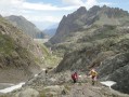
Funicular, trains, dam, dinosaurs, La Terrasse, La Loriaz
 11.86 mi
+5,827 ft
-5,804 ft
10h 30
Difficult
Departure from Vallorcine (Haute-Savoie)
A very varied and interesting hike. First, four modes of transport: a train, a very impressive funicular, a narrow-gauge railway winding through the mountains, and a small cable car. The rest is on foot: a visit to the Émosson Dam, a beautiful alpine hike taking in the highly intriguing dinosaur tracks. Stunning views of Mont Blanc and its glaciers from the Col de la Terrasse, then the Chalets de la Loriaz.
Circular walk via La Barberine and the Diligence Trail
 4.35 mi
+915 ft
-886 ft
2h 50
Moderate
Departure from Vallorcine (Haute-Savoie)
Starting from Vallorcine station, this short circular walk takes you past a recently renovated chapel, the Barberine waterfall and then the museum, before returning via the picturesque stagecoach track.
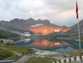
Auberge de Salanfe - Cabane du Vieux Emosson
 10.52 mi
+6,050 ft
-4,813 ft
7 hrs
Very difficult
Departure from Evionnaz (Valais)
A long day leading to Lac d'Emosson via the Col d'Emaney and Col de Barberine. Descent to Lac d'Emosson, then Col de la Gueulaz and the final climb to the Cabane du Vieux Emosson.
Auberge de Salanfe - Mex
 5.95 mi
+1,952 ft
-4,180 ft
4h 25
Moderate
Departure from Evionnaz (Valais)
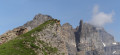
During this stage of the Tour des Dents du Midi, at the Col du Jorat you will enjoy a panoramic view to the south of the peaks on the border with Italy. You will probably recognise the Matterhorn. You will also have a bird's eye view of the Lac de Salanfe, with the Dôme de la Sallière in the background. To the north, the Rhône valley awaits you. In the small village of Mex, nestled on a plateau, several viewpoints offer views of the villages in the valley, all the way to Lake Geneva.
Auberge de Salanfe - Emosson Dam
9.17 mi
+5,502 ft
-4,977 ft
9h 00
Difficult
Departure from Evionnaz (Valais)
During this second stage, after the Col d'Emaney, you will be enchanted by the peaceful Alpage d'Emaney. During the ascent of the Col de Fenestral, you will be surprised by the beauty of the Lac de Blantsin. The Col de Fenestral offers a panoramic view of the entire eastern part of the Mont Blanc massif.
Auberge de Salanfe - Les Marécottes
 6.08 mi
+2,608 ft
-5,089 ft
5h 05
Moderate
Departure from Evionnaz (Valais)
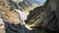
This final stage will take you back to Les Marécottes station, very close to the starting point in Salvan. The Salanfe glacier cirque is located at the crossroads of numerous hiking trails. You will finish your tour via the Col de la Golette, which is not very busy. The passage is quite narrow and the start of the descent is equipped with chains. At the pass, you can enjoy one last view of the Dents du Midi and Lake Salanfe. To the east, you can enjoy the panorama of the Valais Alps.
Auberge de Salanfe – Barme
9.12 mi
+4,206 ft
-5,210 ft
7h 50
Difficult
Departure from Evionnaz (Valais)
This seventh stage will take you from the Auberge de Salanfe to La Cantine de la Barmaz. The route begins with the ascent of the Col de Susanfe, which offers magnificent views of the Dents du Midi. A pleasant descent leads to the Cabane de Susanfe, which is the perfect spot for a break. The descent continues to the Pas d’Encel, a fairly steep section secured by chains and cables. The final stretch of the route passes by the Bonavau refuge before a final short climb and then the descent into the Barme valley.
Please note that for the ascent to the Col de Susanfe between the points (3) and (4), a diversion via the Plan du Château is in place for an indefinite period.
Les Sources de l'Arve
 6.75 mi
+2,615 ft
-2,585 ft
5h 25
Moderate
Departure from Chamonix-Mont-Blanc (Haute-Savoie)
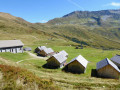
With a group of senior hikers from the Arve Valley, we set off down the Arve River from its source at La Jonction, Geneva, to its confluence with the Rhône.
A short one-day circuit, ascending via the balconies and descending as close as possible to the river, the SM3A path.
Mount Péclerey as seen from the village of Le Tour
 4.59 mi
+1,844 ft
-1,844 ft
3h 45
Moderate
Departure from Chamonix-Mont-Blanc (Haute-Savoie)
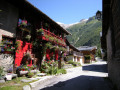
This modest hike takes us up Péclerey Mountain, which overlooks the village of Le Tour at the northern end of the Chamonix valley. This unassuming little mountain nonetheless offers superb views, including of the surrounding peaks (Aiguilles Rouges, Mont Blanc), the Chamonix valley and the Tour Glacier.
Col de Salenton, via the waterfall and the Bérard valley
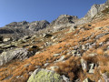 8.80 mi
+3,944 ft
-3,930 ft
7h 30
Difficult
Departure from Vallorcine (Haute-Savoie)
A lovely mountain walk, easy at first, at the bottom of a wooded and green valley, then difficult, on the mountainside, exposed to the sun. Interesting waterfall. Panoramic view from the pass.
⚠️ This route crosses the Aiguilles Rouges nature reserve. Please respect the regulations in force. See practical information.
Tré-les-Eaux - Col de la Terrasse - Loriaz
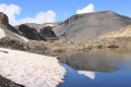 11.24 mi
+4,747 ft
-4,747 ft
10 hrs
Very difficult
Departure from Vallorcine (Haute-Savoie)
A superb circular at the edge of the high mountains (2,700 metres) with a very significant elevation gain.
This hike should only be attempted at the beginning of summer (as snow may still be present and obscure the markings).
In the forests and mountain pastures around Vallorcine
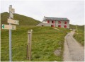 11.74 mi
+4,396 ft
-4,396 ft
10 hrs
Very difficult
Departure from Vallorcine (Haute-Savoie)
Loop through forests and mountain pastures.From the Col des Posettes via the Croix des Posettes or from the Col de Balme via the Catogne chalets, you will have a complete view of the surrounding Vallorcine landscapes.It's like a balcony overlooking Mont Blanc.
⚠️ This route crosses the Aiguilles Rouges nature reserve. Please respect the regulations in force. See practical information.
Pointe de la Terrasse from the Buet station
9.57 mi
+4,760 ft
-4,767 ft
8 hrs
Very difficult
Departure from Vallorcine (Haute-Savoie)
A loop via the magnificent and wild Trè-les-Eaux valley on the way there and via the Col de la Terrasse and the Refuge de Loriaz on the way back. Exceptional 360° panorama from the summit!Trè-les-Eaux is one of the few places in the Chamonix valley that is still untouched by mass tourism.
Couteray - Refuge du Vieux Emosson
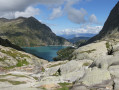 7.45 mi
+3,753 ft
-1,053 ft
6h 40
Difficult
Departure from Vallorcine (Haute-Savoie)
A pretty route, with views of the Tour and Argentière glaciers, which passes through the Refuge de Loriaz to reach the Barrage d'Emosson via a balcony path and finishes at the Refuge du Vieux Emosson.
Tour of the Dents Blanches massif, Ruan, Tenneverge
 75.55 mi
+33,983 ft
-33,875 ft
8 days
Very difficult
Departure from Vallorcine (Haute-Savoie)
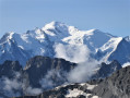
Straddling the Franco-Swiss border, the Dents Blanches, Dents du Midi, Tenneverge, Mont Ruan and Aiguilles Rouges. An area strongly shaped by the folding of the Alps, with surprising landscapes ranging from lunar deserts to high-altitude lakes, waterfalls and forgotten mountain pastures. A wild and unspoilt nature that only hikers can discover. Alpine valleys, often isolated by "pas", technical and cabled paths opening the doors to this universe of raw and grandiose nature...
The Mont Buet loop
14.75 mi
+7,238 ft
-7,257 ft
7 hrs
Very difficult
Departure from Vallorcine (Haute-Savoie)
Starting from Buet, this is a large loop in a very rocky landscape. After the Refuge de la Pierre in Bérard, the ascent of Mont Buet and the Cheval Blanc pass, the circuit makes a short detour into Switzerland to visit the dinosaur site. The return journey is via the Col de la Terrasse, the Refuge de Loriaz and the hamlet of Couteray
⚠️ This route crosses the Aiguilles Rouges nature reserve. Please respect the regulations in force. See practical information.
Le Buet – Moëde Anterne Mountain Hut
 8.83 mi
+4,298 ft
-2,139 ft
7h 50
Very difficult
Departure from Vallorcine (Haute-Savoie)
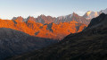
First of three stages on the Tour des Aiguilles Rouges, anti-clockwise. A very beautiful hike, with one major challenge – the climb over the Col de Salenton – but then following a lovely path along the mountainside, with magnificent panoramic views all along the way and a view of Mont Blanc and the Aiguilles Rouges at sunset. A truly memorable hike.
Le Buet from Vallorcine
 11.66 mi
+5,922 ft
-5,892 ft
10 hrs
Very difficult
Departure from Vallorcine (Haute-Savoie)
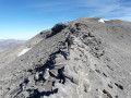
At an altitude of over 3,000 metres, there is a magnificent viewpoint over the Aiguilles Rouges and the Mont Blanc massif. This is a long and demanding hike in a wild setting offering superb panoramic views.
This hike can be done in a single day (Very Difficult) or over two days with a night in a refuge (Difficult).
La Boerne Refuge – Lac Blanc Refuge
 3.43 mi
+3,294 ft
-33 ft
4h 25
Difficult
Departure from Chamonix-Mont-Blanc (Haute-Savoie)
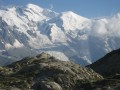
Stage8: from the Refuge de la Boerne (Tré Le Champ) to the Refuge du Lac Blanc via the Aiguillettes d’Argentière.Stop off at the refuge to admire the magnificent panoramic view of Mont Blanc.
⚠️ This route passes through the Aiguilles Rouges Nature Reserve. Please respect the regulations in force. See practical information.
Raccard du Blé
 5.03 mi
+1,657 ft
-1,650 ft
3h 45
Easy
Departure from Orsières (Valais)
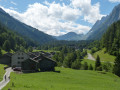
A circular walk in the lower part of the Swiss Val Ferret. One of the walks publicized by the tourist office and well signposted. There are information boards (in French) about the construction of traditional barns made from local stone and timber. Easy walking, navigation and some interesting information. The first section is on a quiet road.
Lac Blanc via the Lacs de Chéserys from the Col des Montets
 6.72 mi
+3,104 ft
-3,074 ft
5h 50
Difficult
Departure from Chamonix-Mont-Blanc (Haute-Savoie)
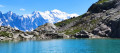
A must-do hike through the Aiguilles Rouges Nature Reserve, in the Chamonix Valley.Lac Blanc, at an altitude of 2,352 metres, offers an unforgettable panorama of the Mont Blanc massif.The route described here offers a much more idyllic and unspoilt setting than the alternative route via La Flégère, which has become far too touristy.
⚠️ This route passes through the Aiguilles Rouges Nature Reserve. Please respect the regulations in force. See practical information.
Lac de la Remuaz loop
 5.35 mi
+2,726 ft
-2,710 ft
4h 50
Moderate
Departure from Chamonix-Mont-Blanc (Haute-Savoie)
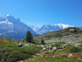
Magnificent hike, facing the Mont Blanc Massif all the way! While the whole route is quite busy, Lac de la Remuaz is off the trail and therefore isolated: a little forgotten gem.
Loop: Posettes ridge and Vallorcine valley
 8.45 mi
+3,123 ft
-3,117 ft
6h 35
Moderate
Departure from Chamonix-Mont-Blanc (Haute-Savoie)
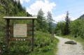
Loop close to the Franco-Swiss border with a variety of exposures in a Nature Reserve (forest to the East, long ridge, alpine pasture, forest to the west), with a beautiful 360° panoramic view and a belvedere ideal for picnics.
Chéserys, Blanc and Persévérance lakes circuit
 7.28 mi
+3,766 ft
-3,766 ft
6h 40
Difficult
Departure from Chamonix-Mont-Blanc (Haute-Savoie)
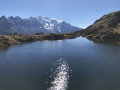
A long loop taking in the various lakes in the eastern part of the Aiguilles Rouges Massif, with magnificent views of the Mont Blanc Massif just opposite, reflected in the waters of the lakes.
⚠️ The itinerary includes two tricky sections equipped with ladders and metal ramps.
Tré-le-Champ to Lac Blanc - Tour Mont Blanc
2.73 mi
+3,228 ft
-62 ft
4h 05
Difficult
Departure from Chamonix-Mont-Blanc (Haute-Savoie)
This 10th stage of the Tour Mont Blanc (TMB) normally runs along the high ground above the L'Arve valley to La Flègere but here's the description of the variant to Lac Blanc. A shorter stage but full of excitement and challenges. Let's do it!
The TMB is a classic long-distance footpath that goes around Mont Blanc, passing from France into Italy and through Switzerland before returning to France.
Loop from Argentière to Le Tour
 6.10 mi
+1,572 ft
-1,545 ft
4h 10
Moderate
Departure from Chamonix-Mont-Blanc (Haute-Savoie)
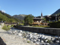
After the sources of the Arve, the second loop of the Arve starts from Argentière and takes you on a balcony to the village of Le Tour. The return journey is via Tré-le-Champs, with beautiful panoramic views of the Mont Blanc Massif.
Forest and alpine pastures on the heights of Argentière
 8.92 mi
+3,734 ft
-4,337 ft
7h 20
Difficult
Departure from Chamonix-Mont-Blanc (Haute-Savoie)
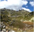
Outward journey from Argentière via Aiguillette d'Argentière and Lac Blanc, then down via Flégère to Les Praz de Chamonix.
Return to Argentière by train from Les Praz station. Otherwise two cars are required for arrival and departure.
Lognan refuge and Argentiére glacier
 8.48 mi
+3,766 ft
-3,747 ft
7h 10
Difficult
Departure from Chamonix-Mont-Blanc (Haute-Savoie)
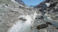
An exceptional hike, with no great technical difficulty, but with a substantial vertical drop that will take you to one of the most beautiful accessible glaciers in the French Alps, along with the Tour glacier.
The scenery is breathtaking, with the Aiguille Verte (4100 m), the Aiguille d'Argentière (3900 m) and the Aiguille du Chardonnet, among the most famous. The glacier is accessible, but be careful not to venture onto this glacier without suitable equipment, as numerous crevasses are visible.