


 Country:

 City:
City:


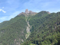
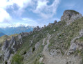
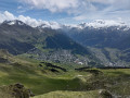
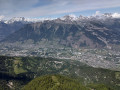
Start at the Col des Planches: there is free parking, and this is the terminus of the B215 bus from Martigny.
(S/E) From the pass, take the small road leading up towards the Col du Lein.
(1) At the first hairpin bend, leave the road and join a path (unmarked) that climbs straight up the slope across a meadow. A little further on, this path joins a route marked in yellow: continue straight on.
(2) When the signposted route turns right, heading uphill towards La Crevasse, carry on straight ahead across the meadow (unmarked path). A little further on, the path joins a wider track.
(3) At the next junction, take a path that climbs to the right and carry on straight ahead to the Col du Tronc (the path joins a wide track just before the pass).
(4) At the Col du Tronc, turn left, then stay on the track on the right at a fork where two almost parallel tracks branch off. Continue along this track until you reach the Col du Lein mountain pasture, where you’ll join a tarmac road.
(5) Take the road on the left up to the Col du Lein itself. Turn onto a track on the right which curves to the left, then comes into view of a reservoir. Continue along the track which passes just to the left of the reservoir, ignoring another track branching off to the left and one passing to the right of the reservoir.
(6) After passing the reservoir, the track turns left at a 90° angle. At this point, leave the track and head straight on along an ascending path. The path is not very visible at first; there are several goat tracks which can be confusing, but they eventually merge into a well-defined path. The path joins the ridge and follows it steeply uphill to the summit of Les Blisiers, from where you get your first view of the Val de Bagnes and the Pierre Avoi.
(7) At the summit, continue straight on, following the ridge along a narrow path. This is an unmarked path, narrow and somewhat exposed in places, but perfectly passable even though it does not appear on the SwissTopo map. Generally speaking, the path stays on the ridge or a few metres below it on the north-facing side: do not be misled by the odd goat track that descends here and there. The path eventually rejoins the track you left at point (6).
(8) Take the track on the right until it ends.
(9) At the next junction, follow the signposting indicating a right turn onto a path leading up towards the Pierre Avoi, whilst the track branches off to the left and comes to an end. Take the path furthest to the right, not the one running parallel further down.
At the next junction, stay on the signposted path that heads off to the right (a sign on the left says ‘no entry’). The path emerges from the forest, climbs to a pass, and turns left until it reaches the Pierre Avoi. Below the summit, the markings change from red and white to blue and white, indicating tricky sections. However, all tricky sections have been made safe.
(10) From the summit, head back down the same path you took at the start, then keep left onto a path that follows the ridge. Continue to the Col de la Marlène.
(11) Take a path leading down to the left, due north. The start is not very visible, but the rest is well marked. Continue straight down to the first junction, where the path on the left is signposted as off-limits. The path then joins a track.
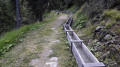
(12) Follow it to the right, then turn left at the next junction. The track descends in a series of fairly widely spaced hairpin bends. About 500 m after thefourth bend, the track crosses an old bisse (irrigation canal). It is no longer in use, but the canal is still clearly visible.
(13) Take the path on the left which runs alongside the bisse. It is level at first, but soon begins a very steep descent. At the bottom of the descent, the path crosses a valley, then runs along the mountainside for a good while before another descent to cross a second valley, before finally emerging onto a road.
(14) Continue to the right along the road for a few dozen metres, then the path turns off to the left. It joins a track at the entrance to the village of La Boveresse: carry on straight ahead to cross the village.
(15) On leaving the village, at a three-way junction, take the middle path (in fact, there are two junctions very close together; turn right and then immediately left). The path winds to the right, then reaches a junction where a small track branches off to the left.
(16) The path isn’t very visible, but it’s marked by a sign saying “Court de Lune”. Take this path, which passes under a rocky outcrop, and at the next junction turn left, heading slightly uphill.
(17) When you come out onto a track, take it to the right. Carry on straight ahead until you reach a road, then turn right onto it.
(18) At the first hairpin bend, take a path on the right signposted “Martigny, Charrat”. You’ll need to cross a fence which, although the path is signposted, has no designated crossing point (it’s easy enough to get under it, though).
(19) At the next junction,do not follow the signposted path which descends to the right; instead, carry on straight ahead. When you reach a three-way junction, take the track on the left which leads directly to the Col des Planches (S/E).
 Visorando Member

 Association / Club / Walk leader
 Moderate
