Trient – Finhaut

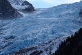
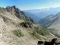
This fourth stage will take you from Trient to the village of Finhaut. The route begins with a challenging climb to the Pas des Moutons, which offers a view of the Trient Glacier. The ascent continues to the Alpe de Catogne, from where the Emosson Dam is clearly visible. A long descent leads to Le Chatelard. As there is no accommodation in Le Chatelard or at the Emosson Dam, the final section of the route leaves the Chemin des Cols Alpin to reach the village of Finhaut.

Details

n°111338930
Creation:
Last update:
Last review:
–
  • Walking
    Activity: Walking
  • ↔
    Distance: 9.04 mi
  • ◔
    Average duration: 7h 30 
  • ▲
    Difficulty: Difficult

  • ⚐
    Back to start: No
  • ↗
    Ascent: + 3,875 ft
  • ↘
    Descent: - 3,973 ft

  • ▲
    Highest point: 6,798 ft
  • ▼
    Lowest point: 3,074 ft

Waypoints

  1. S : mi 0 - alt. 4,203 ft - Trient – Auberge du Mont Blanc
  2. 1 : mi 0.41 - alt. 4,268 ft - Sign No. 6
  3. 2 : mi 0.95 - alt. 4,386 ft - Hiking sign
  4. 3 : mi 2.25 - alt. 6,342 ft - Sign No. – Les Tseppes
  5. 4 : mi 3.2 - alt. 6,775 ft - Sign No. 6
  6. 5 : mi 3.42 - alt. 6,578 ft - Sign No. – Catogne
  7. 6 : mi 4.16 - alt. 5,886 ft - Sign No. 6
  8. 7 : mi 4.34 - alt. 5,705 ft - Les Preises
  9. 8 : mi 5.11 - alt. 5,030 ft - Sign No. 6
  10. 9 : mi 5.85 - alt. 4,344 ft - Sign No. 6 – Cretton
  11. 10 : mi 6.44 - alt. 3,747 ft - Sign No. 6
  12. 11 : mi 6.52 - alt. 3,701 ft - Sign No. 6 – Barmarosse
  13. 12 : mi 6.89 - alt. 3,711 ft - Hiking sign
  14. 13 : mi 7.51 - alt. 3,583 ft - Trouléro
  15. 14 : mi 7.54 - alt. 3,589 ft - On the left
  16. 15 : mi 8.01 - alt. 3,271 ft - Friteley
  17. 16 : mi 8.17 - alt. 3,153 ft - Hiking sign
  18. E : mi 9.04 - alt. 4,104 ft - Finhaut – Hôtel Les Alpes

Notes

This hiking route follows the Chemin des cols alpins, which is marked on Swiss maps.

Signposting: at every major junction, you will find signposts:
- Sign No. 6 with a No. 6 sticker indicating this trail.
- R sign: Yellow sign with a hiker pictogram

Before setting off, it is advisable to check the Suisse Topo website for any trail closures and diversions. This information is updated in real time.

As well as the Visorando app, you can also download the swisstopo app ( free of charge), where you’ll find this information too.

Transport: Timetables

Weather: before setting off, check the Swiss Weather Service or Météo Blue

Hiking kit, including good walking boots.

Accommodation:

Other walks in the area

For more walks, use our search engine .

The GPS track and description are the property of this route's author. Please do not copy them without permission.