Mount Péclerey as seen from the village of Le Tour

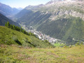
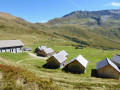
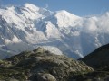
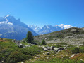
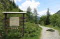
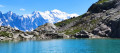
This modest hike takes us up Péclerey Mountain, which overlooks the village of Le Tour at the northern end of the Chamonix valley. This unassuming little mountain nonetheless offers superb views, including of the surrounding peaks (Aiguilles Rouges, Mont Blanc), the Chamonix valley and the Tour Glacier.

Details

2823732
Creation:
Last update:
Last review:
  • Walking
    Activity: Walking
  • ↔
    Distance: 4.59 mi
  • ◔
    Average duration: 3h 45 
  • ▲
    Difficulty: Moderate

  • ⚐
    Back to start: Yes
  • ↗
    Ascent: + 1,844 ft
  • ↘
    Descent: - 1,844 ft

  • ▲
    Highest point: 6,552 ft
  • ▼
    Lowest point: 4,770 ft

Photos

Description of the walk

From Chamonix, drive past Argentière and, before the series of hairpin bends leading towards Vallorcines, turn right and head up the Arve valley, passing through Montroc, and park in one of the large car parks at the entrance to the village of Le Tour.
The car park is generously sized to cope with the crowds during the winter sports season, so its capacity is more than sufficient in summer.

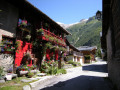
(S/E) Cross the Arve via the large bridge at the bottom of the car park, and take the Chemin du Rocher Nay, which passes in front of a chapel with a wooden bell tower and a pyramidal slate roof. At the start of the street, you’ll see a sign for the Chalet Alpin du Tour. Follow this street straight on, passing the Chalet Alpin du Tour, then cross a dirt and grassy car park where a few vans or motorhomes are often parked.

(1) Continue towards the stream. First, cross a small wooden footbridge over the little Ruisseau du Picheu, then, after a bend to the right, you’ll come to a lovely footbridge with railings that crosses a larger stream. This is the Misme stream, fed by the Tour glacier.

(2) Cross it and join the well-marked path called ‘Petit Balcon Nord’. Shortly afterwards, another path branches off to the right, following the course of the stream. Ignore this turn-off and stay on the path that leads away from the stream. You’ll reach another junction where the ‘Petit Balcon Nord’ signpost indicates ‘Le Planet – Argentière’ straight ahead, and ‘Le Péclerey’ up to the left.

(3) Follow the signs for Le Péclerey, ascending a narrower path which soon winds its way upwards in hairpin bends, with beautiful views of the Tour Glacier always visible in the foreground to the left.
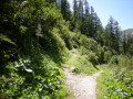
Shortly after reaching the 1,800-metre mark, the path turns sharply to the right. Climb through a landscape of scree and rocks, covered in blueberry heath dotted with scattered small conifers. You’ll reach a dry-stone hut situated at the Tête du Grand Chantet.

(4) Shortly after the hut, continue along the path ascending to the left, which brings you closer to the foot of the Tour Glacier. Carry on straight ahead towards the south, climbing gently towards Mont Blanc. Soon the path becomes almost level as you approach the junction with the path leading left to the summit of the Bec de Lachat.

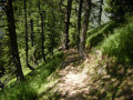
(5) Leave this path and begin the descent to the right. A series of short, very tight bends takes you down a drop of about 300 metres, all through woods of tall conifers (mainly larch). Reach the final hairpin bend on the right.

(6) You’ll reach a gentle slope again; cross a very steep valley floor – this is the Grand Chantet couloir. Continue down a moderate slope until you reach a junction of paths near a spring.

(7) Keep to the right and continue until you reach the junction with the Petit Balcon Nord. Turn right onto this path and follow it. You’ll come back to the junction where the circular path begins.

(3) Follow the same route as on the way out until you reach the first crossroads.

(1) To cross the village by a different route to the outward journey, turn right before the Chalet Alpin. Take the Chemin des Clusettes, which is initially unpaved but then tarmac-surfaced. You will pass another church, of modern construction. After crossing the Arve and passing the cable car station, you will reach the car park (S/E).

Waypoints

  1. S/E : mi 0 - alt. 4,813 ft - Large car park at the resort. Cross the - Arve (rivière) - Affluent de l'Arve
  2. 1 : mi 0.29 - alt. 4,836 ft - Chalet Alpin
  3. 2 : mi 0.45 - alt. 4,820 ft - Footbridge over the torrent
  4. 3 : mi 0.7 - alt. 4,938 ft - Crossroads on the circular loop
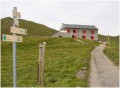
  5. 4 : mi 1.86 - alt. 6,463 ft - Péclerey Hut or Tête du Grand Chantet Hut
  6. 5 : mi 2.08 - alt. 6,532 ft - Highest point
  7. 6 : mi 2.88 - alt. 5,607 ft - Final hairpin bend
  8. 7 : mi 3.34 - alt. 5,279 ft - Crossroads at an altitude of 1,600 metres
  9. S/E : mi 4.58 - alt. 4,813 ft - Large car park at the resort

Notes

Although this walk is short – just over 7km – you still climb more than 550m, so it’s quite steep, with a particularly rapid descent over 300m. You’ll therefore need sturdy footwear and, ideally, walking poles.
It’s best to go in dry weather, as the ground can be slippery, especially on the descent.

Worth a visit

One of the highlights of this walk is that it offers beautiful views from north to south, passing along the sunny side of the Chamonix valley opposite, where you can clearly see the paths leading up to La Flégère or Lac Blanc.
A possible variation involves adding a return trip to the foot of the Tour Glacier from the Péclerey hut: 3 km return, with an additional 200 metres of elevation gain.
From the same starting point, you can also climb to the Bec de Lachat: 2 km return and an additional 400 m of elevation gain.

Reviews and comments

5 / 5
Based on 2 reviews

Reliability of the description
5 / 5
Ease of following the route
5 / 5
Route interest
5 / 5
grandin
grandin ★

Thank you, Laure9
Warning removed

Machine-translated

Laure9
Laure9
• Edited:

Overall rating : 5 / 5

Date of your route : Aug 29, 2026
Reliability of the description : ★★★★★ Very good
Ease of following the route : ★★★★★ Very good
Route interest : ★★★★★ Very good
Very busy route : No

A lovely circular route completed following advice from the Chamonix High Mountain Office. The route is open; there were no rockfalls, so the latest comments from 2020 are no longer relevant. I did the route starting from Montroc station, going in the opposite direction so as to pass between points 6 and 5 on the ascent.
I pushed on as far as the Bec de Lachat but turned back about 100 metres before the summit as it was becoming too dangerous (and if I’d fallen, I’d have definitely tumbled down into the ravine).

Machine-translated

coquinourse67
coquinourse67

Closed access.

Machine-translated

grandin
grandin ★

Thank you rodice
I've added the info to the description

Machine-translated

rodice
rodice

ATTENTION: this route has been closed since 11 June 2020
Rockfalls
Circuit closed by decision of the town hall

We discovered this closure when we arrived on site...

Machine-translated

Ph.Guilpain
Ph.Guilpain

Overall rating : 5 / 5

Date of your route : Dec 30, 2019
Reliability of the description : ★★★★★ Very good
Ease of following the route : ★★★★★ Very good
Route interest : ★★★★★ Very good

A hike I've done many times. As always, I recommend autumn: light and larches.
But I much prefer the opposite route: leave from Le Planet (large car park), climb to 1410 and then join marker 6. Little used in this direction, the path is more pleasant, regular and in the shade. It is essential to push on to the Bec de Lachat. A wilder landscape.
The descent to the Grand Balcon (marker 3) is then less strenuous than the rather chaotic ascent in the direction shown here.

Machine-translated

Other walks in the area

For more walks, use our search engine .

The GPS track and description are the property of this route's author. Please do not copy them without permission.