Le Buet – Moëde Anterne Mountain Hut

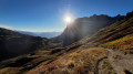
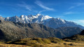
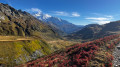
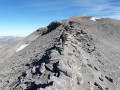
First of three stages on the Tour des Aiguilles Rouges, anti-clockwise. A very beautiful hike, with one major challenge – the crossing of the Col de Salenton – but which is then followed by a lovely path along the mountainside, offering magnificent panoramic views all along the way, including a view of Mont Blanc and the Aiguilles Rouges at sunset. A memorable hike.

Details

n°108306695
Creation:
Last update:
Last review:
–
  • Walking
    Activity: Walking
  • ↔
    Distance: 8.83 mi
  • ◔
    Average duration: 7h 50 
  • ▲
    Difficulty: Very difficult

  • ⚐
    Back to start: No
  • ↗
    Ascent: + 4,298 ft
  • ↘
    Descent: - 2,139 ft

  • ▲
    Highest point: 8,258 ft
  • ▼
    Lowest point: 4,396 ft

Photos

Description of the walk

Park in the car park at Le Buet station.

(S) Cross the Route du Col (D1506) at the pedestrian crossing to reach the footpath opposite. Follow the signs for “Waterfall à Bérard”, “Refuge de la Pierre à Bérard” or “Col de Salenton”.

(1) At the crossroads about a hundred metres further on, cross the stream and head towards the Poya chalets.

(2) Turn left, walk uphill for about twenty metres, then take the path on the right, following the signs for the Refuge de la Pierre à Bérard. Pass the paths leading to the viewpoint over the waterfall on your right and continue to a fork in the path.

(3) Make a first turn left then right, following the path towards “Refuge de la Pierre à Bérard” – “Col de Salenton”. On your right, you can see the Waterfall à Bérard. Continue climbing through the forest, staying on the main path alongside the stream (Eau de Bérard).

(4) Carry on straight ahead, ignoring the path branching off to your right which leads to the Fontaine Froide.

(5) Cross the footbridge over the Eau de Bérard to reach the opposite bank.

(6) The path emerges from the woods. Continue climbing towards the Refuge de la Pierre à Bérard. The stream is still on your left. You’ll reach a three-way junction.

(7) Keep to the left to stay as close as possible to the Eau de Bérard, following the path which runs parallel to the one on the right and eventually joins it.

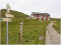
(8) Carry on to the left to reach the Refuge de la Pierre in Bérard.

(9) Take the path branching off to the right towards the Col de Salenton.

(10) Turn left to cross a vast scree slope. Continue the ascent to the junction at the foot of the Aiguille de Salenton.

(11) Take the path on the left to reach the Col de Salenton (2,526 m). Keep an eye out at the pass; you may sometimes spot a magnificent ibex just a few metres away.

(12) Turn right onto the western slope and descend to the Diosaz torrent.

(13) Ford the stream and take the path that starts on the left. Follow this balcony-like path, which runs almost along the contour lines and presents no particular difficulty. Cross several small streams.

(14) Pass directly below the Villy chalets and continue along the path.

(15) Head straight on towards the refuge, ignoring the path branching off to the left. Cross the Nant des Sangles (stream) and reach another junction.

(16) Carry on straight ahead to reach the Moëde d’Anterne mountain refuge (E).

Waypoints

  1. S : mi 0 - alt. 4,396 ft - Car park at Le Buet station - Gare de Le Buet
  2. 1 : mi 0.06 - alt. 4,419 ft - Crossroads, go straight on
  3. 2 : mi 0.25 - alt. 4,501 ft - La Poya, on the left
  4. 3 : mi 0.48 - alt. 4,708 ft - Turn-off to the refreshment bar - Cascade de Bérard
  5. 4 : mi 0.95 - alt. 4,931 ft - Fontaine Froide junction
  6. 5 : mi 1.07 - alt. 5,013 ft - Footbridge
  7. 6 : mi 1.56 - alt. 5,440 ft - Exit from the woodland
  8. 7 : mi 2.26 - alt. 5,705 ft - Turn-off, on the left
  9. 8 : mi 2.87 - alt. 5,945 ft - Turn-off, on the left
  10. 9 : mi 3.22 - alt. 6,312 ft - Refuge de la Pierre à Bérard
  11. 10 : mi 3.91 - alt. 7,251 ft - Turn left at the fork – scree slope
  12. 11 : mi 4.38 - alt. 8,156 ft - Trail junction, turn left
  13. 12 : mi 4.5 - alt. 8,241 ft - Col de Salenton
  14. 13 : mi 5.52 - alt. 6,913 ft - Ford on the Diosaz
  15. 14 : mi 7.08 - alt. 6,834 ft - Directly opposite the Villy chalets
  16. 15 : mi 7.95 - alt. 7,067 ft - Path junction, straight ahead
  17. 16 : mi 8.47 - alt. 6,621 ft - Path junction, straight ahead
  18. E : mi 8.83 - alt. 6,552 ft - Chalet - hôtel de Moëde Anterne

Notes

(E) Moede Anterne Mountain Hut: capacity 91 people.
Tel. Off-season: 00 33(0)609424234
Tel. (in season): 00 33(0)450936043
A spring flows into a fountain behind the second house.
Around 20 camping pitches for those wishing to pitch a tent.

Worth a visit

(12) At the Col de Salenton, do take a moment to look to the right and left in the hope of spotting a ibex.
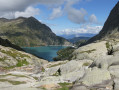
Beautiful view of the Mont Blanc massif.
(E) At the Moëde Anterne refuge, 60 to 30 minutes before sunset, don’t forget to take photos of the Aiguilles Rouges.

Other walks in the area

For more walks, use our search engine .

The GPS track and description are the property of this route's author. Please do not copy them without permission.