Auberge de Salanfe – Barme

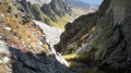
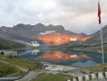
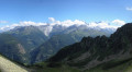
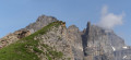
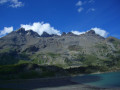
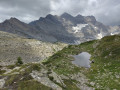
This seventh stage will take you from the Auberge de Salanfe to La Cantine de la Barmaz. The route begins with the ascent of the Col de Susanfe, which offers magnificent views of the Dents du Midi. A pleasant descent leads to the Cabane de Susanfe, which is the perfect spot for a break. The descent continues to the Pas d’Encel, a fairly steep section secured by chains and cables. The final stretch of the route passes by the Bonavau refuge before a final short climb and then the descent into the Barme valley.

Please note that for the ascent to the Col de Susanfe between the points (3) and (4), a diversion via the Plan du Château is in place for an indefinite period.

Details

n°110961593
Creation:
Last update:
Last review:
–
  • Walking
    Activity: Walking
  • ↔
    Distance: 9.12 mi
  • ◔
    Average duration: 7h 50 
  • ▲
    Difficulty: Difficult

  • ⚐
    Back to start: No
  • ↗
    Ascent: + 4,206 ft
  • ↘
    Descent: - 5,210 ft

  • ▲
    Highest point: 7,884 ft
  • ▼
    Lowest point: 4,895 ft
  • ⚐ Country: Switzerland
  • ⚐
    Area: Alps
  • ⚐ City: Evionnaz 
  • ⚑
    Start: N 46.144577° / E 6.970246°
  • ⚑
    End: N 46.149321° / E 6.833483°
  • ❏
    IGN map(s): Ref. 3528ET, 3528ETR, 3530ET, 3530ETR
  • Hour-by-hour weather

Waypoints

  1. S : mi 0 - alt. 5,899 ft - Auberge de Salanfe
  2. 1 : mi 0.12 - alt. 6,079 ft - Sign No. 6 - Lac de Salanfe
  3. 2 : mi 1.04 - alt. 5,722 ft - Sign No. 6 – Towards Col de Susanfe
  4. 3 : mi 1.67 - alt. 5,932 ft - Start of diversion
  5. 4 : mi 3 - alt. 7,569 ft - End of diversion
  6. 5 : mi 3.15 - alt. 7,772 ft - Col de Susanfe
  7. 6 : mi 4.55 - alt. 6,886 ft - Cabane de Susanfe
  8. 7 : mi 5.07 - alt. 6,467 ft - Signpost to the Pas d’Encel
  9. 8 : mi 5.67 - alt. 5,945 ft - Pas d'Encel
  10. 9 : mi 6.45 - alt. 5,085 ft - Sign No. 6
  11. 10 : mi 7.01 - alt. 5,062 ft - Cabane de Bonavau
  12. E : mi 9.12 - alt. 4,918 ft - Barme - Cantine de la Barmaz

Notes

This hiking route follows the Chemin des cols alpins, which is marked on Swiss maps.

Signposting: at every major junction, you will find signposts:
- Sign No. 6 with a No. 6 sticker indicating this trail.
- R sign: Yellow sign with a hiker pictogram

Before setting off, it is advisable to check the Suisse Topo website for any trail closures and diversions. This information is updated in real time.

As well as the Visorando app, you can also download the swisstopo app ( free of charge), where you’ll find this information too.

Transport: Timetables

Weather: before setting off, check the Swiss Weather Service or Météo Blue

Hiking equipment, particularly good walking boots.

Accommodation:

Other walks in the area

For more walks, use our search engine .

The GPS track and description are the property of this route's author. Please do not copy them without permission.