Col de Balme - Source de l'Arve - Col des Posettes from Le Tour

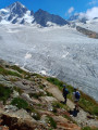
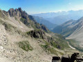
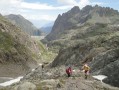
A short summer hike with exceptional panoramic views over the Chamonix valley and its massifs. There are several ways to approach it from Le Tour: the one shown is from the East, using the Charamillon cable car and the Autannes chairlift. The return journey is via the Charamillon cable car.

Details

35300562
Creation:
Last update:
Last review:
  • Walking
    Activity: Walking
  • ↔
    Distance: 2.88 mi
  • ◔
    Average duration: 1h 25 
  • ▲
    Difficulty: Easy

  • ⚐
    Back to start: No
  • ↗
    Ascent: + 82 ft
  • ↘
    Descent: - 1,204 ft

  • ▲
    Highest point: 7,241 ft
  • ▼
    Lowest point: 6,073 ft

Description of the walk

Start: Pass through Montroc then Le Tour to reach the Charamillon cable car, where there is a car park, or access by bus.
Take the Charamillon cable car, then the Autannes chairlift.

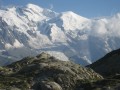
(S/E) Head due North, left out of the chairlift. Very good path with exceptional panoramic views over the Chamonix Valley and the Mont Blanc Massif'' towards Col de Balme.

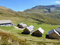
(1) Continue past the chalet's terrace, then take the left-hand path to Col des Posettes.

(2) Pass the Source de l'Arve, located a little above the path, and continue on this path, which begins to descend a little further to the Col de la Posettes.

(3) Turn left towards Charamillon on the carriage road to the Charamillon cable car (S/E).

Waypoints

  1. S : mi 0 - alt. 7,195 ft - Arrival of the Autannes chairlift
  2. 1 : mi 0.44 - alt. 7,228 ft - Col de Balme
  3. 2 : mi 0.75 - alt. 7,215 ft - Source of the - Arve (rivière) - Affluent de l'Arve
  4. 3 : mi 1.78 - alt. 6,558 ft - Col des Posettes (1997m)
  5. E : mi 2.88 - alt. 6,073 ft - Departure from the Charamillon cable car

Notes

Start & Parking: Pass through Montroc then Le Tour to reach the Charamillon cable car, where there is a car park, or access by bus.
Take the Charamillon cable car, then the Autannes chairlift.

From the top of the Charamillon cable car, you can reach the (S), with a 2-hour walk and an additional 700 m of ascent.

Worth a visit

Panoramic view of the Chamonix Valley, marmottes (prairie dogs).

Reviews and comments

5 / 5
Based on 1 review

Reliability of the description
5 / 5
Ease of following the route
5 / 5
Route interest
5 / 5
FlickaPatsy
FlickaPatsy

Overall rating : 5 / 5

Date of your route : Jul 16, 2026
Reliability of the description : ★★★★★ Very good
Ease of following the route : ★★★★★ Very good
Route interest : ★★★★★ Very good
Very busy route : Yes

A lovely route suitable for everyone, including young children. PI, our grandchildren aged 5, 7 and 11 managed it with no trouble at all and… without complaining.
Once we reached the Balme mountain hut, we extended the route by heading up to the Croix d’Arolette and the Tête de Balme, following the ridges: magnificent views, particularly of the Emossons Dam, the Cheval Blanc and the Buet.
We were lucky enough to spot some marmots and see the famous Heyrens cows grazing in the mountain pastures.
The entire route is 11 km long with 360 m of elevation gain.
The refuge offered a very warm welcome, and we enjoyed excellent, hearty meals, all homemade.
It was quite busy as the chalet is situated on the TMB route.

Machine-translated

pierregauthier.1950
pierregauthier.1950
• Edited:

Our group did not follow the route suggested by your hike, but as soon as we left the Tour car park, we climbed to the aiguillette des Posettes via the GR Tour du Mont Blanc, then the col des Posettes and col de Balme, finally descending on foot to the Tour car park via the GR variant.
I only recorded your hike for inspiration.

A very nice walk with exceptional views and weather on Monday 25 September 2023.
Thank you

Machine-translated

Other walks in the area

For more walks, use our search engine .

The GPS track and description are the property of this route's author. Please do not copy them without permission.